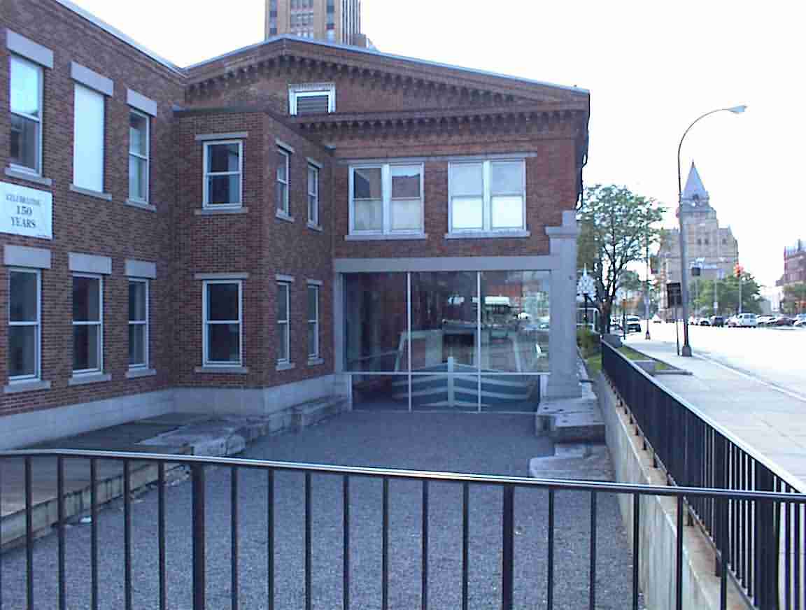
I woke up shortly after dawn to a beautiful morning. It was nice to have picnic tables and I had a leisurely breakfast. It was amazing how much dew there was on my tent fly so I removed it and shook off quite a puddle of water. I then stretched it out between two tables to attempt to dry it before I packed it. When I unpacked it after Ontario some mould had started so I’m being extra careful now.
There was a cemetery across the road and I wandered through in the early morning sunshine. Port Gibson is a very old town and there were many tombstones which were now illegible. Made me reflect on the transitory nature of life. People who in their day may have been quite famous no longer even had their graves properly marked. We really must do what we can while we can.
After packing up I was on the road by 8 a.m. My goal was to find the old farm of Hiram Edson which is in the area. This is an important historical site since he was one of the founders of the Seventh-day Adventist church. In the early 1800’s throughout the world there was a ‘Great Awakening’ in the form of many religious revivals. Although the common belief at the time was that the world was going to enter into a period of peace and prosperity. A number believed that instead Jesus would return to earth—they were called Adventists since they believed in the second Advent.
Their premise was based on a clear reading of the Bible—today virtually all churches accept the doctrine of Jesus’ second Advent—and in particular a biblical text in Daniel which said "unto 2300 days the sanctuary would be cleansed". Using the exegetical principle of a year for a day they worked forward from when the Hebrew sanctuary was rededicated and got to the period around 1843. Later, they put the date at 22 October 1844.
These people sincerely believed that Jesus would come again that day. Why they missed the texts that ‘nobody knows the hour’ is an enigma to me; but miss it they did. The travelled all over preaching that the sanctuary, which they thought was the earth, would be cleansed. A kind of ‘the world will end’ message. They were so busy trying to get the message out that farmers didn’t harvest their fields, but in the end we know that Jesus did not return and nor was the world cleansed.
One of the Adventists, Hiram Edson, lived near Port Gibson and the day afterwards he realised that they had misunderstood the nature of the cleansing of the Sanctuary. Instead of the earth being the sanctuary and it being cleansed, it signified a change in Jesus’ ministry in heaven. This revelation came to him as he walked through his corn field. Later, he met with Joseph Bates and learned of the Sabbath message and they became founders of the Seventh-day Adventist church; the name reflecting these two important doctrines.
I had a poor map which I obtained from the Adventist historical society and so I set off in search of the farm. I had read how they had rebuilt a barn on the original farm so I was sure that it would have been sign posted. Ha. Was I ever wrong. I cycled 15 km up and down the roads and I knew it was nearby, but to no avail. It really wasn’t that important, I just thought it would have been neat to have visited the place since I was in the area. I was close… but then close only really counts when one is using hand grenades.
I cycled down the back roads and ended up on Route 31 again. I was east of Port Gibson but headed back west again across the canal to the north side in search of another important historical site: the home of the Fox sisters. They were from the same era as Hiram Edson but were very far removed from people like him who were committed Christians. They heard a knocking in their cottage and got in touch with the spirits of the deceased. They are credited with the founding of the spiritualist movement. I had no more success with this than with the Edson farm, although I did see some wild deer which ran off into the dense forest on my approach.
I accepted failure and cycled off across the canal again and towards the next main town, Newark. I was definitely out of the flat areas as there were some relatively substantial hills. I stopped at a petrol station and had a fruit juice and refilled my water bottle. As I was sitting on the sidewalk in front of the station I saw three cycle tourists travelling east along Route 31 (which is also NY Cycle Route 5). They were travelling at quite a pace and were bedecked in very serious cycling clothes—the kind emblazoned with the names of the different equipment manufacturers. I’m happy with my T shirt and L.L. Bean shorts. I reflected that over this entire trip I’ve probably seen less than 10 cycle tourists. It’s particularly surprising given that I’ve been to some impressive tourist places like Yosemite, Niagara Falls, etc.
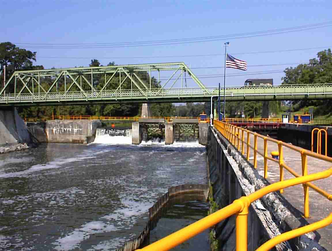
The road through town was very bumpy and I was pleased to soon be out in the country again. I was following the south side of the canal with water on my left and hills with farms on my right. Quite picturesque. The next town was Lyons and I stopped to have a look at the lock as well as the town since it looked to be quite interesting.
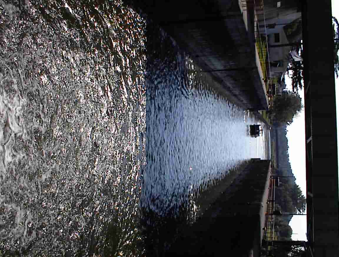
I crossed the bridge and there was spillway to the left of the lock. It was very simple engineering with the spillway gates counterbalanced by weights, but also effective. With what is probably little effort they could raise or lower the gates.
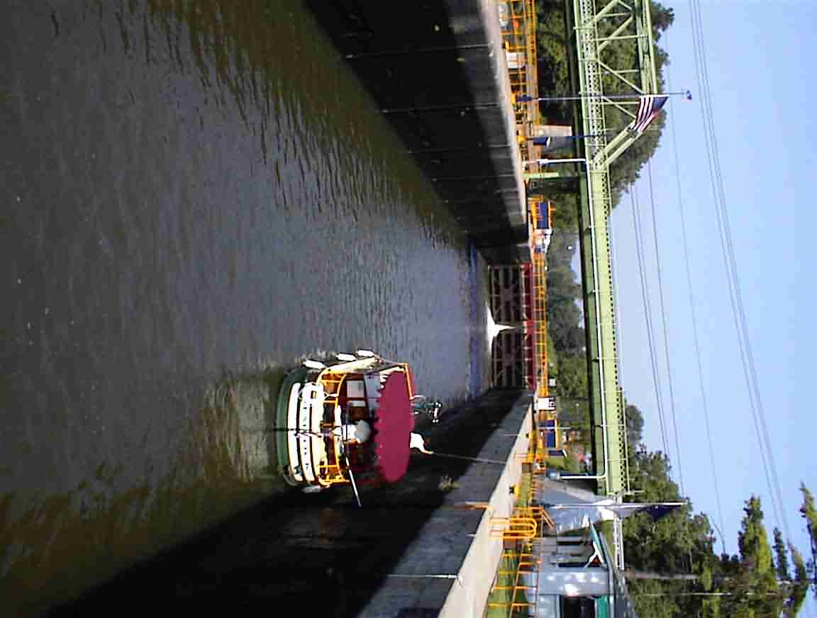
I was fortunate to have a canal boat arrive at the lock while I was there. The boat was very similar to the one that Lis and I rented a few years ago in England and went cruising on to celebrate her birthday. In England the locks are quite small but here they are designed to handle commercial barges so the boats are dwarfed. The photos below gives you an idea of the size of the boat relative to the lock. They have ropes descending vertically along the walls of the lock and the boaters hold onto these when the lock is flooded. I was told by one lockkeeper that they always flood the opposite side to the boat otherwise the water would toss the small boats around the lock.
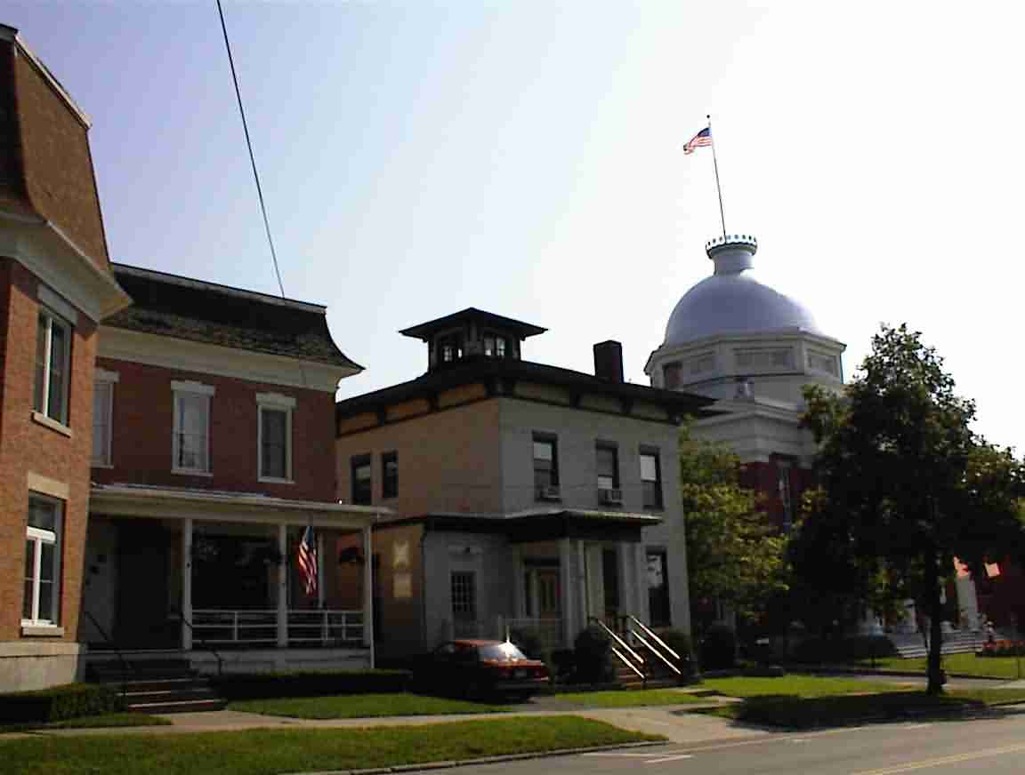
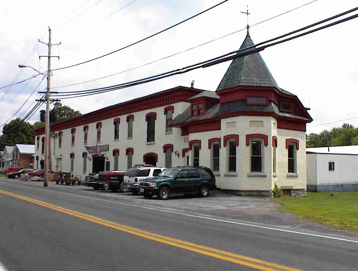
After admiring the lock I cycled up into town. There were a number of old buildings which obviously dated back to the first half of the 19th century. The court house had an impressive cupola but I was more intrigued by the lookout towers atop of several of the houses. You can see one in the photo below along with the cupola in the background. I saw these relatively frequently in towns near the canal and I surmised that they were there for a commercial reason. Probably similar to the way that ship’s chandlers had people watching for boats coming into harbour so that they could be the first to offer them services.
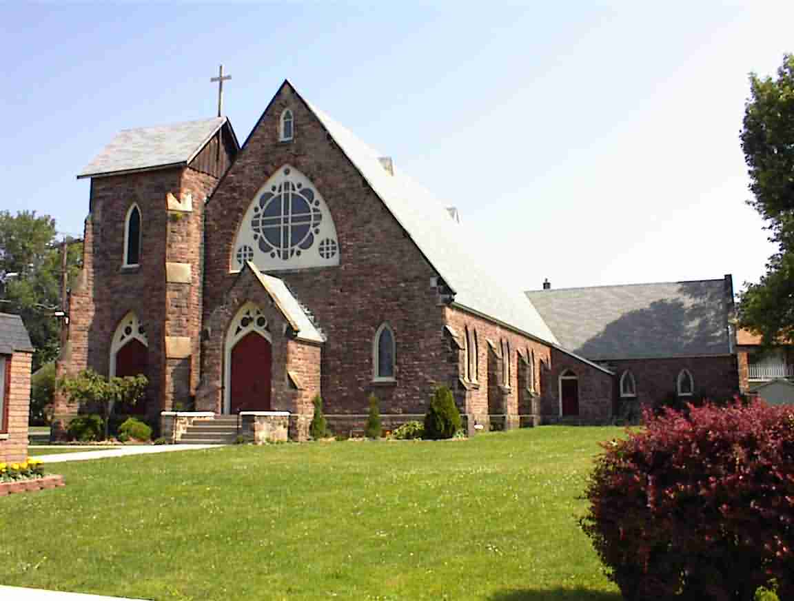
From Lyons the road took me on a northerly route to Clyde. Perhaps because it is more off the beaten track, Clyde looked much more down at the heels than other towns I had been through. There were still a number of lovely old houses and the church below which was made from the red sandstone found near Medina.
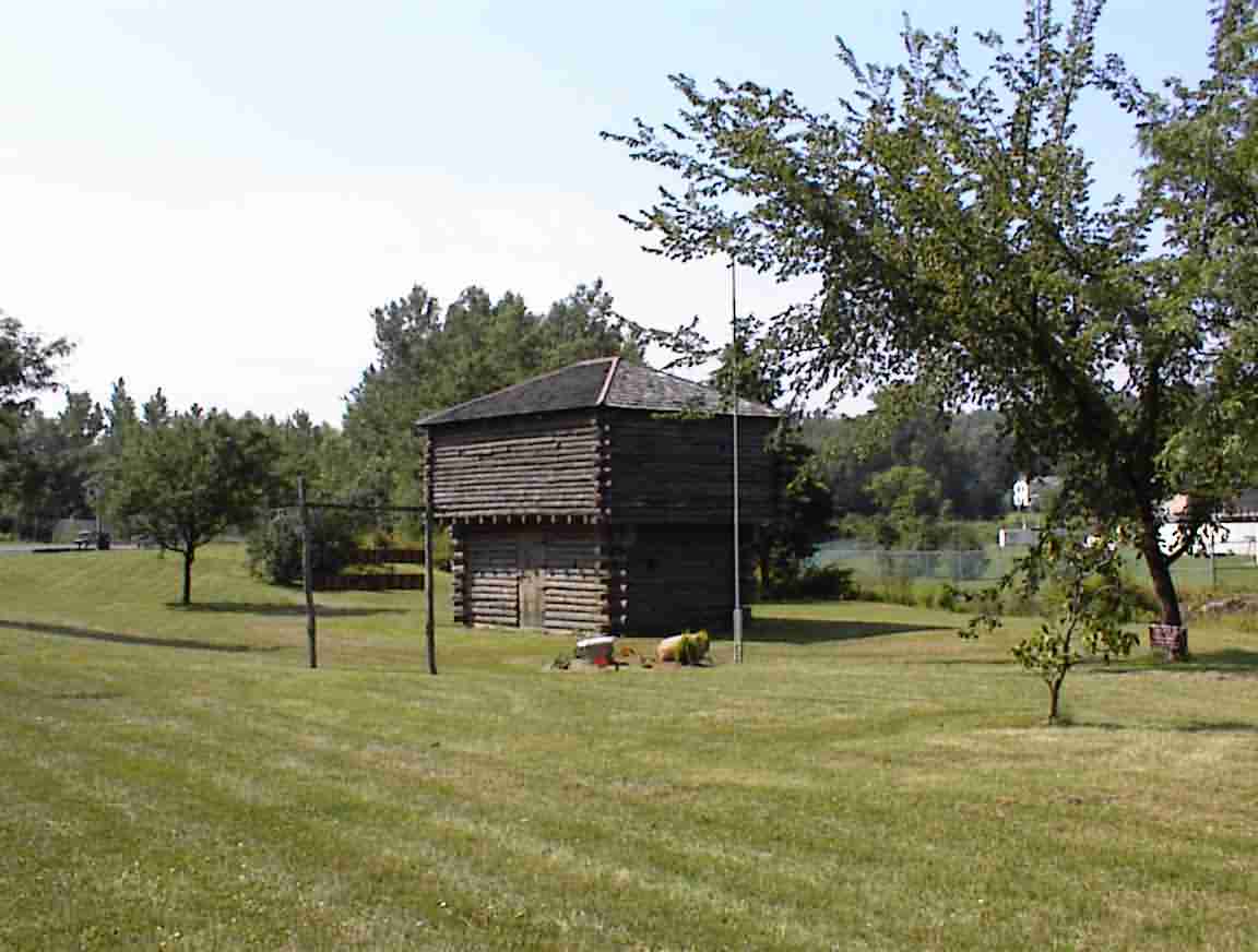
On the way out of town I passed the blockhouse shown in the photo below. The sign indicates that it dates from the 18th century, but I’m sceptical that untreated wood would have lasted for 250 odd years. However, it does serve as a reminder of what life must have been like here on the frontier for that is what this area was until the Erie canal was built. Those who have ever read the book ‘Last of the Mohicans’ by James Fennimore Cooper will be familiar with his descriptions of the dense, virgin forests and the conflict between the European settlers and the Indians. It was a hard place to survive.
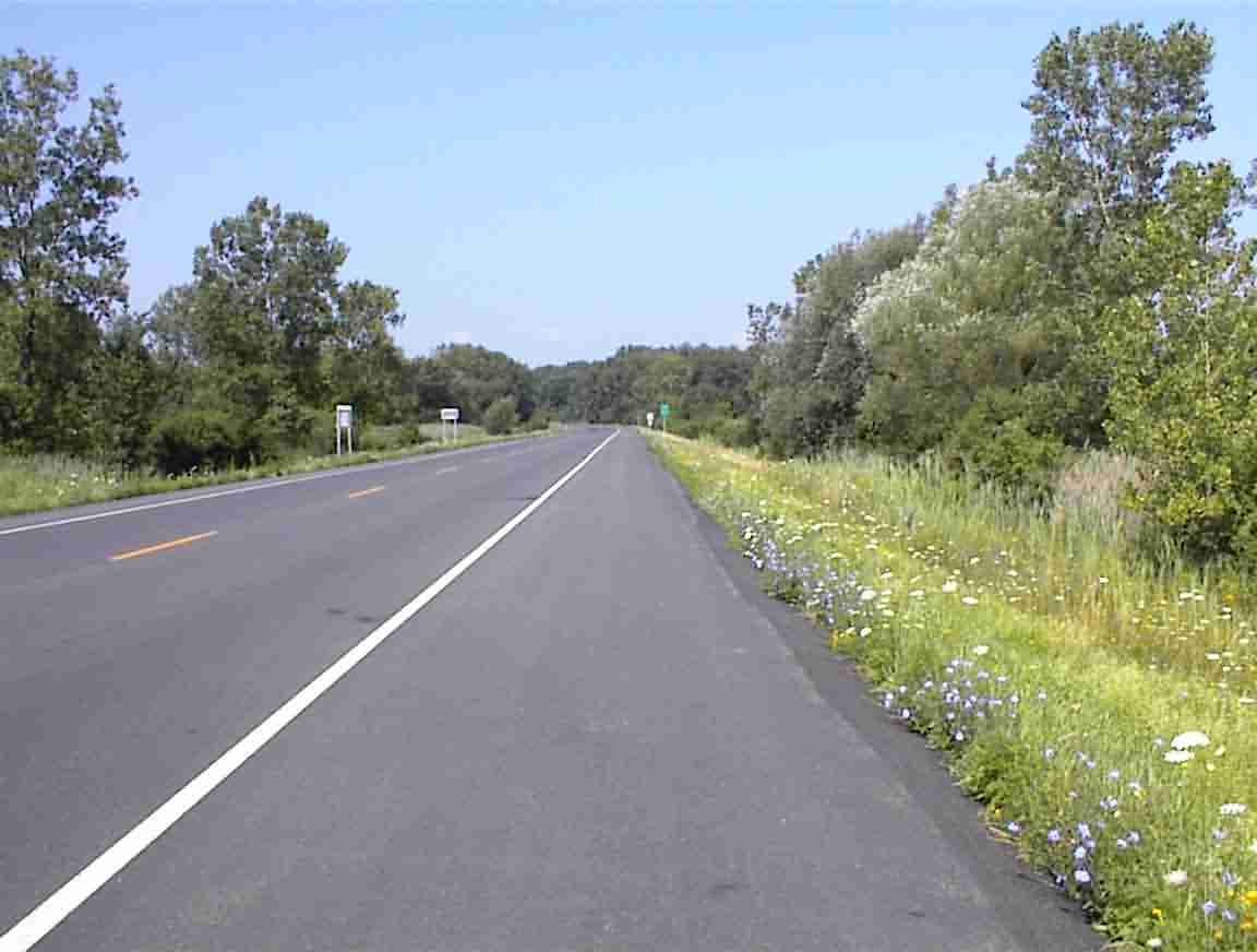
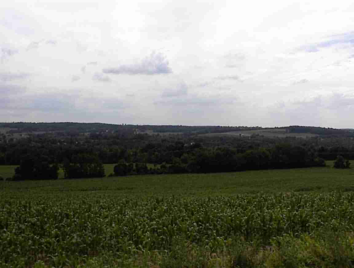
The road was delightful to cycle along as there was little, if any traffic. It took me through rolling hills interspersed with swamps. The photos below really don’t do it justice. Suffice to say that it was a thoroughly wonderful bike ride and it was good to be alive.
Eventually the road joined with Highway 89 and took me south again. It was very hilly and I enjoyed the view from up high looking over the river valleys below with hills rolling off into the distance. I suppose that part of the pleasure came from knowing that I was going to be cycling mainly along the flat bits otherwise it would have been a bit daunting.
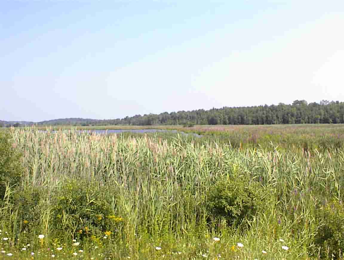
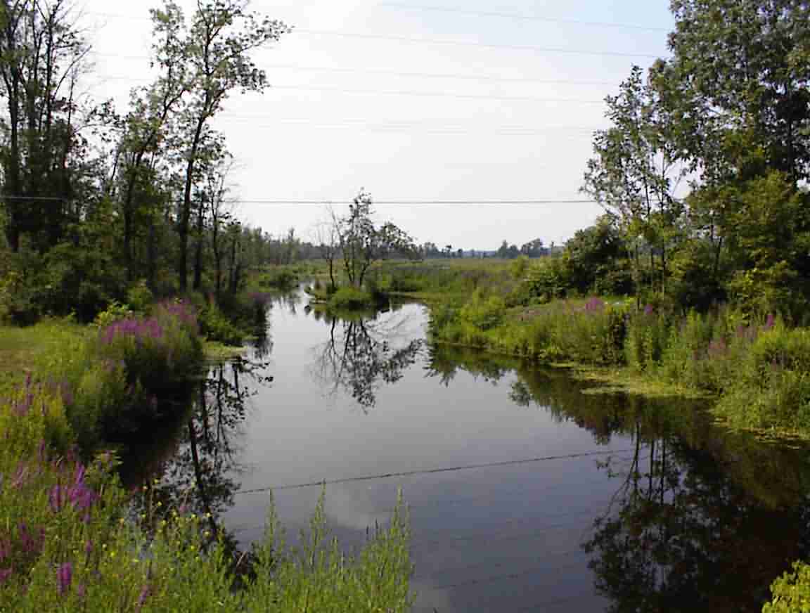
I descended to a huge flood plain which was quite intensively farmed. The rich, brown soil was obviously ideal for farming but I wondered how frequently they were washed away by floods. The river proved to be the Seneca river which connects with the ‘Finger Lakes’ and Lake Ontario via the Oswego canal. They are called the Finger Lakes since they are long and thin and on a map look like someone put their hand in the soil, or scratched it leaving a depression. Indeed, the Indians believed that they were made by the hand of God.
On the north end of the bridge there was a sign that this area was called the place of the mosquitoes and I can vouch for the appropriateness of the name. Seldom in my travels have I encountered mosquitoes as viscous as I have in this area. They were not large like the ones in Nebraska, but they would attack and the itching they caused was all out of proportion to their size. I even had them attach themselves to me when cycling at 20 km/h which is quite a feat.
The town of Port Byron was the next stop and I had a lunch break there in a pizza parlour. Although the USA is the land of the hamburger, pizza must rival it as the nation’s most popular meal. There are always pizza parlours in even the smallest of towns and petrol stations often sell it by the slice, although on wonders how nice it would be having sat for many hours. The one that I found offered submarine sandwiches so I had one of these instead. They kindly asked whether I wanted American or Swiss cheese and I thought I would try American for a change as I wasn’t sure what it was. Big mistake. I should have realised that American equals heavily processed and it was the orange cheese that one buys when one is too idle to be bothered cutting cheese properly. Pre-wrapped in its own cellophane it is the height of convenience, although not ranking that highly on the taste scale. At least the bread was home made and I enjoyed the meal, cheese choice notwithstanding.
I went across the street to the bakery and had an apple fritter for desert and asked directions to the canal trail. The woman behind the counter thought it started in the local park since her son referred to it as the canal trail park so I set off in search of it. This was definitely the place as there was the old Erie canal, overgrown but still holding water.
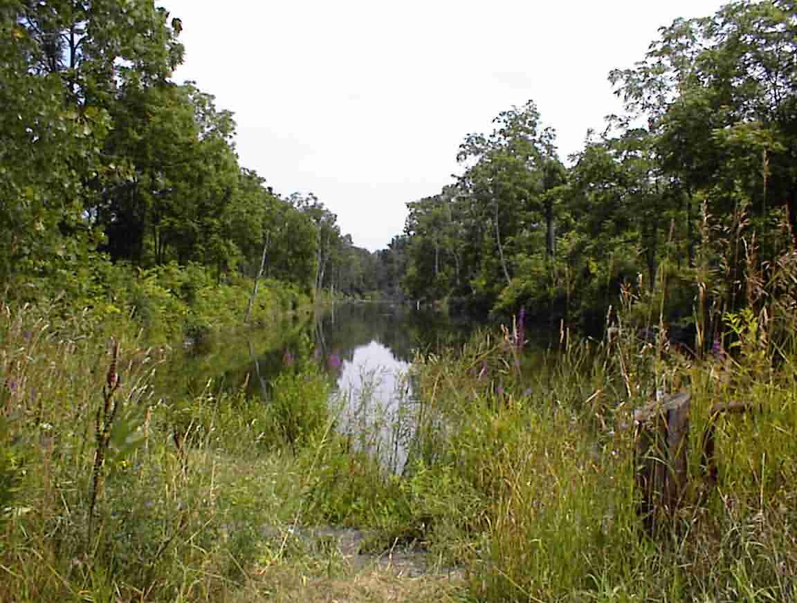
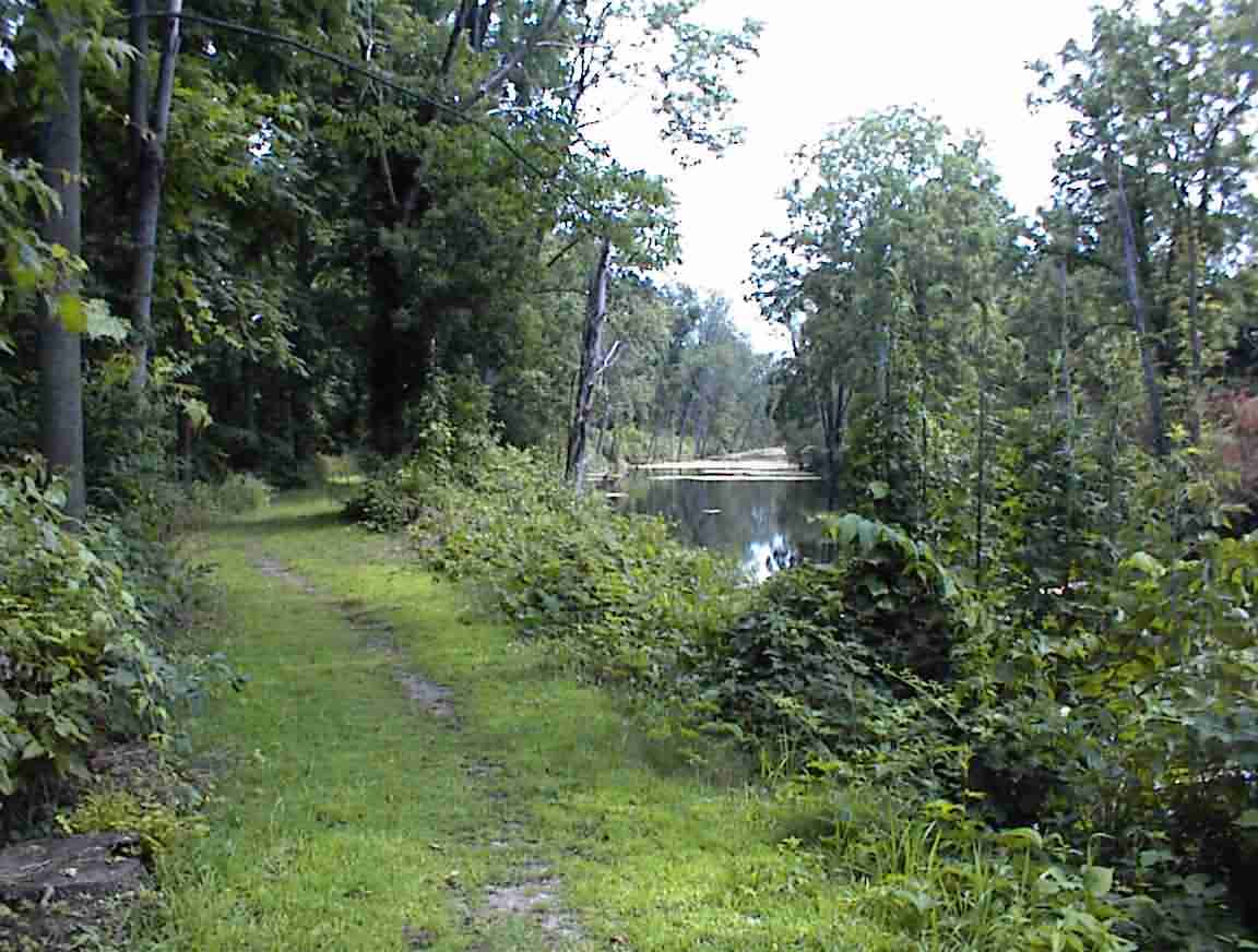
But where was the trail? There were paths to the left and the right of the canal and I selected the left. Good choice as this proved to be correct. However, there was not much of a trail to speak of as it was more of a footpath. Fortunately, I have a mountain bike and so on I went over roots and bouncing along the trail. The photos below give some idea of what it was like.
After about 4 km it ended at an old aqueduct, the foundations of which were still visible. There were children playing in the water and it reminded me of when I was young and played in the Don River in Toronto. I was blissfully unaware of the implications of pollution and so life was much less complicated. This is not the same today and there were some signs that the water in the old Erie canal was polluted and that you should wash if you came into contact with it. Great advice except there was never any water around to do this—except in the polluted canal. For the record, the problem was when the canal was near an urban area.
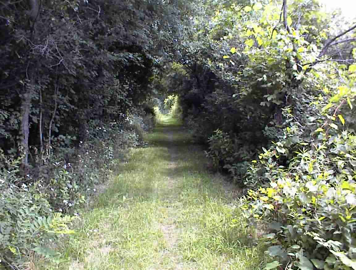
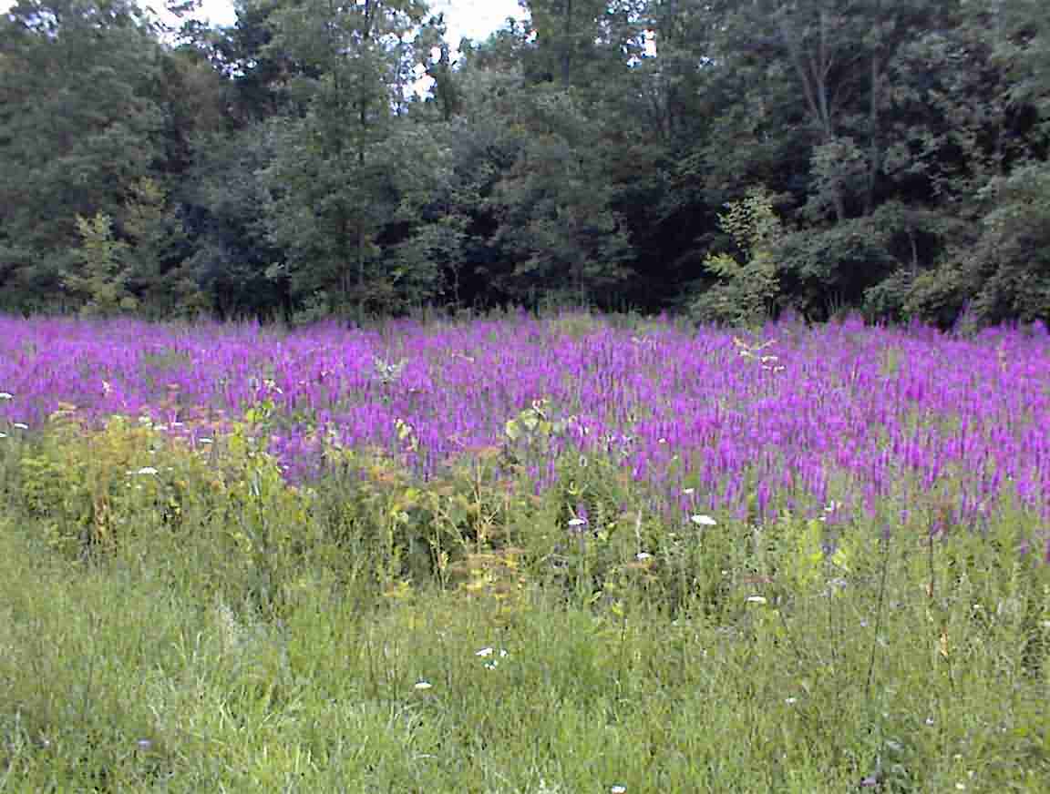
The trail ended at a memorial park—or should I say that part that I could cycle. It continued onwards but it would have been foolhardy to take my pannier laden bicycle along the overgrown hikers trail. I therefore cut out onto the road and continued east. The roadside was full of beautiful purple flowers as shown in the photo below.
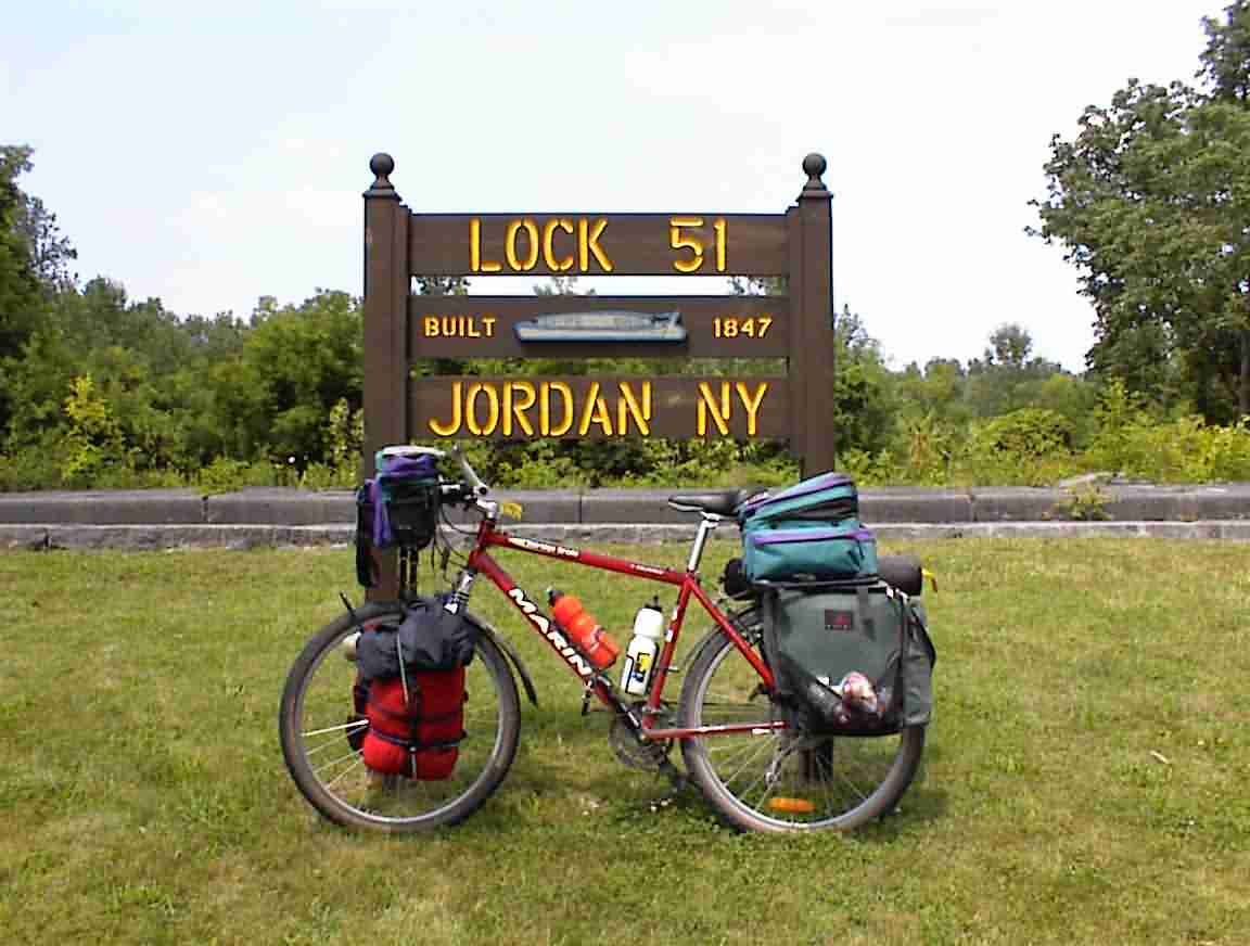
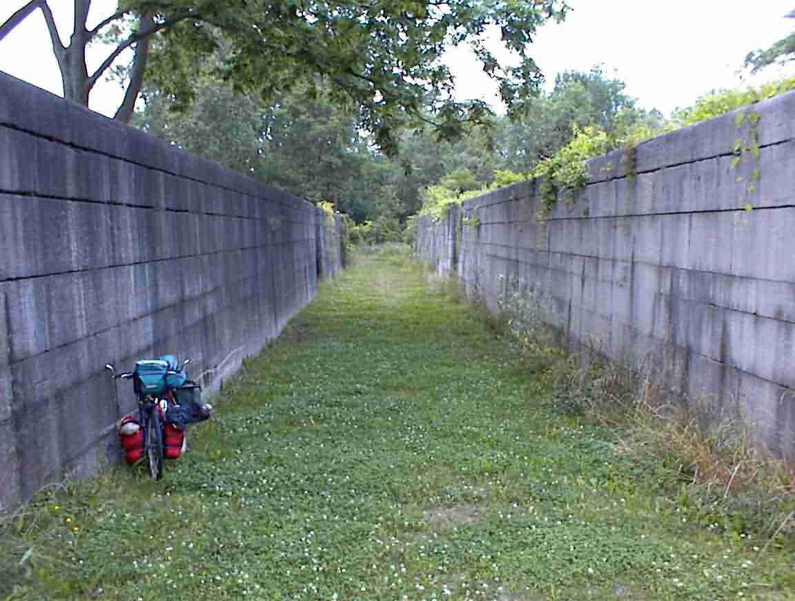
Near Jordan I found an old, abandoned lock. It was interesting to admire the stonework. As the sign below shows, this was built when the canal was widened in the 1840’s. The quality of the stonework was impressive with the large blocks carefully dressed and fitting together with little mortar. They were real craftsman in those days. By contrast, some of the 1820’s work that I’ve seen has more of a rough edge around it, perhaps reflecting more of the time and financial constraints that they were operating under. To give you and idea of the size of the locks I parked my bike inside and took the second photo below.
The bicycle route went north of Syracuse and followed the south shore of Oneida Lake. I wanted to cycle through the Erie Canal State Park which was south-east of Syracuse so I decided to try and find another route. I enquired of a man painting his house and was told that there was a back road to Highway 5 which was what I was looking for.
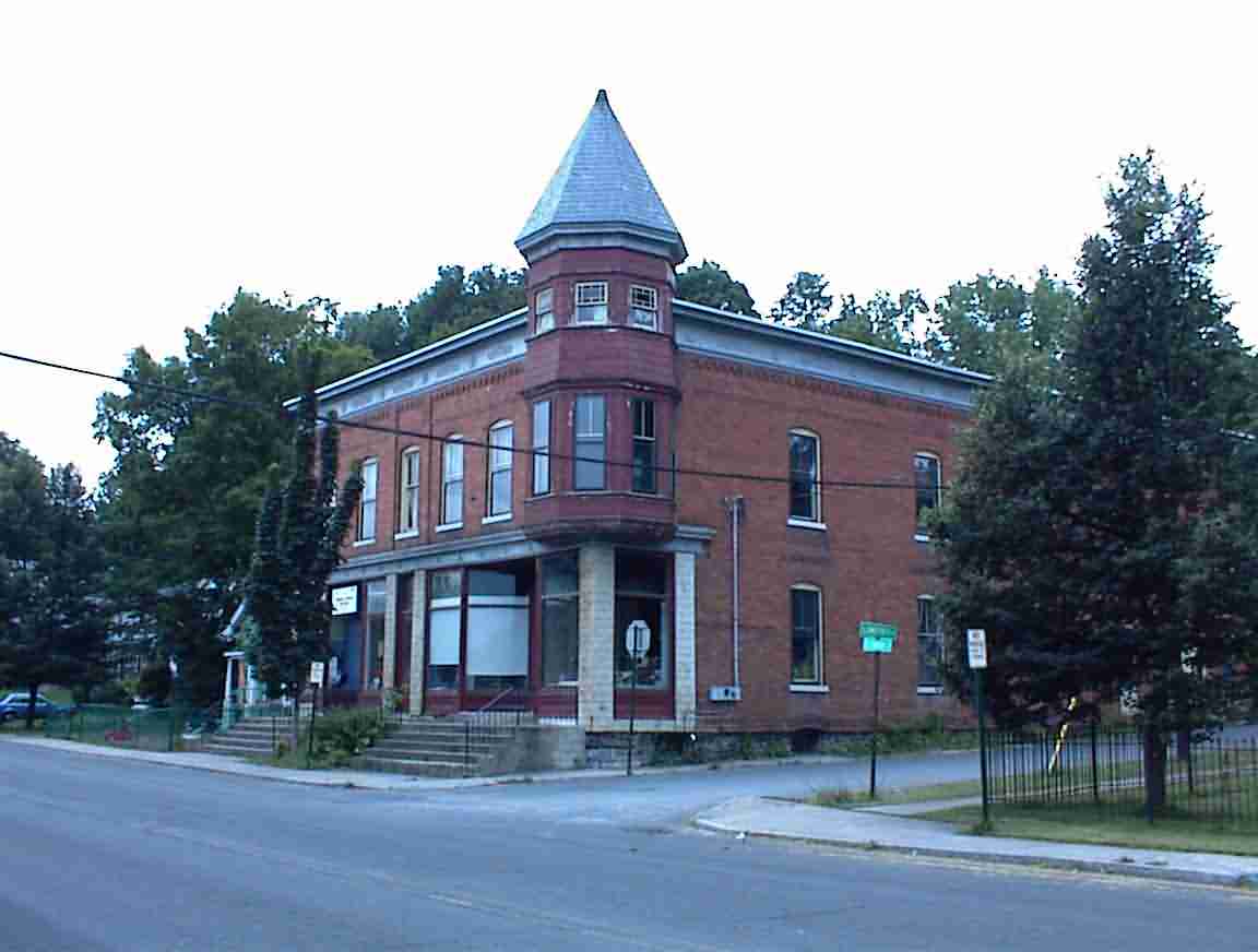
Jordan was a very quiet town. They had turned one of the locks into a sunken garden with lots of flowers and other plantings. It was quite attractive. There were many old houses and buildings in town, with many having towers like the ones shown in the two photos below. The second was a factory with the name of Bennett. Must be some distant relative of mine.
While I was taking the first photo two woman with babies asked if I needed any directions. I thanked them for the offer but told them that I saw the sign to Syracuse which was about 30 km away. One of them was shocked that I was going to cycle that far so I floored her with the comment that I had come from San Francisco so 30 km really wasn’t that big a deal. She told me that it was dangerous on the roads and to be careful. Very sweet people in outback America. I should have told her that having survived Gary Indiana not much frightened me anymore.
It was onwards through the hills to the town of Camillus. It was nice to have the downhill zooms but my gears were acting up again so many stops for adjustments. Camillus was a large town which, I found out later, has a canal museum. It is a pity that they don’t advertise these things more widely. I knew the canal was nearby since I saw more of those houses with the lookout towers.
The traffic was very heavy and it was also very hilly which, coupled with the headwind I now had, made it hard going. At 100 km I stopped and had a drink and called Lis for a short chat before going into Syracuse. I was glad that I chose Highway 5 since there is no way that I would have made it through Syracuse on another route. There was a maze of roads to follow but with good sign posting it wasn’t that difficult. My route took me through the south of the city and although there was a lot of traffic and industrial areas there was not the urban desolation that I have seen blighting so many other cities.
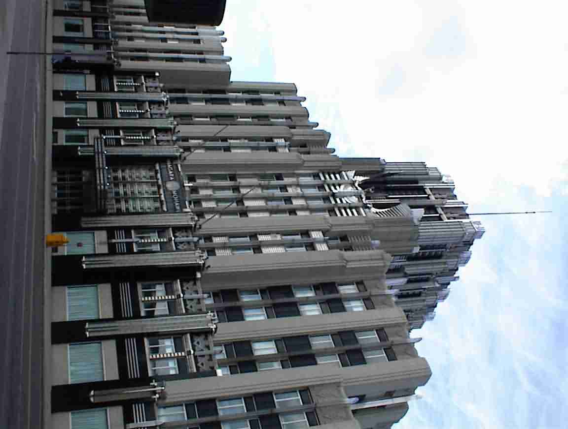
Syracuse was a bustling city and I wonder what the basis is for its economy. There was a range of building styles and I was taken with the 1930’s art-deco style of the local power company. Lots of chrome and flared metal work. The photo below gives a little of the flavour.
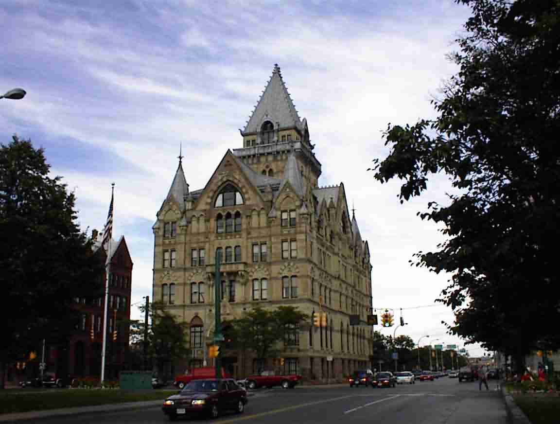
At the same time as the modern sky scrapers, the city had quite a few older buildings that were in excellent condition (and some that were not so excellent). It seems to offer a contrast of modern and old.
I found the canal museum and although it was 15 minutes before closing time they had gone home for the day! Such is the life of the cycle tourist. It was housed in two buildings that were used during the heyday of the canal. One of them was a weigh bridge for the boats and it was used to establish the appropriate tolls.
There was a small lock and the boats entered the lock. The water was drained and the boats came to rest on wooden frames. This gave them the total weight of the boat. Since the empty weight was recorded when the boat was registered, the difference gave them the toll. Apparently this was a common practice around the world but this is the only place where the original building is still standing. You see the building in the photo below and the gravel in front of the building is where the boats were weighed. The busy road to the right of the building is the original canal route.
It was quite time consuming travelling through the town but eventually I reached the eastern side of it, having passed many miles of shops. I also passed a cyclist limping with a very bent front wheel on his bike and a motorist apologising profusely. It looked like the motorist turned in front of the cyclist who rear ended him. One really has to have ones radar on at all times in urban areas, anticipating the actions of these oblivious motorists.
At Fayetteville I headed north and found the Erie Canal State Park. It was sheer bliss to be away from the traffic and on an excellent and peaceful bike trail once again. The trail followed the north of the canal for about 60 km so I had a nice long ride ahead of me. It was well patronised with many walkers, joggers and cyclists.
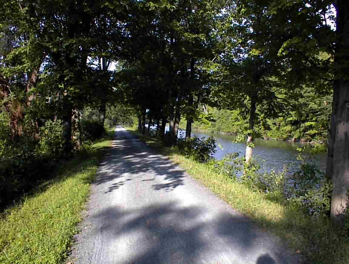
I cycled for about 10 km and then stopped to have a bite to eat. My picnic table was a 150 year old spillway embankment and except for a single cyclist I had the entire area to myself. There were birds in the trees and lovely water in front of me. It was pure bliss.
Eventually I reached Canastota and having travelled over 100 miles (160 km) I decided to call it a night. I found a grocery store that was still open and had a drink. While sitting on the sidewalk a fellow in his 30s came out of a house across the road and started playing with a radio controlled truck. I was amazed at the speed at which it moved and how it bounced over all the obstacles. He drove it across the street, around and under parked cars, and obviously really enjoyed his hobby. I guess we guys never really grow up.
I indulged myself with a motel room but was told that I couldn’t park my bike inside. I was assured that it was safe locked outside the main door so I took them at their word. After a great shower, my first in three days, I downloaded 58 e-mails and responded to the most critical ones. This led to a late night, but that was OK since it was such a good day.
loans loans loans loans loans loans loans loans loans loans loans loans loans loans loans loans loans loans loans loans loans loans loans loans loans loans loans loans loans loans loans loans loansloans loans loans loans loans loans loans insurance insurance mortgage mortgage