25 July - Day 50: Eagle Harbor to Port Gibson – 122.5 km @ 19.7 km/h
I awoke to a beautiful sunny day and had breakfast in the sun while sitting on my bed mat. It was wonderful and relaxing with the canal in front of me; trees behind and birds singing. My breakfast consisted of muesli, cherries and blueberries. Very tasty – particularly the cherries. I have a real weakness for them and it is a luxury to have as many as I can eat.
Some women walked by along with a couple of cyclists otherwise I had the entire place to myself. Even though I’m in the USA it is only about 50-75 km from Canada directly across Lake Ontario so I could pick up radio signals from Canadian stations. It was neat to be listening to them, but I found it hard to relate to the news of traffic jams on the highways entering Toronto when I was sitting in such a peaceful setting.
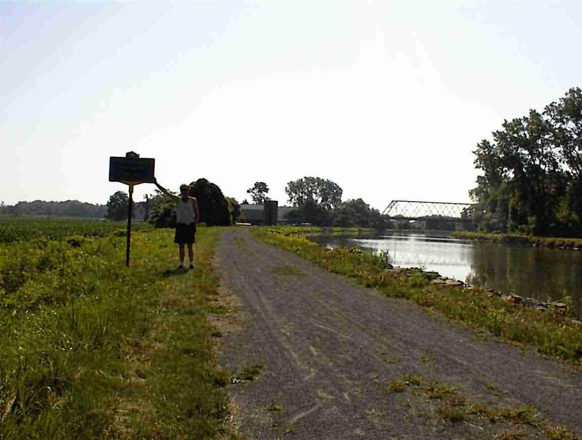
Eventually it was time to head off so I cycled east. I still had a headwind. Bother. After a few kilometres I came to a sign which indicated that this was the northern most point of the Erie Canal so posed for the photo below.
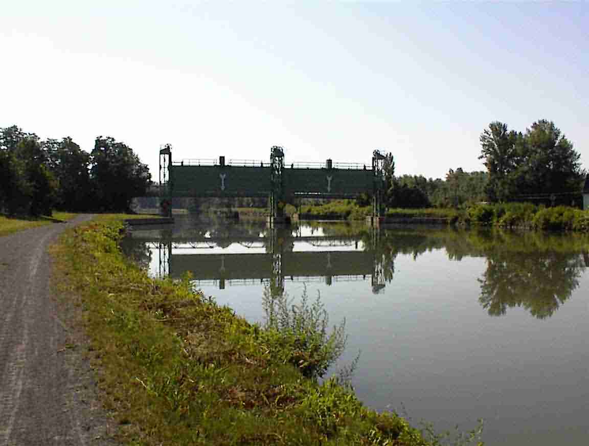
As I travelled along the cycle path I came across a barrier. I had passed several similar barriers yesterday and was to find many more further along the canal. Their function is to stop the flow from the canal in the event of a breach of the embankments. I read how in 1974 contractors were putting a culvert under the canal when they caused the embankment to fail. The barriers were lowered but not before many millions of gallons of water flooded the nearby houses, destroying or damaging 45. There were many years of litigation before the case was settled and I’m sure that it was only the solicitors who did well out of it. I haven’t worked out why they have arrows on the gates. Seems fairly obvious to me which way they will go … but then this is America and perhaps the solicitors would get involved if the signs weren’t there and it was lowered.
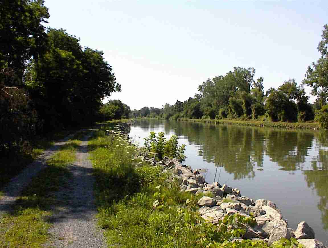
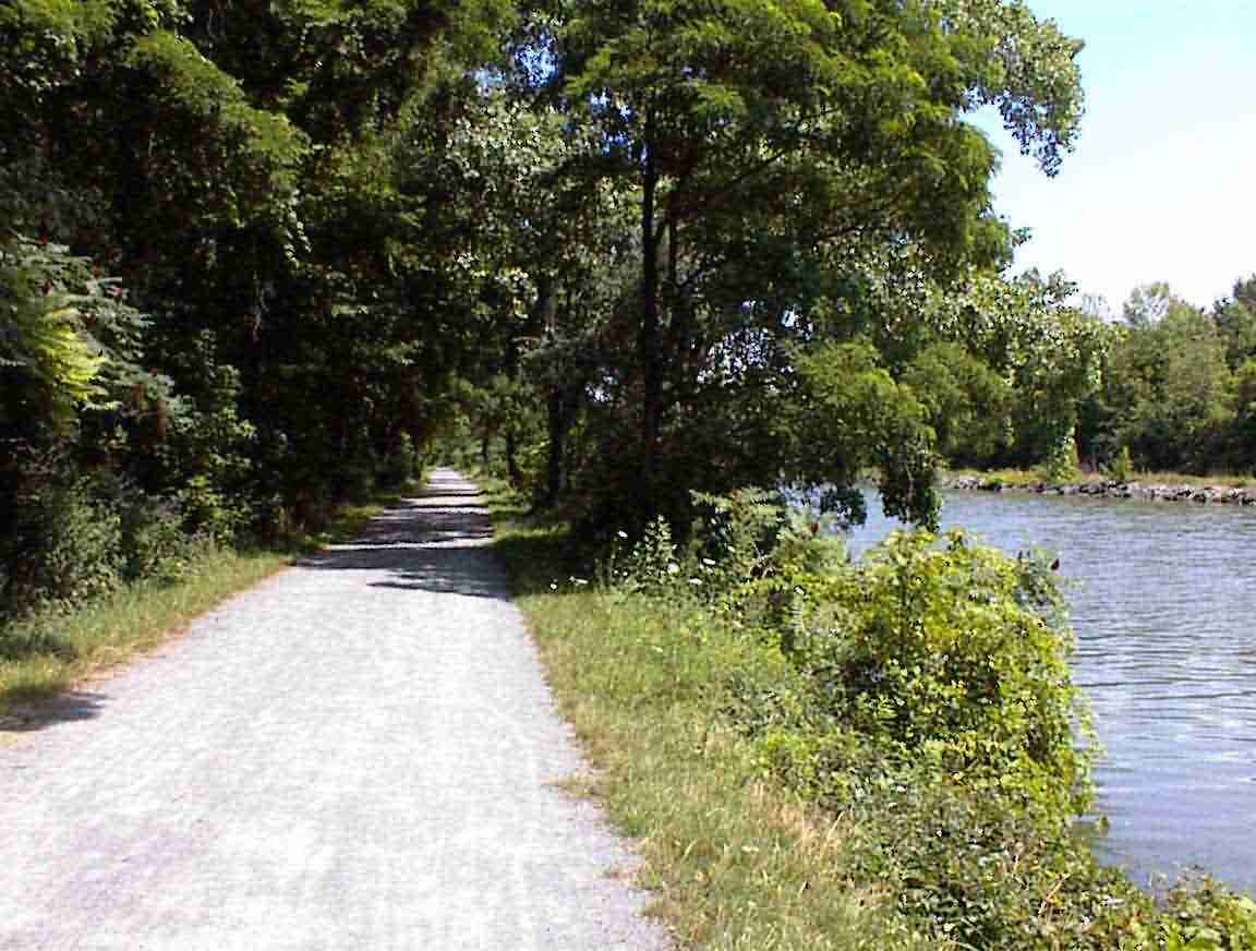
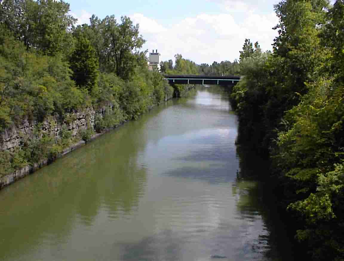
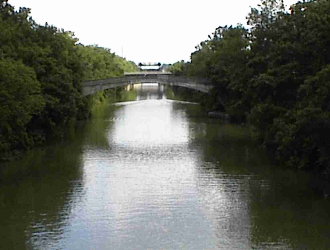
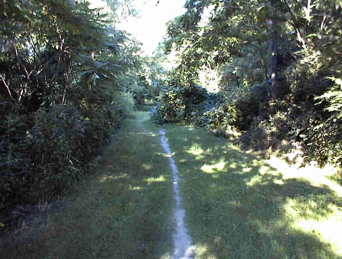
The photos below show the trail in a couple of locations. It was by and large in good condition and wide enough for two to cycle side-by-side. They used a fine gravel surface which put up a lot of dust so my bike and bags had a light grey sheen to it. In some sections they had used regular gravel which gave a much harsher ride; and it caused me to be concerned about my tyres and wheel. In a few places the trail was a path and I came across some workers building a new trail—not that was rough!—but overall this is probably the longest section of smooth bike trail I’ve ever come across (over 100 km in total).
When I got to the town of Albion I went exploring. It was very quiet and had obviously seen better days when the canal was the main through fare to the west, but it was still nothing like the dying towns I had seen out west. There were a number of beautiful buildings made from a red sandstone. This was indigenous to the area and at one stage over 1200 people were employed in the area cutting stone. They claim that it went as far as Buckingham Palace, but I’m surprised given that it is a grey, ugly building lacking the character that this sort of stone evokes.
There are quite a few bridges along the canal, many of them are low bridges which must be raised to let the boats pass. In Holley I stopped and chatted with the bridge keeper who was busy paining the bridge "the only thing holding it together". He told me that there were 18 of these bridges and they dated from 1915-1920 when they widened the canal.
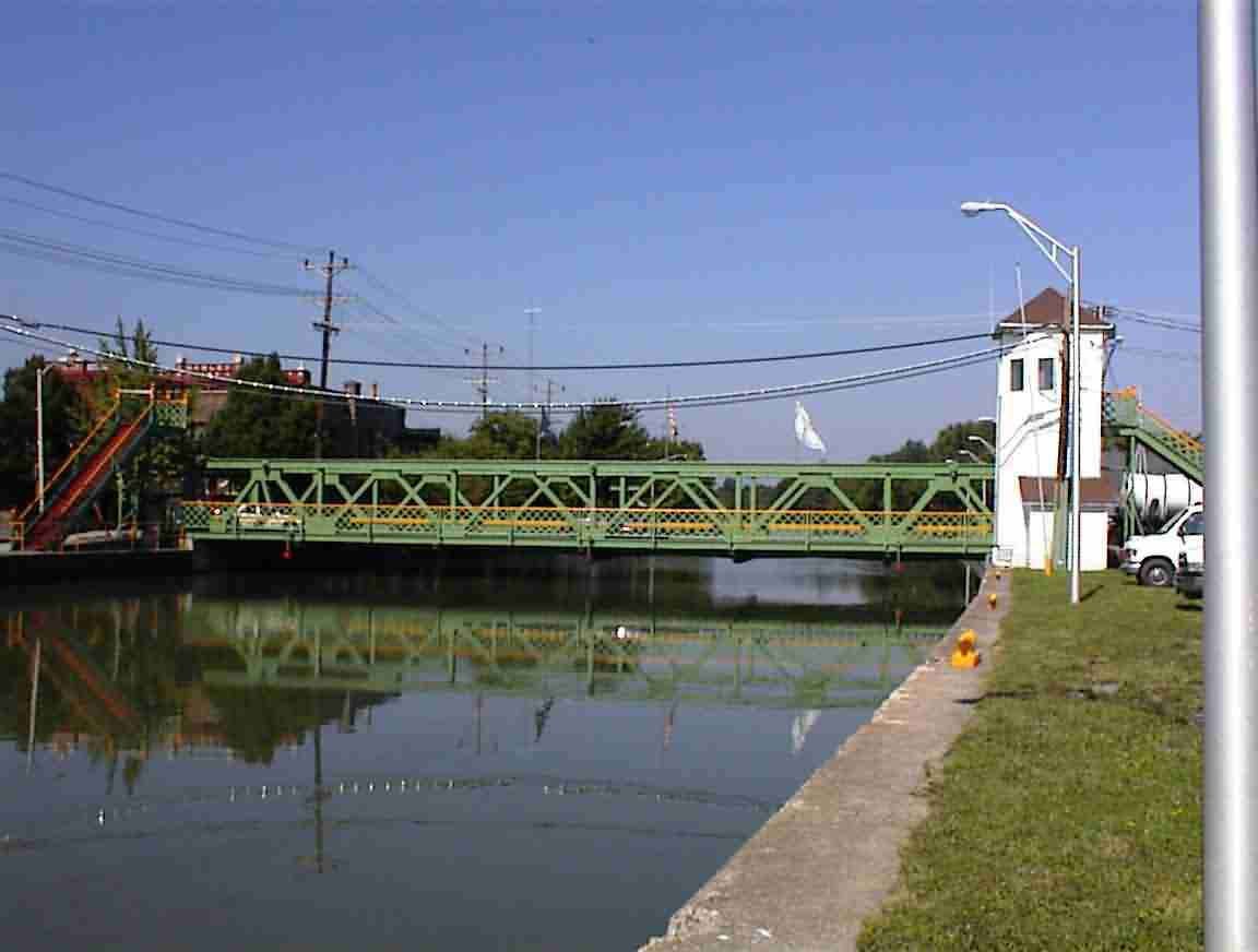
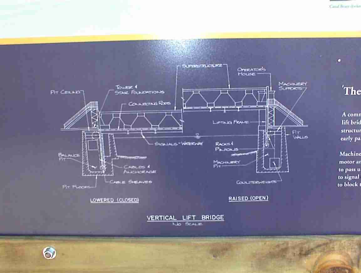
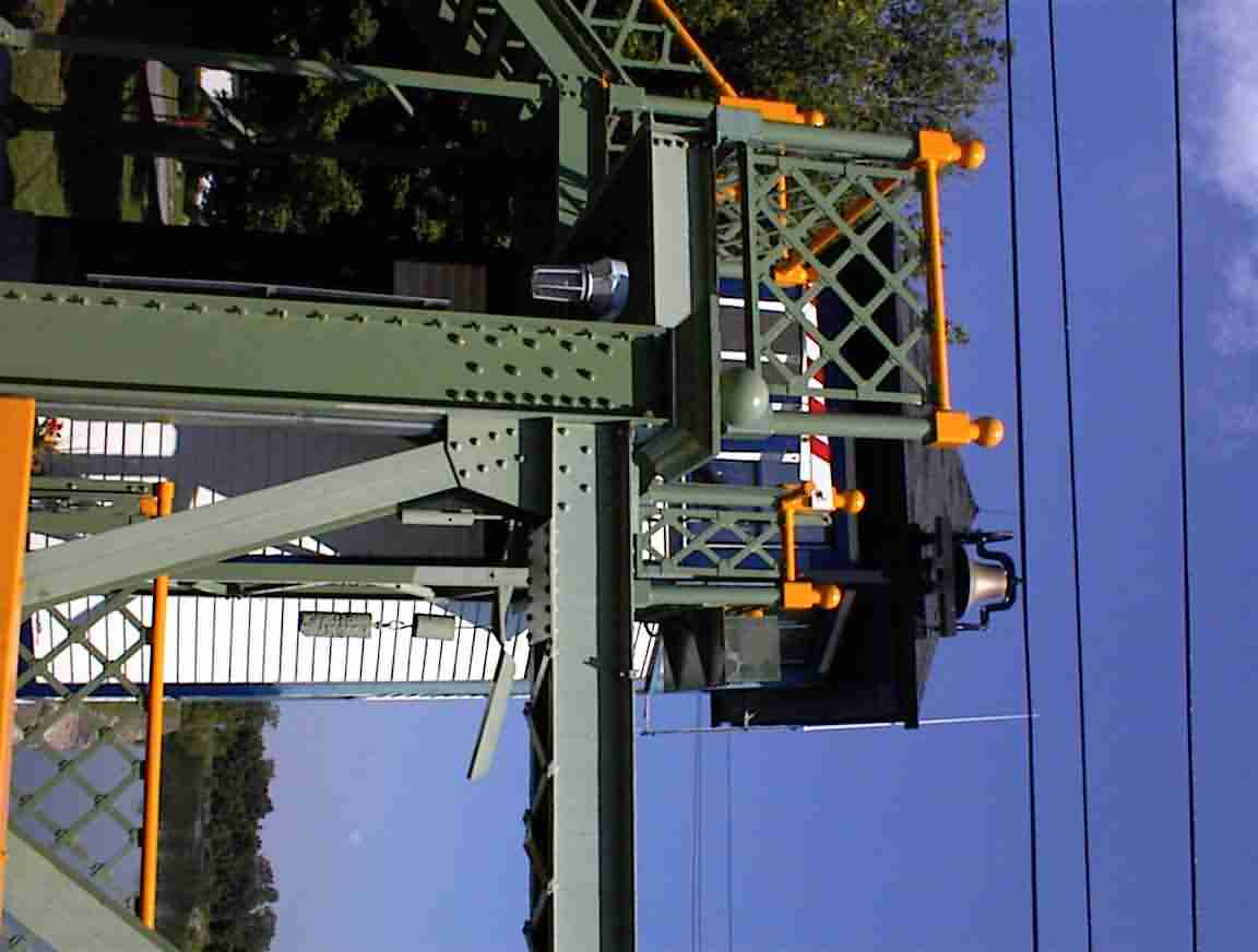
The engineering of these bridges was impressive. The draw bridge I saw on the Hennipin canal in Illinois was also a lift bridge but the counterweights were in four large towers at each corner of the bridge. Here there were no visible counterweights. This is because they are suspended in a 30 foot deep pit at each end of the bridge. The weights are 5% lighter than the bridge so that the bridge won’t bounce when it is lowered. The entire system is operated by a 25 hp electric motor. Very impressive when you consider that the bridge weighs 60 tons! At each end of the bridge there are stairs which makes it possible for pedestrians to cross the bridge when it is raised. I was told that this reflects the fact that when the bridges were built more people walked than drove. This is a blueprint which shows the operation of the bridge.
Each bridge had a bridge keepers building at one end. This one had a beautifully polished brass bell which you can see in the photo below. When a boat came they rang the bell before activating the electric bell on the arms which lowered on either end of the bridge to stop the traffic. I asked how many boats per day passed and was told that typically the bridge was raised 15-30 times a day. They had just had a flotilla of 150+ boats through to commemorate the flotilla which opened the canal and the bridge was raised 38 times that day.
I continued east to Brockport where I found a cycle shop to repair my rear wheel. I left the bike and went to a restaurant where I had a nice lunch next to the canal. There was a noticeable increase in the traffic as the day progressed and the bridge in town was raised a number of times over the course of my meal.
The town was very pleasant and there were lots of cafes with people sitting outside enjoying the sunshine. I found a most excellent bookshop and spent a while browsing. It really is one of my most favourite pastimes. I looked for a book on the construction of the canal to no avail, although they had a number of other books on the history of the area.
I retrieved my bike and, for the first time on the trip, was charged for the repairs. It didn’t bother me as they did an excellent job and the bike rode very well. It was great not to have to worry about the strength of the wheel any longer, and I got some advice on upgrading the wheel when I get back to N.Z.
There were a number of small towns which once were hubs of commerce. One of them was Adams Basin and at an information sign there was a photo of them loading hundreds of barrels of apples at the wharves. There was also a photo of a building which was built in 1825 just after the canal opened and was still in use today as a Bed & Breakfast. They said that it had been used continuously as a tavern and hotel/accommodation continuously since then.
I came to the sign below. No, I wasn’t transmorgified to the Mediterranean; it just reflects the background of the settlers. There were obviously Italians (the town of Medina), Arabs (Egypt); Norwegians (Bergen); Latvians (Riga) and Dutch (Batavia). A collage of nationalities … but today they are all Americans.
Just outside of Gates I came to an old, overgrown canal spur heading off to the left. There were the remnants of the canal lock gates in the overgrown weeds. There was a sign nearby indicating that this was a short-term canal used for only a couple of years early this century when the Erie was upgraded. They showed how the canal went through three stages. Initially, it was 40’ wide. This was then increased to 70’ and the canal deepened after about 30 years as the demand increased. The canal was also straightened at the time. The major upgrade happened early this century when it was further widened and deepened to take large barge traffic. The number of locks was also decreased as instead of lifting about 6’ they lifted 12 – 20’.
As I entered the suburbs around Rochester the canal was cut through deep rock. I surmised that this must have been done during the most recent upgrade as I can’t see it having happened with the original canal. I subsequently read that the original canal went through what is now downtown Rochester but that it is now some of the city’s streets.
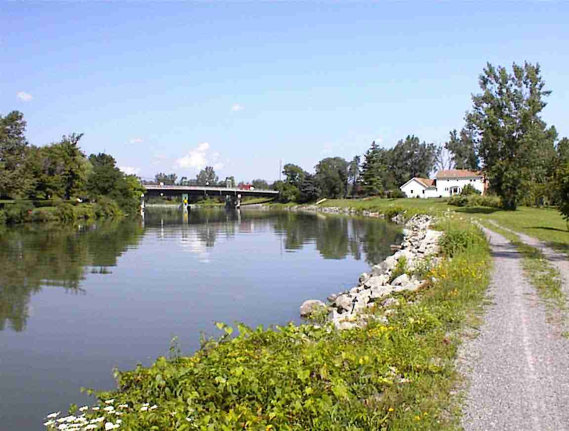
The canal intersected the Genesee River at there was this massive area of water. There were large parks with lots of people walking and cycling. In fact, the canal trail had become quite busy with a continuous stream of traffic. There were lots of bridges along the canal and due to some poor directions I went over several successive ones, crossing the canal three times! I met a couple of women who were also lost but together we found the right trail.
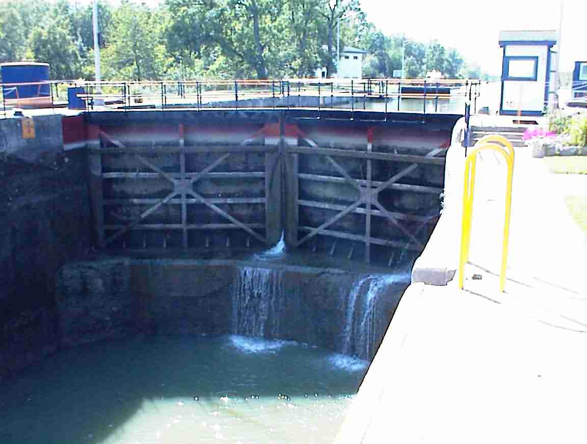
The canal has no locks between Lockport and Rochester but east of Rochester the locks begin again. When I reached Lock 33 I stopped and chatted with the Lockkeeper who was very keen on showing myself and two female cyclists the lock. He told us how there was an annual competition between the lockkeepers for who has the best lock in the system. When he took the lock over three years ago it was ranked 45th out of 49. Last year it was 5th and this year he is aiming to win. If he doesn’t I’d love to see who does since the lock was in incredible condition.
We started off at the lock gates. He told me that the design of the gates wherein they come together at an angle was invented by Lionardo DaVinci. Really quite smart since it is more efficient and uses the weight of the water to hold them in place.
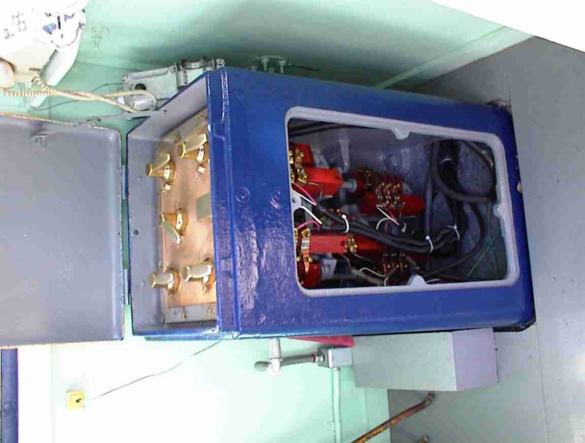
The electronics dated back to the 1940s and they were a work of art. The switchboard was a combination of copper and brass, all of which was polished to a sheen (see below).
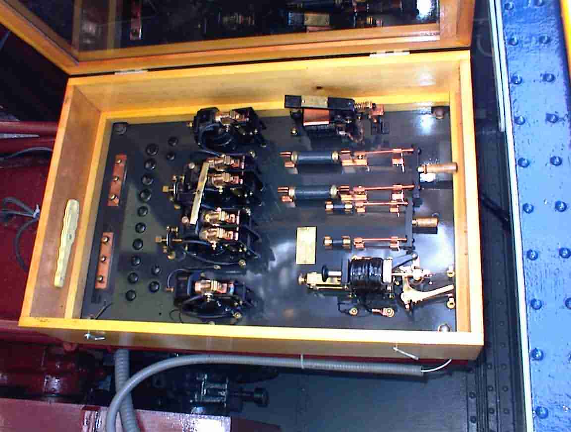
The lock was controlled by only a few levers (see below). The canal basin has a series of horizontal nozzles which have gravity valves. When opened it is filled by about 15 million litres of water to raise the boat. It is amazing how quickly the canal fills; probably 5 minutes at most.
The canal trail from Rochester east was very well developed. There were places like Pitsford and Fairport which had cafes and boats offering tours of the canal. There were lots of people about and I thought it was great that the canal was so well patronised. It really is a great recreational asset.
All good things come to an end and eventually the trail petered out near Palmyra (see below). Not that I let it stop me, after all, what are mountain bikes for? I followed the trail into town until I could go no further.
It was early evening so I stopped for a meal after calling my office in N.Z. I found a local pizza parlour and had a folded pizza which was baked. Most delicious. My batteries recharged, I cycled east to Port Gibson and stopped at a boat landing point with the intent of camping. However, there was a strange fellow there so I decided to head back to the town and try to find somewhere else to stay. The local grocery store was open and advised me to ask at the fire station if I could stay in their park. The station was abandoned but I saw someone walking down the road in heavy boots so cycled over and asked if he was a fireman. Which he was.
Steve was most helpful and used his cell phone to call the park. His colleagues were still there tidying up after the evenings activities. They had been pushing a large ball with their hoses. A combination of training and fun (mostly fun) which they apparently compete against other fireman with. Steve was an ex-Marine who had travelled the world before returning to quiet Port Gibson where he was a building contractor. Scott and Dave were still at the park and we chatted before they left. I pitched my tent and sat at a picnic table working on my computer until the battery failed, listening to National Public Radio. The stars were out and it was a lovely evening, mosquitoes notwithstanding.
On to the Next Day or Back to the Home Page
loans loans loans loans loans loans loans loans loans loans loans loans loans loans loans loans loans loans loans loans loans loans loans loans loans loans loans loans loans loans loans loans loansloans loans loans loans loans loans loans insurance insurance mortgage mortgage