24 July - Day 49: Niagara Falls ON to Lockport NY - 106.5 km @ 18.7 km/h
Susan and I had a leisurely breakfast and continued our discussions from the previous night. I also gave her some suggestions on equipment to take to Laos. I’ve been meaning for sometime to start a newsletter for friends with tips on things like my small portable 10 h batter for notebooks, accessing e-mail on the go, etc. I’ve learned quite a few things the hard way and it’s great when I can pass on some tips.
After Susan went to work I answered a flurry of e-mails and then cycled into town. It never ceases to amaze me how a trip which takes an eternity the first time one travels to a new place is so short on the way back. There was also a lot less traffic than the previous night which made things much more pleasant.
My first stop was the museum in Lundy’s Lane. Although it was quite small, it was very well laid out. They gave me a small booklet which served as my guide as I walked through the museum. It opened with a display on the Indians who were the first in the area. There was also a painting of the great Mohawk chief who took the name Joseph Brant. He fought with the British in the American Revolutionary war and after the war his tribe moved to the Niagara area where they were given large tracks of land around the present day Brantford.
The display progressed through settlement by Europeans to the most significant event: the War of 1812. As I described yesterday, the most significant battles were in the Niagara peninsula area and it is where the war was won by the British. The museum was located at the site of Lundy’s Lane battle which ended once and for all the hopes of conquest by the Americans. It was interesting to read the story of Laura Secord who was a heroine on the Canadian side for travelling through forests to warn the British of an impending attack. The small force of British troops and Indians surprised the Americans and the 50 of them captured over 500 troops.
I continued on to the display on daredevils. It described these crazy people who crossed the falls on tightropes. They crossed on foot, on bicycle, and even with people on their back. One woman even put baskets on her feet! Their folly was only surpassed by those who went over the falls in barrels. Some survived; some died; many were injured. Fortunately, they have stopped such
stunts, although some people still try.
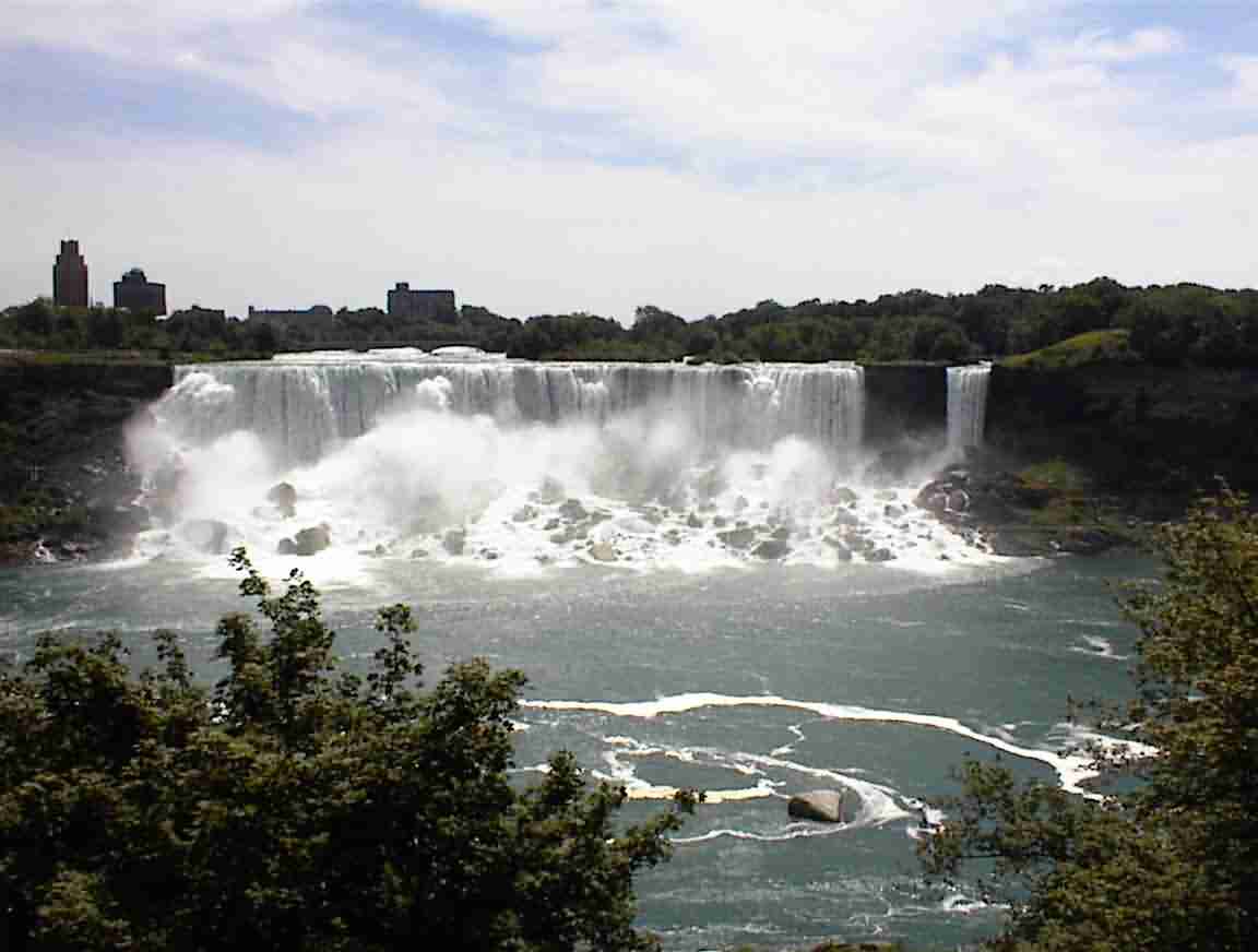
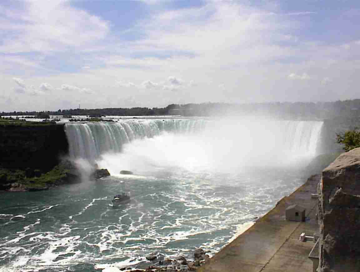
Eventually I finished and went down to the falls. The light was better and so I took some more photos. The first is of the American Falls and the second of the Horseshoe falls.
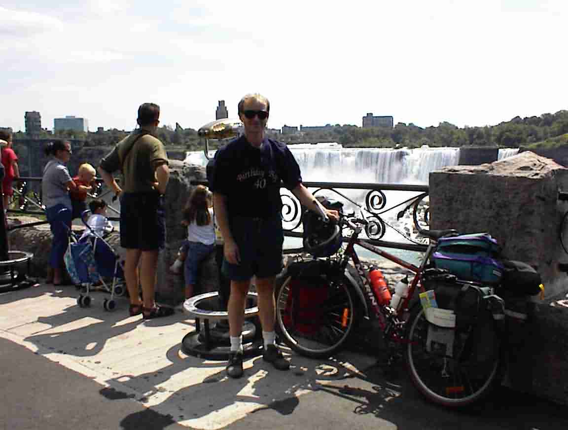
There was an elderly couple was sitting there watching the people go by and I asked them to take a photo of me. I donned my T-shirt again and the resulting photo is below. It transpired that they were from Newcastle on Tyne and I told them of Lis and my trip across the Pennine mountains which ended in their city. One of the interesting aspects of the visit was seeing a mini-version of the Sydney harbour bridge. It transpired that the Sydney bridge was a copy of the one in Newcastle and it was even built by the same workmen.
There was a wide sidewalk along the riverbank and there were so many people I had to walk my bike. There was a polyglot of languages, many of which I didn’t recognise. This really is a popular tourist destination. After seeing enough of the falls I headed east along the riverbank. The Niagara River flows through a deep gorge, as shown in the photo below.
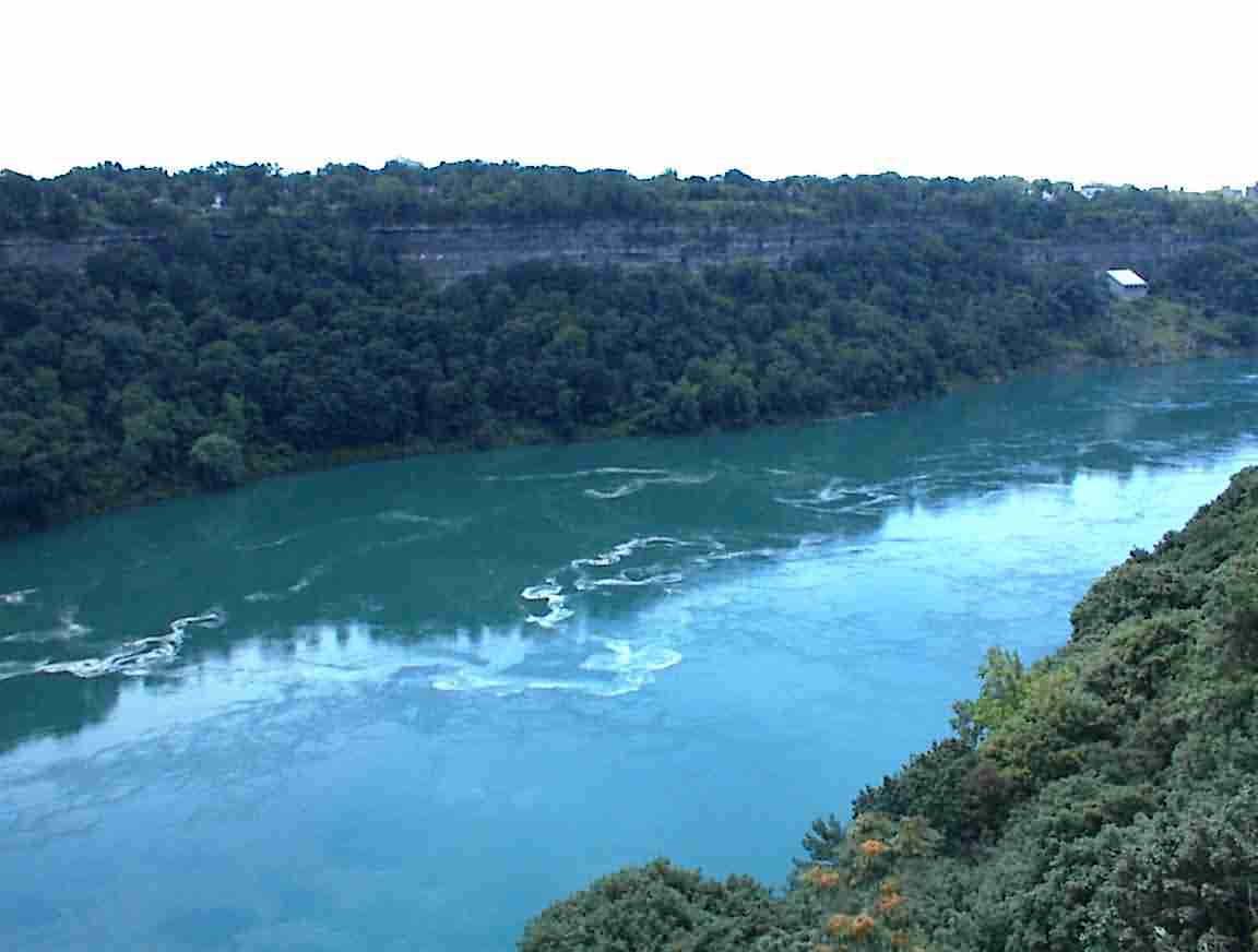
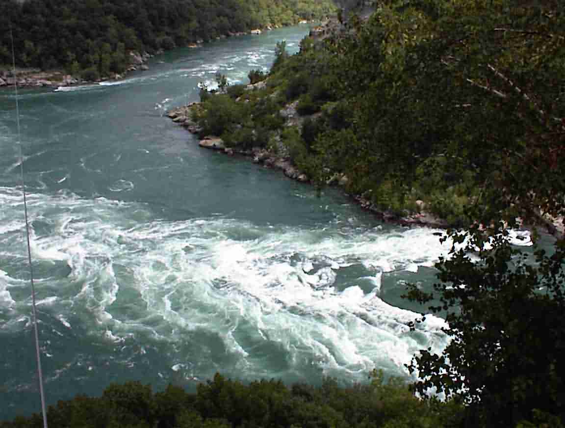
There were a number of places to stop and view the river, although for much of the length it was obscured by trees. There are also some excellent bush walks which take you down to the water. There was a whirlpool area which was very impressive, the photo below barely does it justice. I was impressed by the fact that they once sailed a steamboat down the river. Although it was damaged in the rapids and the whirlpool they made it to Lake Ontario. They were crazy in those days …
In an attempt at avoiding towns I had decided to cross to the USA at Queenstown. This is the easternmost bridge on the river and is at the site of the battle where General Brock was killed. There was a monument to General Brock, the original of which was blown up in the 1850’s by Irish rebels. In fact, there was an invasion of Canada by the IRA around 1860, but they were defeated by the British and militias. The soldiers were Irish who had fought in the Civil War and they received a slap on the wrist by the American government who didn’t want to alienate the powerful Irish vote.
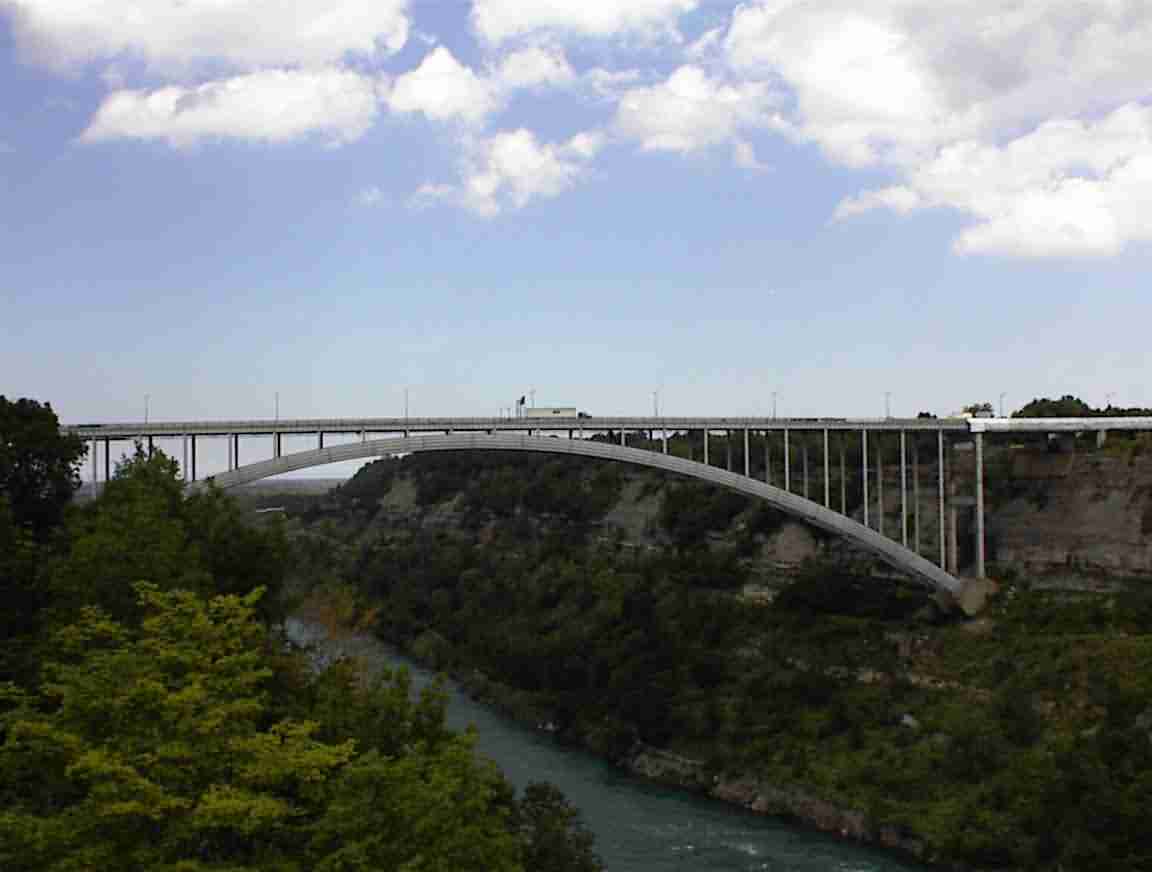
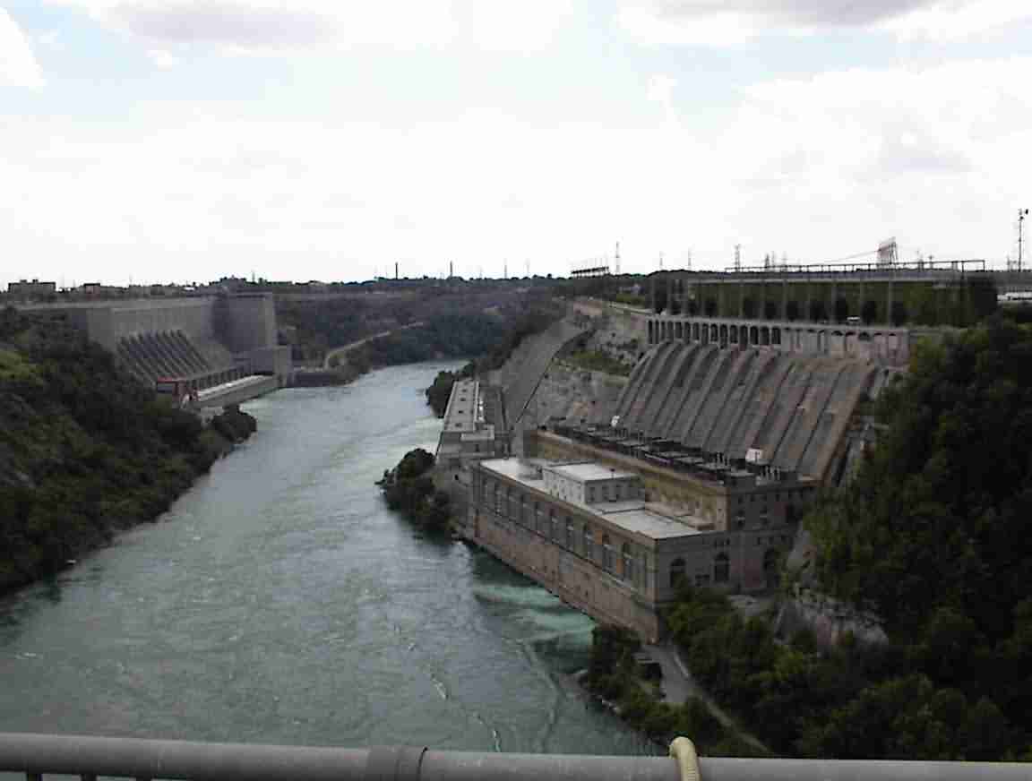
There were no immigration formalities on the Canadian side so I cycled through and across the bridge. It was under renovation so one of the lanes was closed to traffic—but not to bicycles! It was great to have the lane all to myself and it was possible stop and take the photo below of the power plants on the river. The one on the right is the Canadian side and it was opened in the 1920’s. At the time it was one of the largest hydro power plants in the world, but today only provides sufficient power for a small/medium sized city.
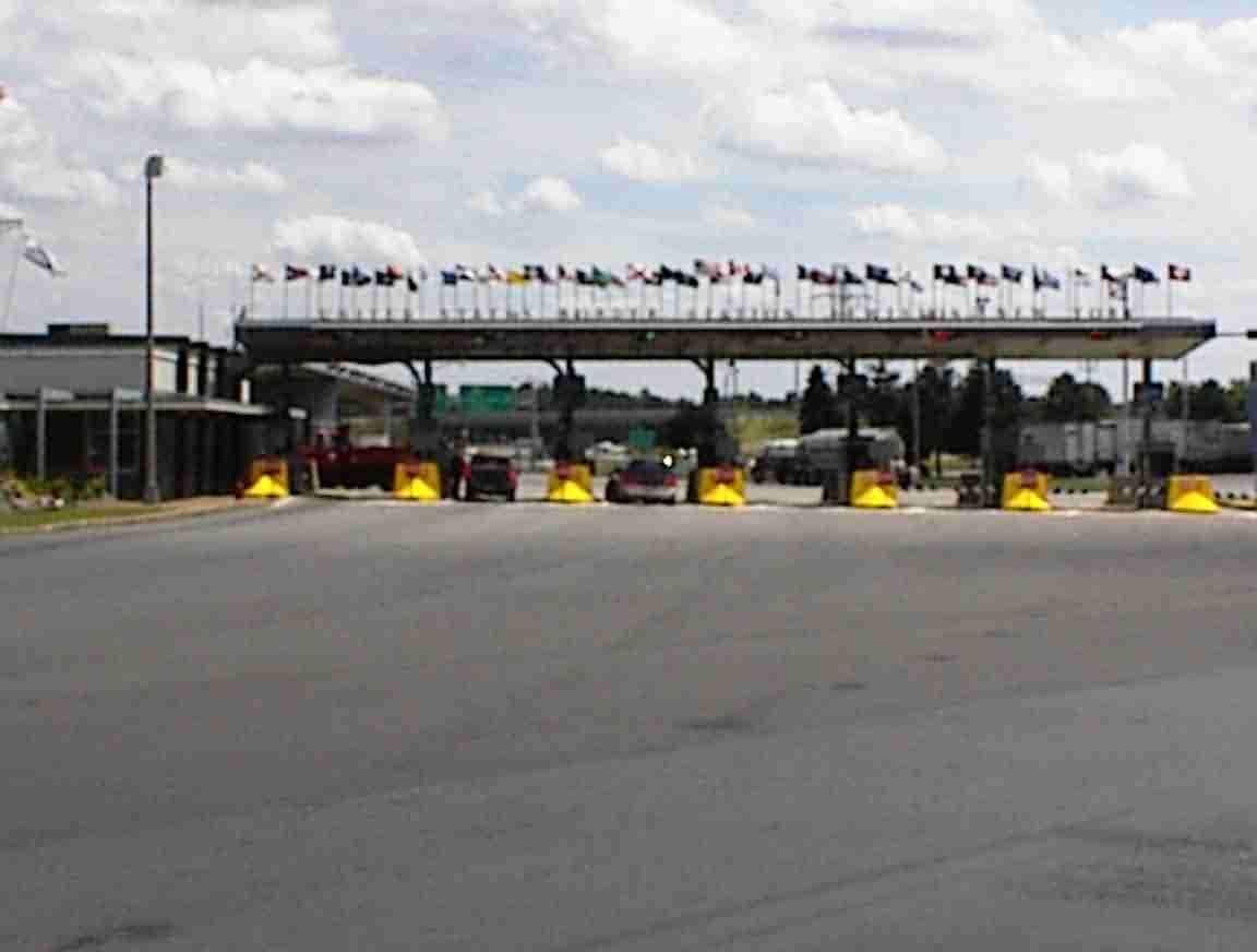
Across the bridge there was a large immigration processing area, as shown in the photo below. There were lots of bays for vehicles, but no signs for bicycles. I decided to follow the pedestrian entry since it also meant I didn’t have to cross the lanes of traffic. I cycled around the trucks and was heading around towards the main office when an immigration office came out and asked what I was doing. After explaining that I was pretending I was a pedestrian he said that I should have gone through the vehicle bay. He was surprised that I was going to Boston, and amazed that I had come from San Francisco. "Do you do this often" he asked. "And for fun?". After a cursory look at my passport he bade me farewell.
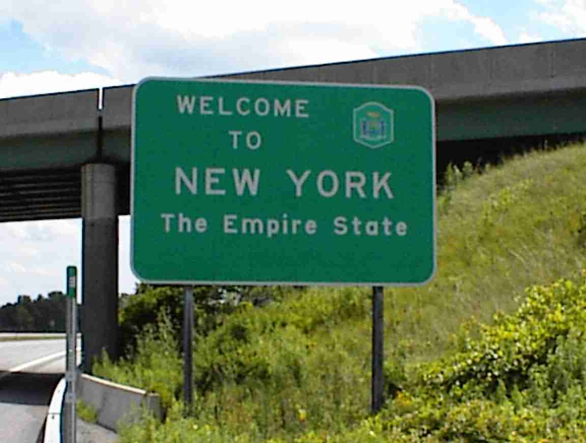
I was now in New York and had decided to take Route 104 to Lockport where I would pick up the Erie canal. It was a busy road but not too bad once I was past the Lewiston area where there was the usual array of interchanges to negotiate. The area was lovely with lots of trees, interspersed with farms. I could see across to the Canadian side and I was ashamed to admit that it was nicer here since there was more trees.
There was a strong headwind—what a surprise!—and I found it quite tiring. I rested in a vineyard and had a sandwich. I finished a McMaster University newspaper that I had collected at the university and enjoyed relaxing in the sunshine. The area was full of farms of all types, from orchards to wheat to cattle, along with many vineyards.
At Wrights Corner I found a supermarket and bought some provisions. A fellow approached me in the checkout line and asked if that was my bicycle outside. He was most interested in my experiences in America and was pleased by my favourable response. It really has been a great trip and I’ve met such wonderful people.
I then followed Route 78 south to Lockport. I visited the Tourist Centre and they were most helpful, plying me with lots of brochures and maps. They also advised that the canal museum was open for a further 30 minutes so I rushed down to pay it a visit. I had reached the Erie canal! During the planning of my trip this was one of the few ‘must see’ places.
The Erie canal was started in 1817 with the intent of connecting the Hudson River with Lake Erie. By doing so, it would serve to not only provide a cheap and safe way to transport produce from the west of the state to market, but it would also open up the west to settlers. The main proponent of the canal was NY Governor DeWitt Clinton, who was a former mayor of NY City. Called "Clinton’s Folly" and later "Clinton’s Big Ditch", at over $6 million it was the largest civil engineering project proposed for the country to that date. President Thomas Jefferson was totally opposed to it. It went ahead anyway and they dug a canal 4 feet deep and 40 feet wide spanning about 340 miles. From the time it opened on October 26, 1825 it was a success and it earned tolls of over $42 million before they were abolished in 1882. More importantly, it led to the development of industry and communities along the breadth of NY, as well as opening the US mid-west to settlement. Its importance cannot be overstated.
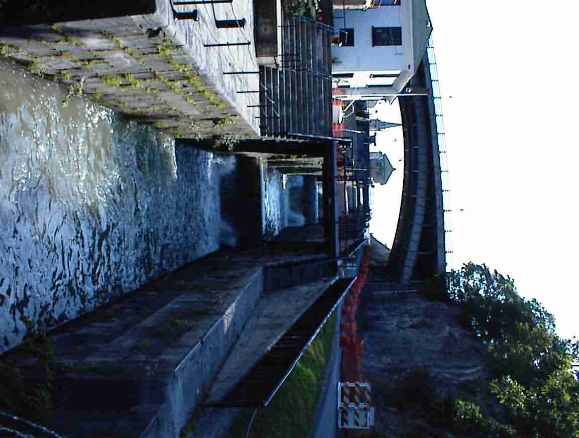
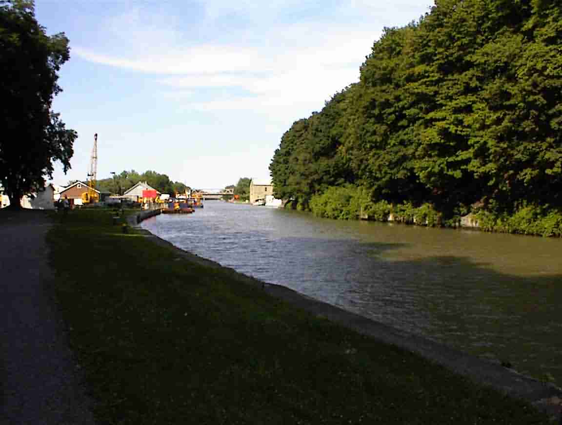
Lockport was a critical junction on the Erie canal. It was here that the canal had to ascend the Niagara escarpment and this was achieved through a flight of five locks. In order to prevent a traffic build up they built two sets of locks; one in each direction. When the canal was upgraded early this century they replaced the locks with two large lift locks and turned one set into a spillway. This is what it now looks like, with the lock spillway to the right.
Although I was going to cycle along the Erie canal, this was technically incorrect. The original canal was so successful that within 20 years it was straightened and enlarged. Early this century the Barge canal was built. This used portions of the enlarged Erie canal, but using modern engineering they were also able to harness the lakes and rivers to a much greater extent. As a result of this, much of the original Erie canal was abandoned and in some places built over. For example, it went through the centre of many cities (or to be more precise, the cities developed outwards from the canal) and when the canal was no longer needed the land was turned to roads.
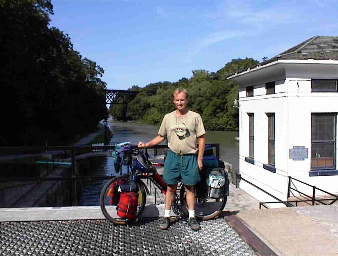
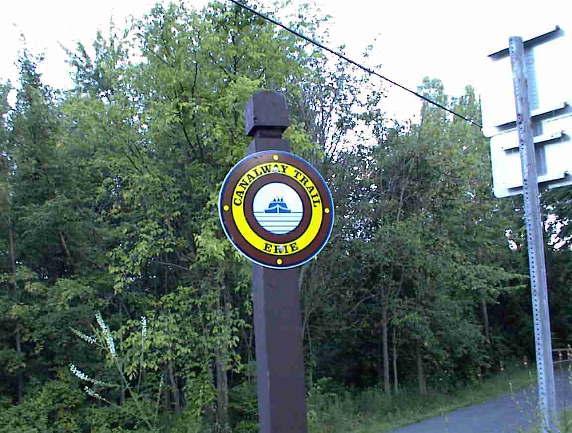
In recent years the state of NY has been developing a canal way trail along the route of the current Barge canal and the old Erie canal. It is not complete, but offers a great way to see this part of the country, relatively free of traffic. About 1/3 of the route at present are bike paths or multi-purpose trails. Eventually, they will be complete and what a resource they will be. Although the trail continued west of here towards Buffalo, I had decided to start in Lockport since urban areas are always difficult to negotiate trails through—particularly when they have built roads over the canals! The photos below show the marker signs along the trail and the start of the canal trail.
I had not cycled far when I heard that terrible metallic "twaaaang" which signified a broken spoke. I stopped and found that there were two broken spokes, one of which was on the freewheel side which meant that it could not be fixed. I was in the process of removing the panniers when two teenagers cycled by and stopped to chat. Aaron and Ian were locals and they were intrigued by my trip. Aaron said that he planned on cycling to Alaska but I said that I wouldn’t be too keen on that because of bears. In fact, just recently a Canadian athlete was killed by a bear in Quebec while training for the Olympics. One doesn’t mess with bears …
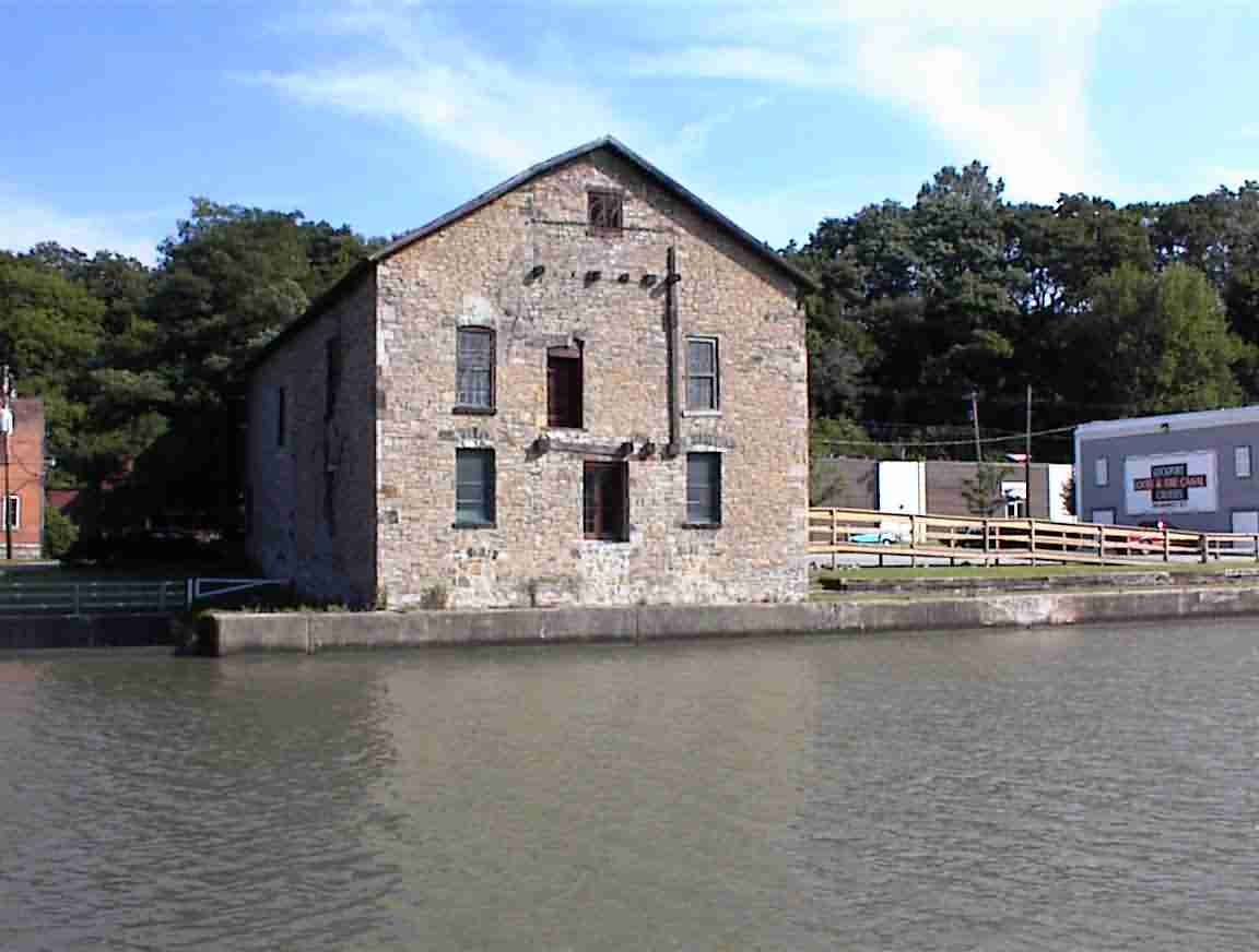
After I replaced the spoke I continued on my way. The trail was in good condition. Flat with a solid surface. There were a number of abandoned buildings along the way, such as the one shown below.
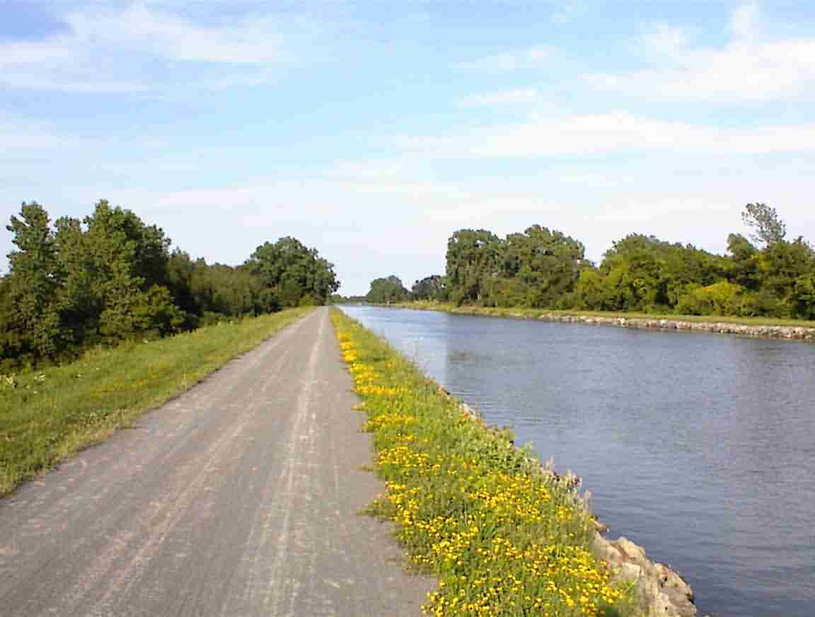
The trail ran along the north side of the canal which was the original towpath. I was soon out in nature with few developments. There were farms in the area but small towns about every 10-15 km. The path was very well patronised by joggers, fisherman and cyclists. No rollerbladers since it had a loose gravel surface. This is a photo of the trail.
As I was having a drink a very overweight woman of about 55 on a bicycle stopped. She was interested in some advice on long-distance touring. She was planning on a 150 mile trip and wondered what she should take. I advised mainly water since that is always the hardest to find when touring. She said that last year she had cycled 2000 miles and this year she was only up to 750 so was planning on some long trips. I thought that it was an excellent effort.
Shortly afterwards I was stopped by two men who were riding in the opposite direction. They were interested in what I was doing and we had one of my typical conversations explaining that cycle touring isn’t that difficult once you started.
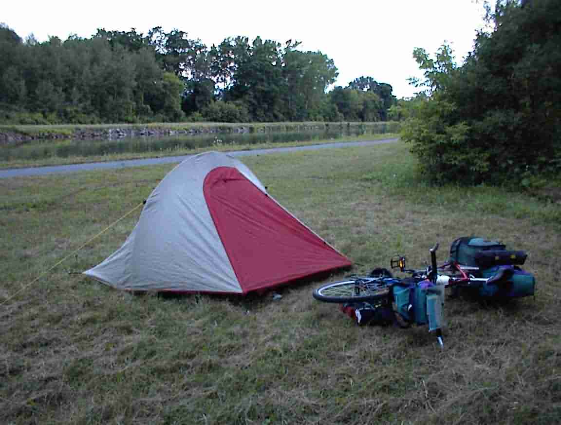
Eventually I continued on past Medina and other towns and as dusk settled I decided to camp next to the Canal just past the bridge at Eagle Harbor. It was a great spot, sheltered by the bush on the side of the canal with a good, flat area for a tent. This is a photo of my site. An excellent end to an excellent day. It was great to finally be on the Erie canal.