28 July - Day 53: Canajoharie NY to Waterford NY– 113.6 km @ 19.8 km/h
The day started with my working on my journal. What with visits to friends and camping (no power and short battery life) I have got quite far behind on things. Unfortunately, my palmtop decided to be difficult and continually crashed on me which wasted a lot of time. I suspect that the hard disk is too full to operate my web publishing software (Microsoft FrontPage-a memory hog) and things will hopefully get better when I offload things to my portable hard drive. It's amazing how much space the digital photos take up, at least when one only has an 800 MB hard disk. I often think that Bill Gates must own shares in hard drive companies since his company's software contributes so much to the bloatware that is so common these days. Long gone are the days when a 360 k floppy disk was all you needed.
The manager of the hotel came out to bide me farewell and safe travels which was very kind of him. It transpired that I had stayed in the village of Palatine Bridge which is completely separate to Canajoharie. I wonder what the historical origins of these differences are since it is so common to have small towns next to each other but with their own councils and even police forces. There would be real economies of scale were they to consolidate the way that N.Z. did some years ago. However, one reason not to do so is for the franchisees who operate the myriad of businesses from hamburgers to tyres. These franchises are awarded on geographical areas and I heard a specialist on urban planning noting that because of urban sprawl the only way you can tell when you are in a new area is when the franchises start repeating themselves.
I cycled down the hill and across the canal to Canajoharie. A small town, it has several claims to fame:
· It has an art gallery which is regarded as one of the finest small galleries in America.
· There is an excellent 46' high waterfall.
· The Beech-Nut company produced the first commercially peanut butter here, and still has a factory.
· Paper bags were invented here during the Civil War due to the shortage of cotton which was mainly sourced from the Confederates.
However, all of these milestones paled in comparison to what I really wanted to see: the traffic signal. Traffic signal? Yes, Canajoharie is famous for having one of the few remaining 'dummy policeman' to be found anywhere. These are traffic signals which were placed in the centre of intersections early this century to replace police officers who had been doing point duty. The signal here dates from around 1923, although it has been replaced several times over the years due to negligent drivers hitting it. The photo below shows this relic.
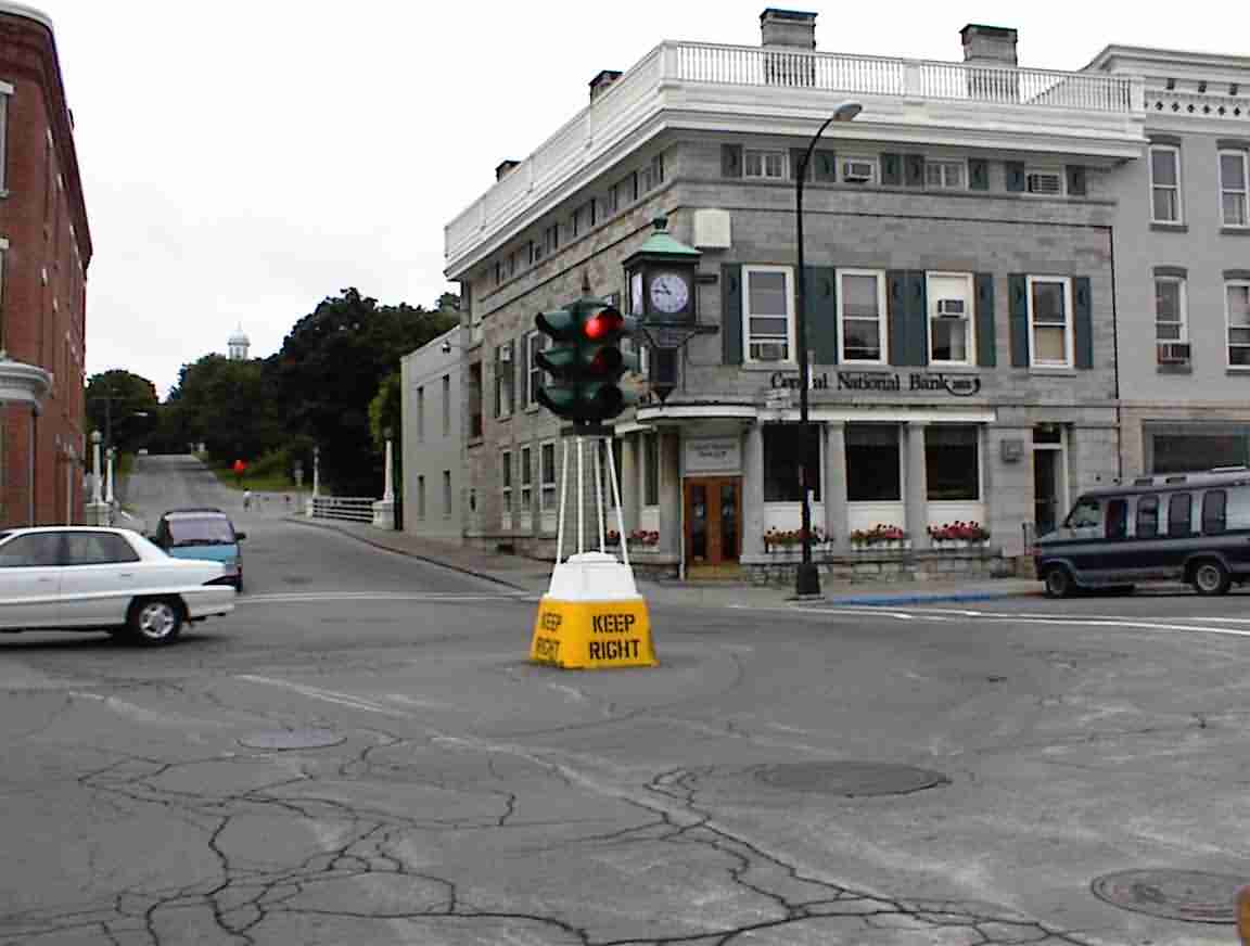
It is at the intersection of two major roads; Highway 10 which runs to the north and Highway 5S which is an east-west route. I had by and large been following the latter. With the NY State Thruway having an exit in town the demand at the intersection was quite high, and this was on a Friday morning around 11 a.m. I wondered what it would be like in really heavy traffic. Some vehicles clearly had problems manoeuvring around it and the parking was not properly laid out on the opposite corner in front of the bank which served to reduce the turning radius. However, those issues notwithstanding, I was looking at a very rare bit of traffic engineering history.
When I went over to the Visitor's Bureau on the opposite corner I was greeted by Barbara and the local Sheriff. It transpired that they were discussing the traffic signal and having seen me taking photos they invited me to join the conversation. It seems that the village was in the process of discussing what to do with the intersection. The mayor wanted to eliminate the signal and turn the management of all the roads to the Department of Transport. It was proposed to replace it with a mini-roundabout or to string signals through the air.
I ventured the opinion that in a historical town like Canajoharie it would be a travesty to remove something as rare as that traffic signal. On principle I've always been opposed to lights strung out along the horizon and even more so when there are many old buildings around and so I was not keen on that option. It seemed that Barbara had been fighting a campaign against these proposals for some time and she was most interested in getting the views of a traffic engineer on the matter. I was horrified at what she was saying since it seemed that the mayor's concept was that trucks travelling through the town have an inalienable right to use any of the towns streets and that the town should widen its roads by taking out buildings or reducing frontages to facilitate traffic flow. I kind of felt like I was in Asia again or the 1960s. They had no concept that streets are also for people and that it is much wiser to re-route the heavy traffic around the town or limit it to truck routes.
After the policeman left Tom, the town treasurer, came by and the conversation continued. He agreed that the proposals fell short of what was best for the town and the DOT traffic engineers had even acknowledged that the roundabout would make it difficult for pedestrians to use the intersection. The fact that the town's only bank is on one corner did not seem to have been taken into consideration. This reminded me of the time in Toronto that the engineers were going to remove countless 40-60 year old healthy trees from my parents road because the pavement needed to be replaced. Why remove trees for a resurfacing project? Because the standards indicated that sidewalks would be required and these, coupled with the wider pavements in modern standards meant that the trees had to go. The idea of engineering an environmentally sound solution was beyond them. Pity that decisions in the USA seem to be so heavily influenced by politicians. I'm thankful that we live in N.Z. where there is a more rational decision making process.
It was by now lunchtime and I asked Barbara for a recommendation. Without hesitation she told me to go to the local deli and I was not disappointed. I had a fantastic sandwich with some excellent salads. It had started raining lightly while I was at the information booth so I took my time over lunch and by the time I left it had effectively stopped. I've been very, very fortunate at avoiding rain this trip. The time for procrastinating was past so it was on my bike and east on 5S which was still Bike Route 5. Perhaps it was the moisture in the air but I found it quite cold cycling so I donned my rain gear and was soon too hot. When exercising it is difficult to get the right balance, even with Goretex.
The route east followed the Mohawk River. This was once the home of the Six Nations Iroquois Indian Confederacy. The river is named after one of the tribes and it was a main trading route for hundreds of years, first with the other Indians and then with the European trading posts. The Dutch settlers arrived in the area in the 1600's and they made themselves valuable to the Indians by helping them with blacksmithing, interpreting and in building fortifications. Unfortunately, the arrival of the Europeans brought diseases such as smallpox which devastated the Indians and I am sure that alcohol also caused its share of suffering.
The Mohawks joined the British in fighting the French and when the American Revolutionary War started they stayed loyal to the British, respecting their treaty obligations. Having backed the losing side they were forced from their lands after the war and the British awarded them large tracks of land in southern Ontario. Their chief Thayendanegea, who adopted the name Joseph Brant, moved them there and the city of Brantford now stands in their land. Historical footnote: they got their own back on the Americans a generation later since the Indians were invaluable in helping the British repel the American invaders from the Niagara peninsula during the War of 1812.
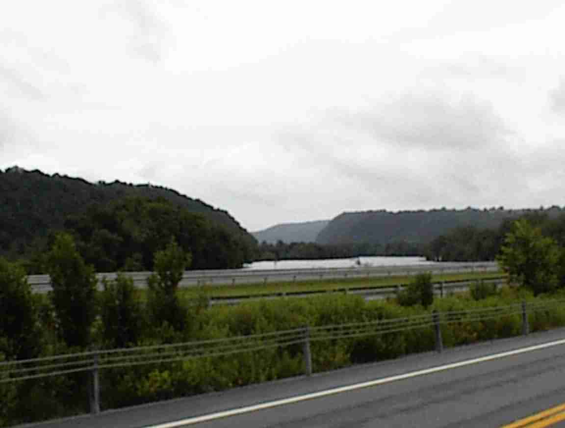
The road followed the river and it was obvious why this was such an important trade route. It is the only place where there is a break in the Appalachian mountains, and this is shown in the photo below where there are hills separated by a gap through which the river runs. This corridor is busy containing a road and railway north of the river, an Interstate and a road south of the river; and the remnants of the Erie canal also to the south of the river.
Since the road followed the river plain, it was fairly easy riding with only a few minor hills to cycle. The rain didn't materialise and as it warmed up with the sun I shed my rain gear and dried off. Just past Fultonville I cam across the 'National Shrine of North American Martyrs' on the side of a hill next to the road. This was the site of the Mohawk Indian village Ossernenon and the location where two Jesuit priests were killed by the Indians in 1644. The site consisted of some statues and a wall but was in a state of disrepair. However, I was still able to read the brass plaques at one of the monuments which gave an overview of what had happened. I later filled in the gaps by talking with others.
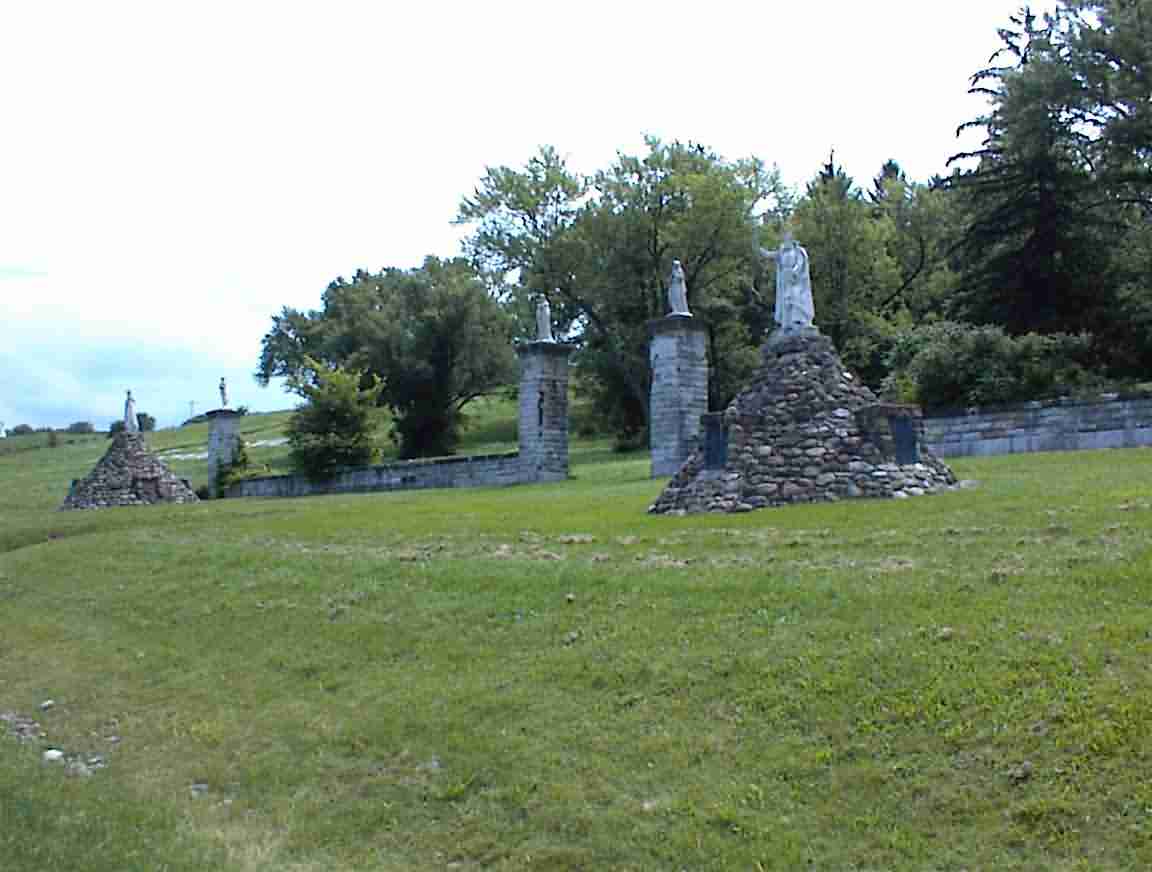
It seems that one of the priests came in 1642 with the intent of proselytising the Indians. He was not favourably received and was tortured by them. A Dutch protestant minister managed to arrange for his freedom and he was taken to France, eventually returning to Canada. He still felt that he had a calling to the Mohawk and returned in October 1644. He was hit on the head with a tomahawk almost on arrival and killed. It seems that during the intervening period the Mohawk's crops had failed or been eaten by insects and they blamed him or his holy paraphernalia which had been left behind.
This story made me think about the history of the Iroquois that I had read as a child, and famous books like 'Drums Along the Mohawk'. They were a powerful, warlike people who were greatly feared by their enemies. I've resolved to read up some more on their history to refresh my memory.
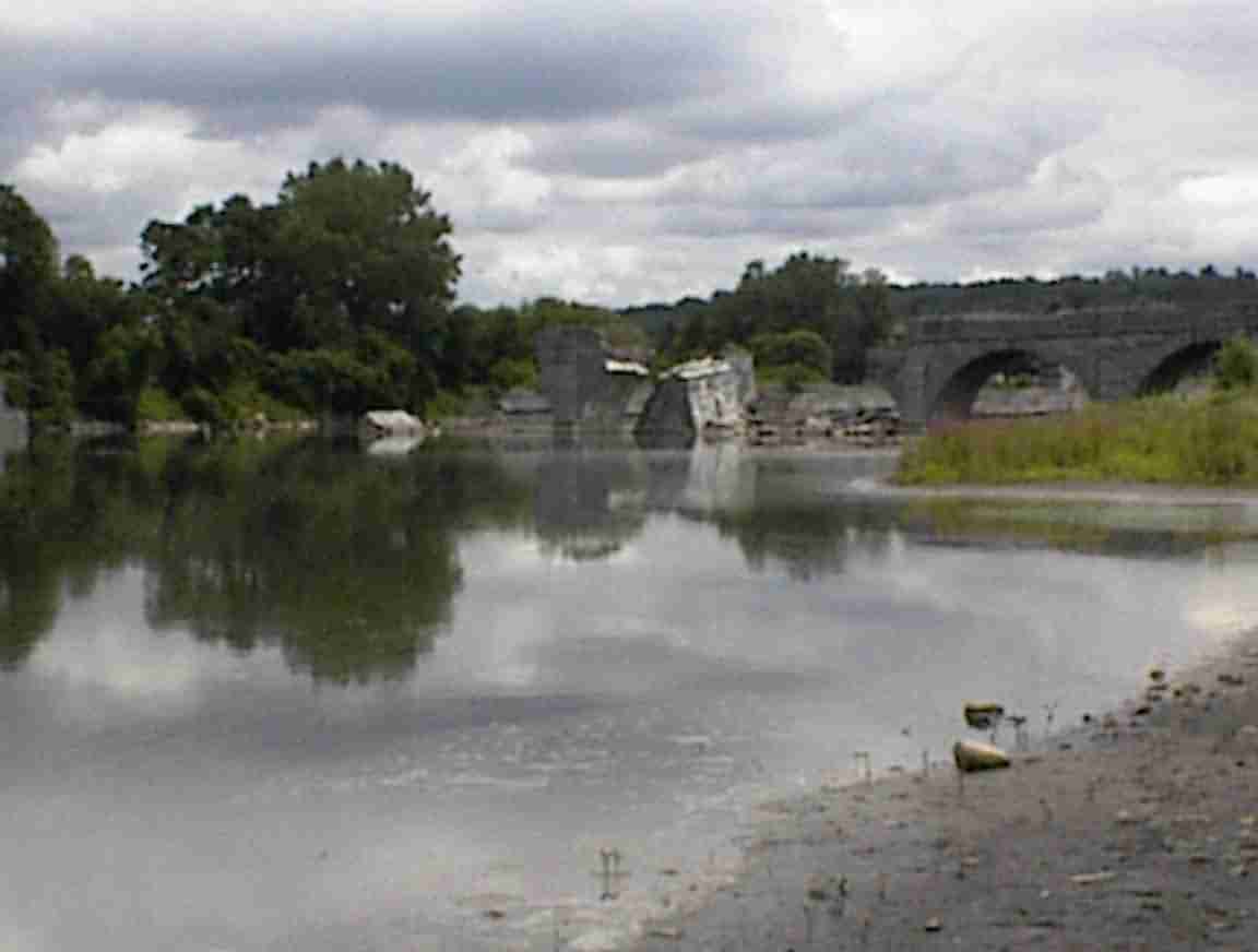
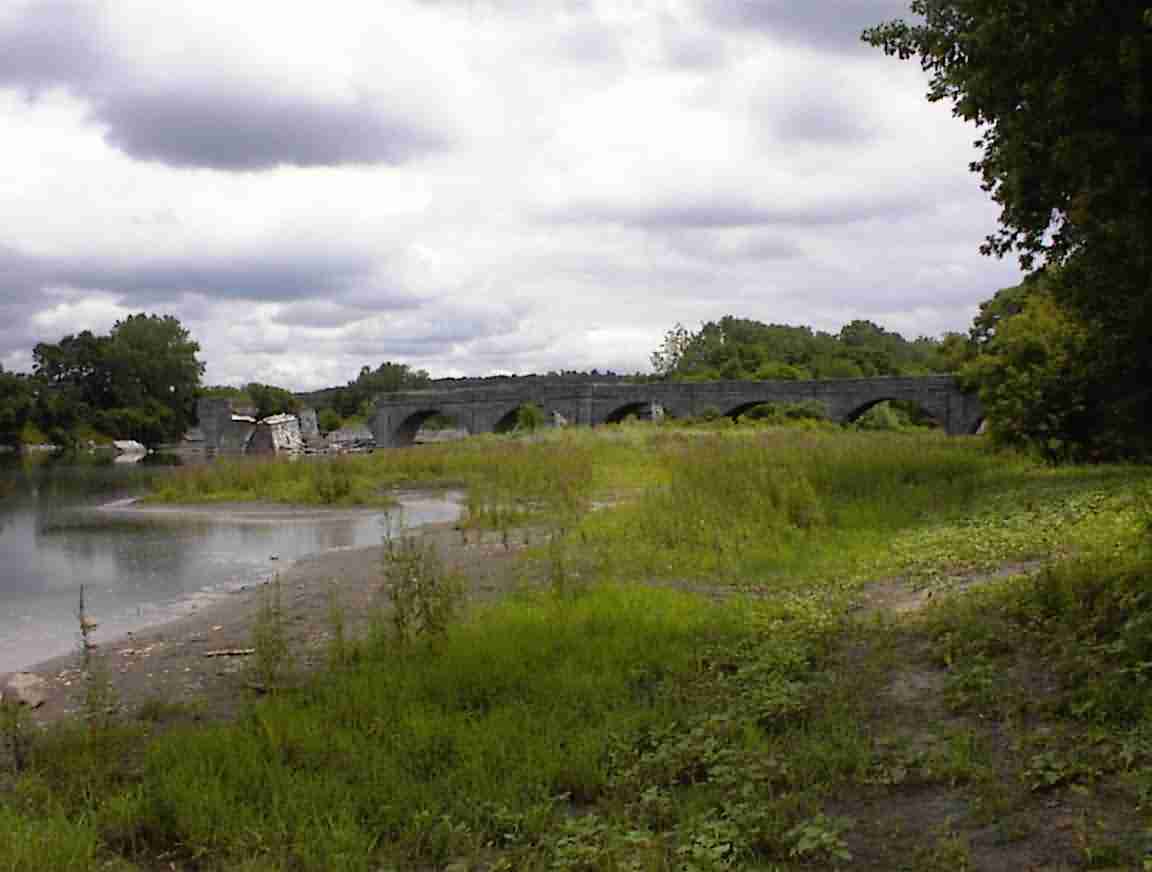
Not very far from the shrine I came to the Schoharie Crossing. This was a very important point for the canal since it was here that the canal crossed Schorarie Creek. When the canal was first built they put in a dam (replaced a number of times) which served to create a pool of water that the boats could be towed through. Unfortunately, the creek was subject to flooding and it was not uncommon for boats to go over the edge or for the dam to fail. This meant that there were often major delays during the flood season as boats waited for the waters to subside making travel safer.
To circumvent this problem they decided to build an aqueduct over the creek when the canal was enlarged in the 1840's. When completed in 1842 it was over 600' long with fourteen arches. It fell into disuse when the barge canal was completed in the early 1900's and in the 1930's some of the arches collapsed. Even partially collapsed it is still an impressive structure, as the photo below hopefully shows.
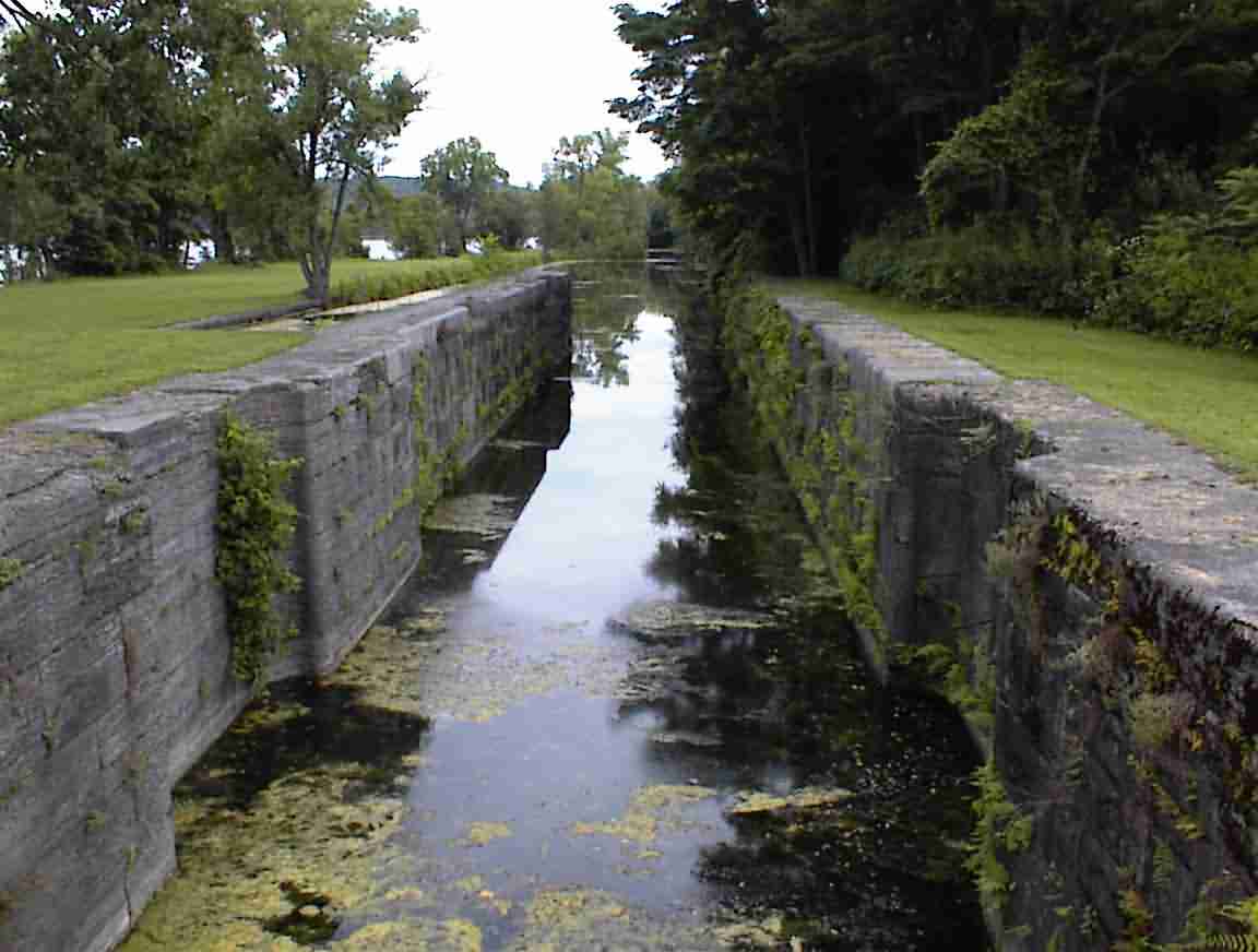
There was a visitor's centre on the other side of the creek so I cycled over. It was adjacent to an overgrown section of the original canal and there was still the remnant of the locks visible. The displays were nothing special but they did have some books and I bought one describing the social impacts of the canal on development.
The site contained several other locks and I cycled by "Yankee Hill" Lock which was Number 28 on the enlarged canal. It was quite substantial with two locks adjacent to each other, one for traffic travelling in each direction.
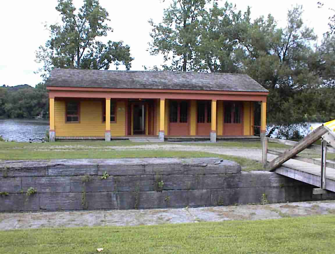
Adjacent to the locks was "Putman's Lock Stand". This building dated from around 1850 and served as a general store to the canal patrons. There was a display describing how businesses developed to supply provisions and other needs to the canal travellers. It sounded much like the businesses of today who crown around highway interchanges. Land on the tow path side always had a premium as it meant that the canal boaters could be served without them having to hitch their towing animals. The display had a quote from a Harper's Weekly magazine about this particular location observing that while there were many idle and indolent people about, and the show was not clean or easy to navigate around, they had everything that people working or travelling on the canals could require. And that is what was important since that is what made them money.
There was an excellent bike path all the way to Amsterdam. It followed the route of an old road and there was the occasional old milestone in the scrub, overgrown with weeds. It is a pity that they didn't have the date on them since they looked very old. It was next to the Mohawk river and the river was quite large at this stage. The photo below shows this; it is of a dam across the river at Amsterdam with a lock on the far bank.
This gives some idea why it was necessary to build a canal which ran next to the river: in the early 19th century they didn't have the technology to build the structures to control the river. However, the modern barge canal was able avail itself of advances in steel fabrication and construction machinery so it was able to follow the rivers and lakes.
Amsterdam, on the north bank of the Mohawk, was a big city with lots of industry. There were many factories lining the river and they looked to still be in operation. This was in contrast to upstream in the smaller towns where the factory buildings were often abandoned. The bike path ended just east of the city and it was back on the road again.
As I have mentioned before, the map I was provided by the Canal authority was not exactly accurate. For example, it has Bike Route 5 south of the canal east of Rome when it is actually north of it. This inaccuracy is compounded by the programme they have of extending the canal way trail so there are often new sections which are not marked. I have therefore become quite adept at keeping my eyes open for opportunities to exit onto bike paths or trails and one of these presented themselves at Rotterdam Junction. I noticed a trail off the side of the road and doubled back to enter it. There were no signs but I saw the overgrown old canal to my right so I knew I was on the right path. It was a delightful ride with lots of shelter from trees and a brand new surface. Although it ended in town-or to be more precise I lost the trail-I found it again and it took me all the way to Schenectady.
The cousin of the fellow in Nevada who put traffic signs in places they are not required must live in Schenectady. At one point the path ran next to a road leading to a bridge over the river. As would be expected, the path turns under the bridge so that the cyclists do not imitate lemmings going through the fence and over the edge into the Mohawk river. On the other side of the bridge the path turns again back inland and then runs parallel to the river again. They had actually put a winding road sign about 30 m from the river which was in plain view, as was the turn. I saw the work of another cousin later that day which was even more notable, but that will come later.
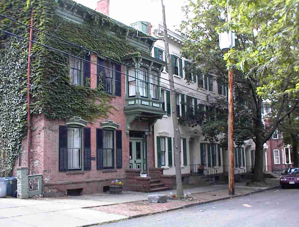
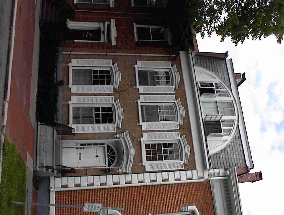
The city of Schenectady obviously had Dutch origins and was a major trading post in the 17th century. I had been advised to visit the 'Stockade Area', so named because it was the site of the original stockade which protected the city. It was 100' square with block towers at the corner and could hold 300 troops. Around it developed the commercial centre of the old city, although it was burned down by the French during the French-Indian war. The area is full of old buildings, many of which sport plaques giving the date of construction. The architecture was very European and it was a pleasure to cycle through the (relatively) traffic free streets admiring the buildings. The following photos are a sampling of the area.
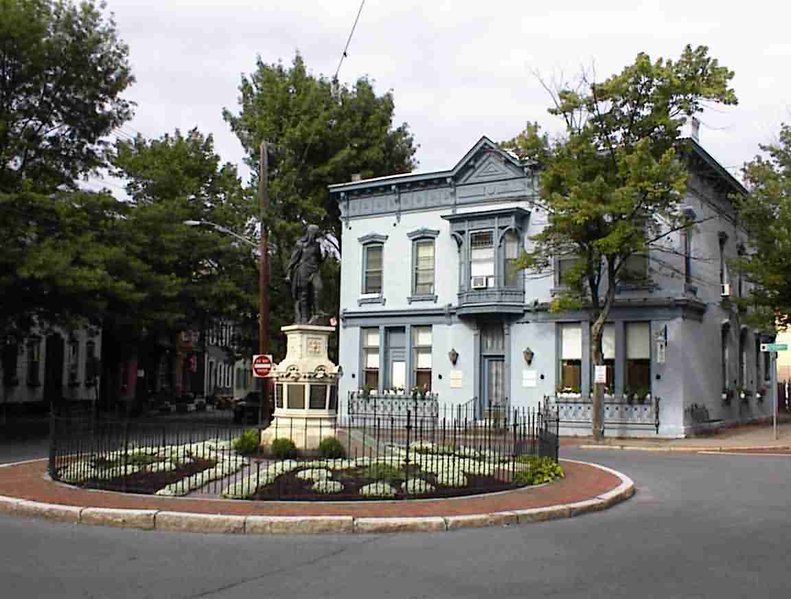
The last photo above marks the location of the original stockade and has a statue of a Mohawk Indian reflecting the good relationship that they had with the Dutch. There was a grocery store on one corner entering the roundabout which had been in operation since 1796. I bought a frozen yoghurt and sat outside relaxing and enjoying the ambience of the area. They had tables and benches on the sidewalk which the patrons sat at having coffees or just discussing the world going by.
One of them was discussing the paradox how one could discover a country which was already inhabited. He said that he had never been to Montreal but thought he may go up there and 'discover' it, occupying someone's land. He made a fascinating statement which I must research. There is the famous story of the Pilgrims who came to America and were facing starvation until a local Indian helped them out. He asked the question how was it that they communicated with the Indians. It seems that the local chief had spent 14 years in England and was a graduate of Oxford. Sounds a bit fanciful, but not impossible. Both the English and the French had an active programme of assimilation of key natives into their culture.
After calling Lis it was time to continue and I got quite lost trying to find my way east. Well, lost is a relative term insofar as I dead reckoned it as best I could east, following roads which ran parallel with the river. I have a good sense of direction and have often used the sun to confirm that I have the right general heading. However, since it was overcast that wasn't possible and eventually I found myself heading more inland than my map suggested was appropriate. I was on a bike path and there was no other one around, but it just didn't feel right. I confirmed with some walkers that this would eventually get me to Niskayuna so I continued on. I passed a large General Electric factory as well as some research laboratories but was concerned when I couldn't see the river any longer.
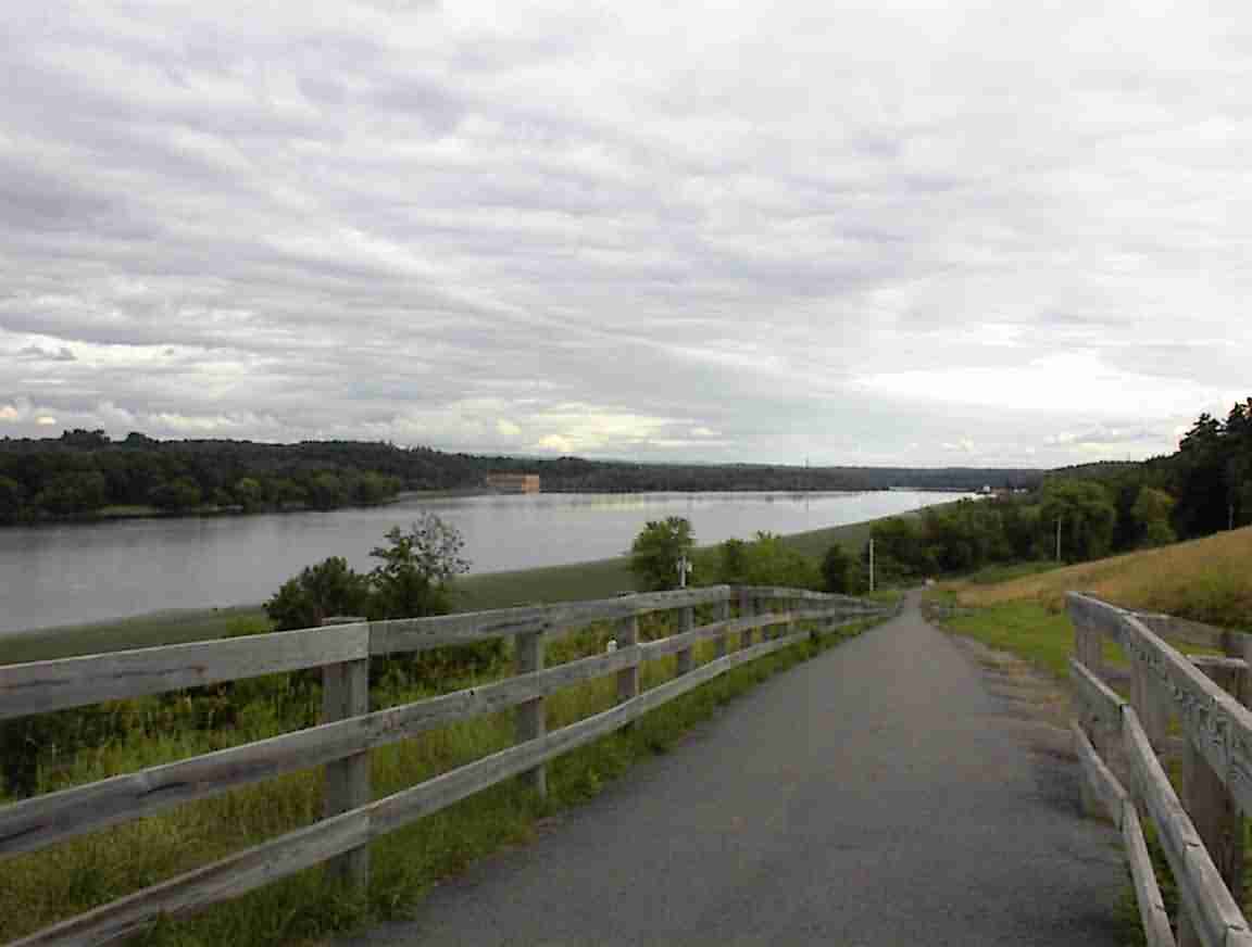
Fortunately, I came across some cyclists having a rest so I stopped and asked directions. They told me that the trail had been rerouted around an old nuclear facility so my trusty canal map was once again wrong. They were a group of Boy Scouts out doing their cycling badge and the leader Mike kindly gave me a bicycle map of the general area so I would not have any further problems. It really wasn't necessary but it was appreciated nonetheless. We chatted for a while before I cut over through the park and down to the river. The view down the river from the hill was spectacular.
As I took this photo two couples came up and spoke with me. One were Punjabis from India and the others Americans. I will never tire of seeing the reactions of incredulity when in response to the questions if I've come far I tell them from San Francisco. With my almost across the continent it is such a long way, but the trip really hasn't been that hard.
The route was an excellent bike path that ran adjacent to the river. It was very well patronised with walkers, joggers, cyclists and rollerbladers. I ever passed a fellow in a wheelchair walking his two dogs! I think that it is great the way that disabled people have access to so many facilities.
My water supply was low so I pulled into a baseball stadium in Colonie Town Park. There was a woman's tournament in progress with lots of spectators about and cheering of the teams. I parked at the concessionaire's stand and the fellows running the barbecue and selling T-shirts immediately engaged me in conversation. We chatted about my trip and impressions of America. They offered me bottled water but I said it was like throwing pearls to swine given the quality (or lack thereof) of much of what I have had over the trip so I filled up at the fountain. I also declined the hamburger and a free T-shirt but accepted their help in finding accommodation. They got the Yellow Pages and identified a motel in Waterford which was the only place in town.
I continued on to the town of Cohoes and stopped at the 'Cohoes Falls Overlook' which was on the north end of town, over the Mohawk river. It was quite disappointing. Where once there would have been a great, wide waterfall the water has been diverted for power generation to the extent that it is but a mere trickle.

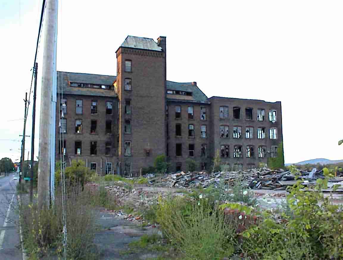
The town of Cohoes is at the junction of the Mohawk and Hudson rivers, and represents the end of the Erie canal. As would be expected, when the canal was at its peak it, along with the other towns in the area, were bustling, vibrant communities. It was for a time the main textile manufacturing centre as well as manufacturing steel and other commodities. There were many large factories, some of which were still in use, but the decline of the area was obvious with others abandoned.
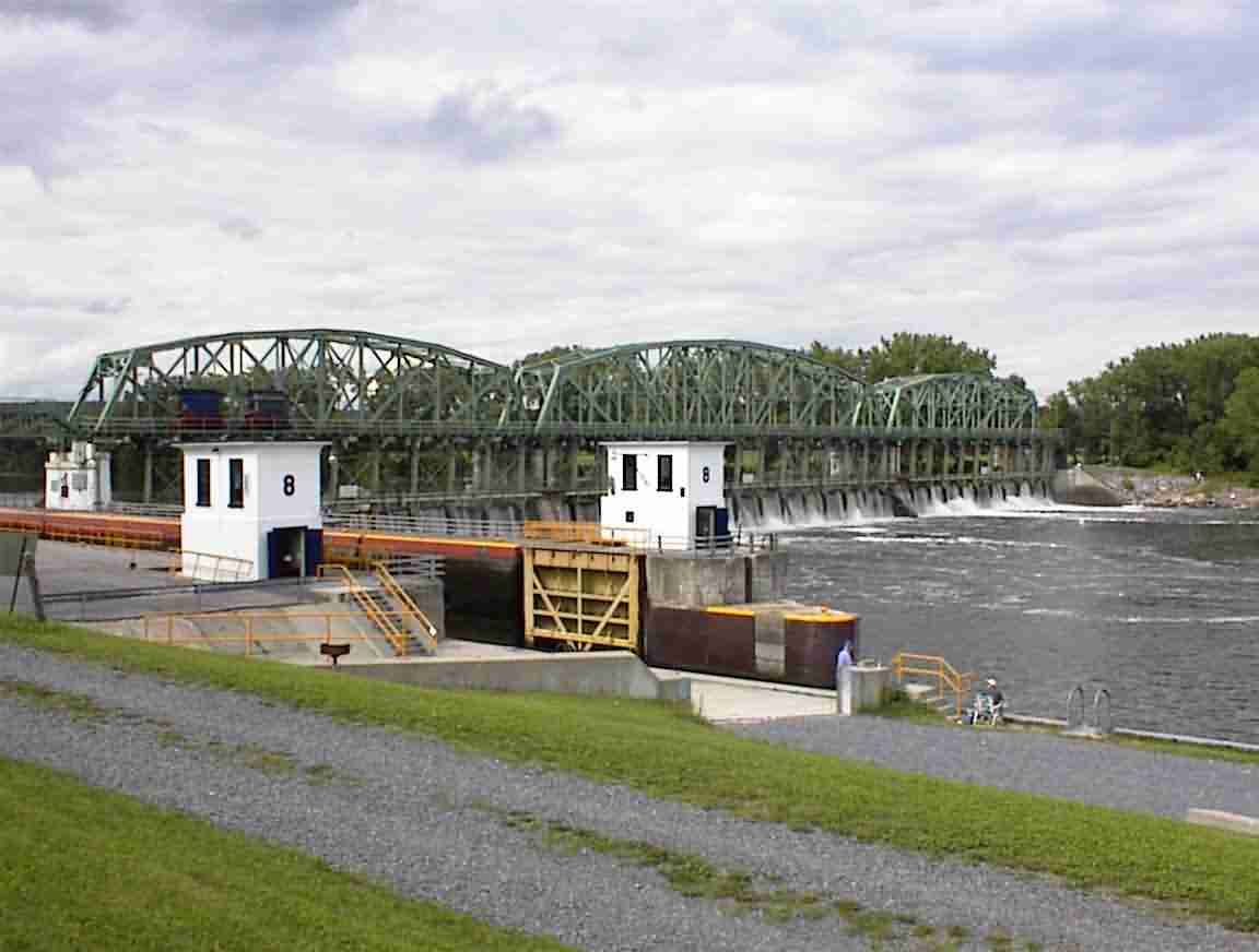
I crossed the Mohawk river and went north towards the locks that marked the end of the Erie canal. I found a sign pointing me to the Canal trail so rejoined it and cycled through the town of Waterford on the canal. At the Barge Lock 2 I got lost when I was directed back onto the town's streets, but picked up the canal and continued on. After going some distance it felt wrong so I headed back and asked two walkers for directions. It seems that my objectives were on the other side of Lock 2 and I had missed it by following the diversion. I headed back to the area and found the old locks I was looking for.
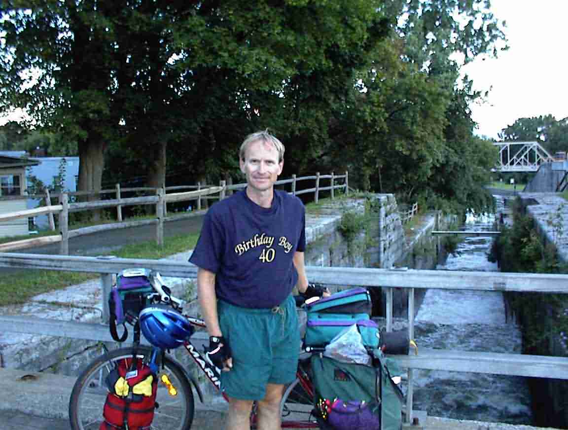
The rise in elevation from the Hudson was quite substantial and it was achieved through a flight of 6 locks. They still exist and the water rushes down at a great rate of knots. There must have been a lot of traffic jams here since it would not have been a fast process raising the vessels up to here. I donned my commemorative T-shirt and got the obligatory photo. In the background you can see the water cascading down through each of the old locks.
I mentioned earlier about another cousin of the fellows putting up needless signs. The water going through the locks was travelling at an incredible rate of speed. I wouldn't have wanted to take a white-water kyak through it. Yet they had actually put a sign on one of the walls warning against wading!!! The mind boggles.
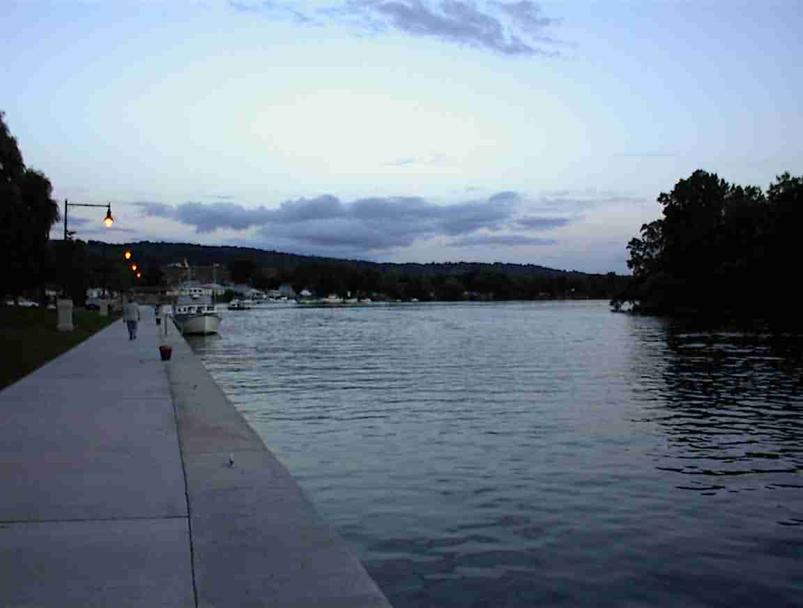
To finish I cycled down to the Hudson river and as the sun was setting I got the photo below where the canal joins the Hudson.
So ended my trip along the Erie canal. It had been a wonderful exploration into history, with the added benefit of having some fascinating technology added. From here it was a few days to the east coast and the end of my trip, but this was definitely one of the highlights of my travels. When planning the trip it was one of the few 'must do' activities, and I was not disappointed. I must return one day and cycle the Hudson river up to Lake Champlain.
On to the Next Day or Back to the Home Page