5 July - Day 37: Hennepin Canal IL to Channahon IL - 154.0 km @ 19.3 km/h
The day was very overcast with a light rain. After breakfasting at the motel, you can by now guess what I had, I was out on the road. The rain let up but the humidity was incredible so I removed my Goretex jacket and got slightly sodden; it was better than expiring with the heat! My plan of action was to head to Princeton and see if I could find a way around the bridge or to take the alternative route which, supposedly, wasn’t too much of a diversion. I was a tad sceptical since motorists have a different perspective on distance (and grades) to cyclists.
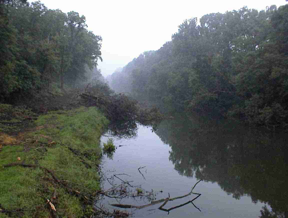
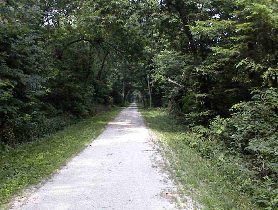
The road took me over the Hennepin canal and I was able to see the towpath in the light of day. Definitely not a pretty sight, as the photo below shows. It was a mess of fallen trees and mud. I found out later that they are in the process of clearing the towpath and they will in the next 1-2 years be putting down a proper cycle/walking path. It’s a great idea since it is such a pleasure to walk/cycle by a canal. But more about that later …
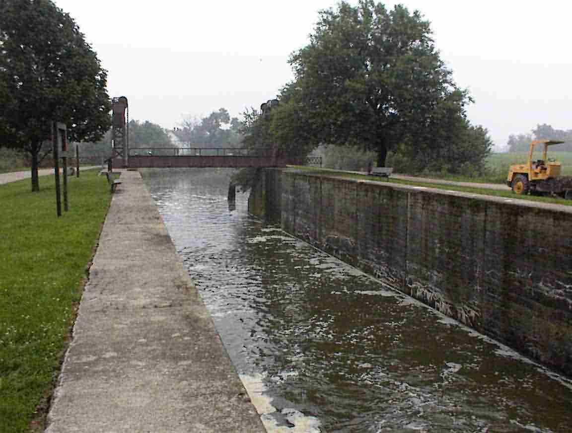
The road I followed cut across the canal and at one point they had restored a lock and one of the bridges so I went and had a look. The Hennepin canal was unusual in that it was completed around the turn of the century, quite late by canal standards. To that end, it has some relatively modern construction techniques, one being the use of concrete for the locks. In all the other canals that I have seen the locks were masonry. They also had photos of them building the canal and showed them using early steam-powered diggers; quite the contrast to the man and mule power used to dig the earlier canals. The photo below shows one of the concrete locks. It was noted that the construction techniques honed on this canal were used to build the Panama Canal a short time later.
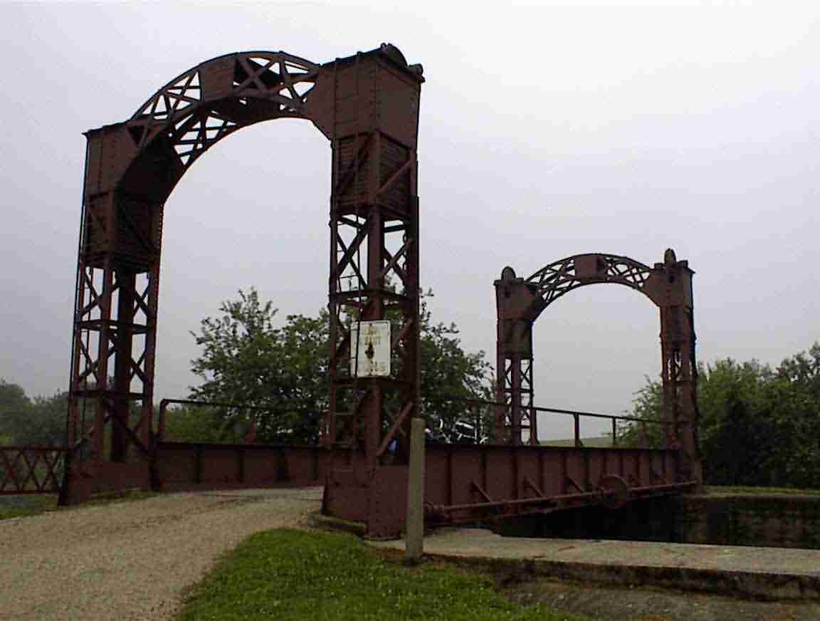
At the end of the lock was a bridge that had been put in to provide access to the local farmer’s fields. It was able to be raised as there were a set of counterweights in each of the four columns at the corner of the bridge. The barge operator (or farmer) only needed to turn a handle in the middle of the bridge for it to be raised or lowered. I was intrigued to see how much effort it would take but they had (wisely?) set it up so that it couldn’t be played with by inquisitive engineers such as myself (or kids).
The terrain was pretty much the same as I’d had for the last week; corn and soy bean fields. Eventually I got near and found my way to the bridge. The road to the bridge was muddy and sodden after yesterday’s rain. They were just laying the reinforcing steel so I couldn’t get across, but the workers directed me back up the road and to the alternative route to Princeton. It took me along some heavily wooded lanes and across a relatively small bridge before I emerged once again into the interminable fields of corn and soy. I passed by an old age care facility and I felt quite sorry for the residents as there was literally nothing to watch in the area except the corn growing.
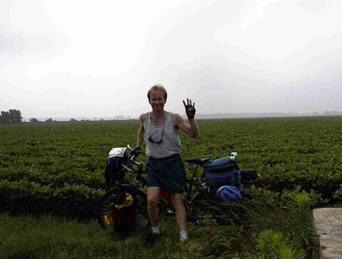
It was in this area that I reached another milestone for the trip—4000 km! I had y choice of backgrounds for the mandatory photo: a corn field or a soy field. I chose soy since there was a better place to rest my camera. This is the photo below. I forgot to put on my celebatory shirt. Bad form or what?
One cannot describe the excitement that one has cycling hour after hour through the fields. The monotony was final broken when I reached a golf course and was able to watch some of the golfers. Uncharacteristically—at least compared to the other courses I have passed—a number of the golfers were walking and carrying their bags or pulling them in a trolley. Much better for you than driving around in a cart. One woman had scaled the fence and was looking through the rough by the side of the road for her ball. I’d be surprised if she ever found it as the grass was several feet deep; but good on her for trying!
The golf course was on a back road that I was trying as an alternative to the road that I had been on. We had intersected with an Interstate and there were too many trucks for my liking. This proved to be a great choice as not only was there no traffic, but it was one of these great runs through winding country lanes shaded by trees. It eventually took me past two cemeteries which were meticulously maintained; there was not a blade of grass growing up around any of the tombstones, and then back to the main road which I followed to the town of Peru.
I found a bagel restaurant in Peru and stopped for lunch. They had an absolutely delicious vegetarian patty on a bagel with all sorts of fresh vegetables. I also bought some other bagels to munch on later, but only one made it out of the restaurant. They had such an amazing array of flavours to choose from—there were over 20 different types—that I was in bagel heaven. It was in the mid-30s with a blazing sun so I took my time over lunch and cooled down thanks to their air conditioning and an apple juice. While there I read a Chicago paper which reported that crime was down, although the number of murders was still staggering at over 200 so far in the year. There had also been several drive by shootings on July 4th. I’m so glad that N.Z. has gun control since at least the crazies don’t have access to the same firepower they have here. Keeps the death toll down quite a bit methinks.
I continued on through the town of La Salle, which seemed to be just a continuation of Peru, and there saw my first black for some time. It is one of the great enigmas to me that you do not tend to see any non-Caucasians in the smaller towns with the possible exceptions of East Indians (e.g. Pakistanis) who are running the 24h convenience stores or petrol stations. Otherwise, rural America is a Caucasian domain. One hears of the unemployment problems amongst urban blacks and I countered this with the need for manpower in the rural parts of America. It would seem that there is some impediment to them moving to the rural areas to take up work, but I have not found anyone who can explain what it is. I’m sure that racism plays a part of it, but it must be more than that; I was told that Lincoln Nebraska took in a large number of Iraqi refugees which helped to counter its depopulation problem.
I noticed on the map that a lot of the names in this area were French or familiar to those from Canada, such as the towns of Ottawa, Marseilles, Iroquois County, Sudbury, and more. The reason for this lies back in the early exploration of this area by the French in the 17th century. In 1673 the first Europeans to reach the area were Louis Jolliet and Father Jacques Marquette. The French viewed the Great Lakes area as one offering valuable resources and spanned far and wide. At the same time they endeavoured to convert the local Indians to Catholicism which they did with some success.
Jolliet and Marquette’s expedition is quite famous (at least to Canadians) as they were the first to explore the Mississippi. They had been charged by Governor Frontenac to establish whether the river flowed south as was believed, or west as was rumoured. They travelled far enough south on the Mississippi to prove that it flowed to the Gulf of Mexico and took the Illinois river on their northward leg, having been informed by the Indians that it was an easier route than the Mississippi. The followed the Illionois and DesPlaines rivers and discovered that there was an easy portage over a low divide to Lake Michigan. Indeed, the watershed between the two waterway systems was only 13 feet high and Jolliet called for a canal to be dug which would connect the Great Lakes to the Gulf of Mexico. This idea was subsequently rejected by the French explorer La Salle who noted that the harbour on Lake Michigan tended to silt up and was not suitable for navigation. It was used as a portage and is today the site of the city of Chicago.
The French established a series of forts throughout the area at places like St. Louis, Peoria, and Chicago, but they were never successful at establishing secure settlements or trading routes due to continuous problems with the Iroquois Indians. The area declined and it was only in the late 1700s that interest was aroused in the area as the Americans wanted to cut off British trade with the Indians. To this end they established Fort Dearborn at what is now Chicago and in 1810 it was suggested that a canal be built. The Indians ceded ten miles of land either side of the river—although within 20 years all Indians would have been ‘expelled’ from the territory—and this was used as the basis for developing the I & M Canal.
The importance of the canal to the development of the U.S.A. cannot be underestimated. It took 25 years to build, due to funding as opposed to engineering problems, but once opened was a major artery for commerce. In 1848 a cargo of sugar and other goods from New Orleans reached Buffalo and this heralded what was soon to become a continuous flow of goods and people between east and west. The Midwest’s hub became Chicago and the city’s population increased by 600% in the decade after the opening of the canal. The development of cities and communities along the canal altered the development of Illinois with immigrants pouring into the northern part of the state.
The canal was soon under threat from railways which offered faster travel so it soon became relegated to carrying bulk commodities but it found a new role in carrying the sanitary waste from Chicago. In 1933 it was too small for the modern barges and was replaced by the Illinois Waterway.
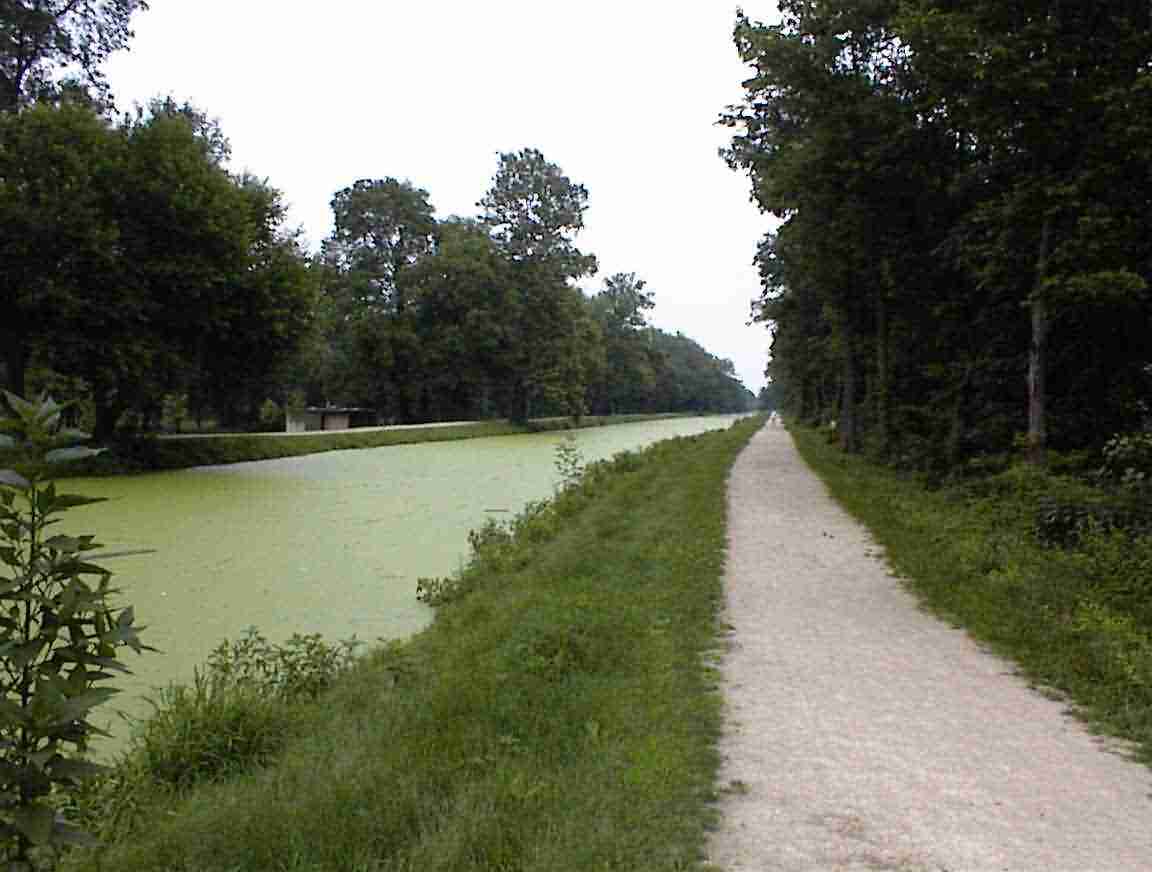
So why this digression into canals—besides the fact that they obviously interest me? It is because the I&M Canal has been resurrected as a recreational trail and I was fortunate enough to find it in Seneca and follow it all the way to the end in Channohan. I had gone to Seneca in search of some water and decided to explore the town when I saw a historical marker and a trail. This was half way along the canal and I could have started in Peru had they bothered to put in signs (grumble, grumble). I immediately changed my plans and headed east along the canal towpath.
Now this was cycling as it was meant to be. As you can see from the photo below, the towpath was a crushed gravel surface which was good for riding and for much of the way it was sheltered by trees. There were frequent markers explaining the history and operation of the canal so I regularly stopped at these. The canal operated in a similar manner to the canals in the U.K. I had been on, although they used mules to pull the boats instead of horses. They apparently preferred female mules since they were considered smarter than the male mules. I’m sure that my female readers will say that comes as no surprise.
The only drawback to the cycle was the number of mosquitoes which swarmed around me whenever I stopped to read the markers, but they were soon under control thanks to my can of repellent. The cycling was flat, easy and an absolute pleasure. I was surrounded by trees and nature with no traffic to bother me.
I stopped in the town of Morris and got a smoothie. It was wonderful since it was so cold. Even though it was 16:30, it was still 35 degrees outside (according to their thermometer) and I appreciated the respite. The canal opened up a bit after Morris, although there were still tree enclosed areas.
I met a couple who were also cycling. From Pennsylvania, they were out in their RV visiting the west and cycled for a few hours each day. They told me that there are a large number of former canals and railway lines in Pennsylvania which have been turned to cycle paths, and one goes all the way to Washington D.C. Tempting …
Occasionally I would catch glimpses of the Illinois river through the trees, but otherwise I was in a world all my own. Near Channahon I met two young women aged about 14 on bicycles and asked them if there was a camping ground near by. Intrigued by my gear they asked where I was from and when I told them one said ‘you rode all the way from New Zealand’. No, I replied, there is an ocean in the way. Another point for American geography teachers, but this was surpassed by the other girl who asked ‘where is Boston’. At least boys their age would know where it was because of the Boston Celtics basketball team.
I grabbed some pizza for dinner and worked on my computer in the restaurant. I then pitched my tent in a corner of the empty campground and listened to the radio. There was a belated 4th of the July fireworks display which kept me up late but I eventually got to sleep.
loans loans loans loans loans loans loans loans loans loans loans loans loans loans loans loans loans loans loans loans loans loans loans loans loans loans loans loans loans loans loans loans loansloans loans loans loans loans loans loans insurance insurance mortgage mortgage