15 June - Day 17: near Heber City to Duschesne UT - 141.3 km @ 21.8 km/h
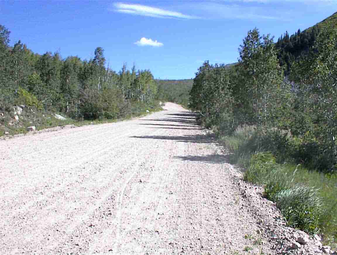
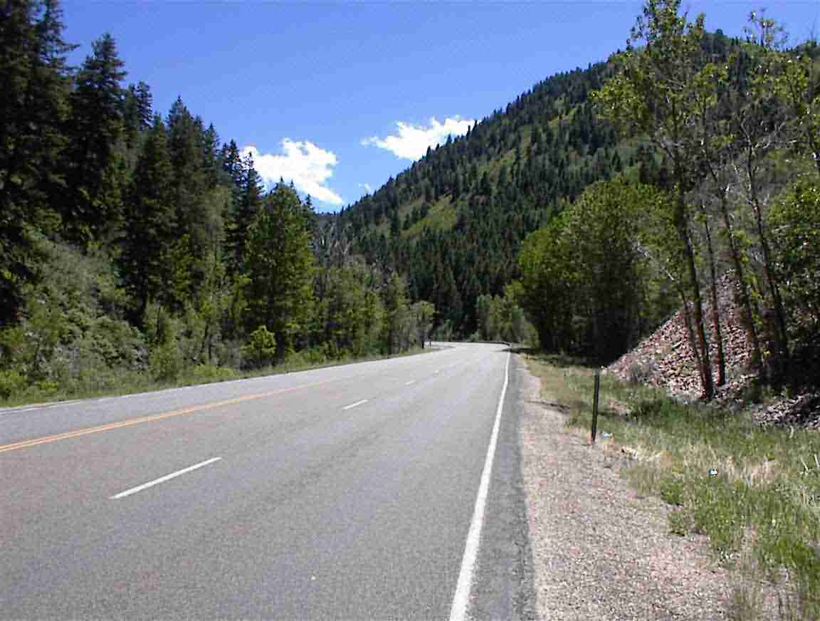
I woke up with the sun shining on my tent and had breakfast. I was still tired so I managed to doze off again for a couple of hours which meant that I didn’t pack up until 9 a.m. Quite late for when I’m camping. I had to fix my front tyre but since I had spare tubes I just replaced the damaged tube with a new one and packed it away to fix at a more convenient time. It was then down to Heber City.One of the things which I have always looked forward to when ascending these mountains is the descent: the wheeeeeee factor where one hoons down the hill at 60+ km/h. However, today this was not to be as the road was unsealed and in places had sharp stones the size of ones fist. It was difficult to keep control in some places while avoiding the potentially damaging stones. By the time I got to the bottom my hands were aching from 45 minutes of holding the brakes. This is an example of the road, and you can see the mountains in the distance in the following photo.
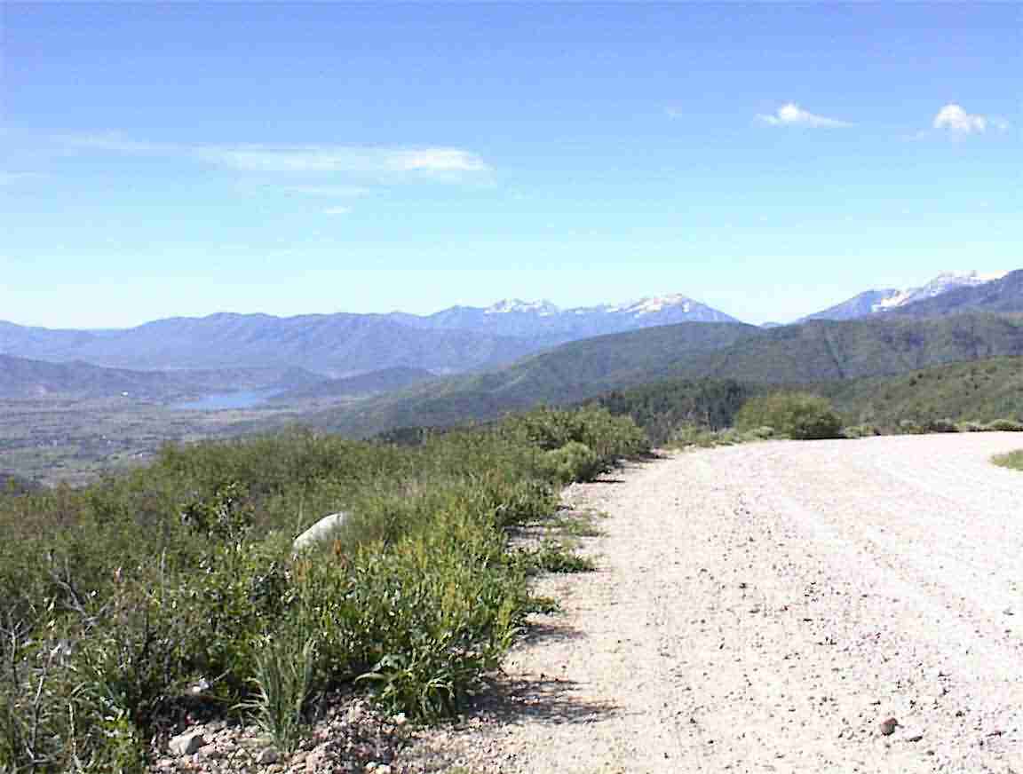
I went down and down and finally came to a sealed portion of road which meant hoon time. Now this was fun. All too soon I was at the valley floor which was about 5000’ below where I crossed. You can see from the following photo the height of the peaks; that is what I crossed yesterday, just to the right of the grey granite you can see.
Compared to California and Nevada, Utah has pathetic signs. In the other states as I ascended the mountains there were regular signs every 1000’ keeping me posted of my progress. They also told you when you crossed a peak and what its elevation was. Even more esoteric signs, like this is the way to the next town, were commonplace. It didn’t matter if I was out back of beyond; they always told me the way. Not in Utah. When I reached the valley floor I dead reckoned it and only after asking two people did I find my way to Heber City.
I had been told the day before that there was nothing in Heber City and that nearby Park City was the place to be. Apparently Park City is more upmarket than Vail or Aspen which, if you’ve ever been to those places, seems absolutely incomprehensible. I was told that there was an abundance of multi-million dollar houses and it was a very chic and trendy place. Heber City was described as a non-entity. Well, Park City must be something else since I found Heber City to be quite an attractive area. There were many fancy housing estates under way with houses which must be in the million dollar plus range. I even saw a mock castle. I thought it was gauche, but someone likes it.
There was a delightful sports field in Heber City which I stopped at and refilled my water bottles. I watched several kids on the jungle gym having a whale of a time. There were three mums sitting on the grass chatting while their young kids wore themselves out on the equipment. I thought what a nice thing it must be for them to spend a sunny day with friends in such a nice park area while the kids can run to their heart’s content.
I went on to the main street which was Highway 40 – the route I was taking to Colorado. I stopped at a 7 Eleven and bought some provisions and then went next door to a sandwich store and had an absolutely wonderful vegetarian sandwich. As per usual the portion was huge, but I thoroughly enjoyed it. Their smoothie wasn’t that good, but it was still enjoyable to have a nice meal and read the paper, even if it was bereft of any international news to speak of.
From there it was down Highway 40 and I found a market. I went in and it was most impressive with the biggest fruit and vegetable section I’ve seen yet. Yay!! I bought bananas, oranges, plums and apricots – the latter to make Lis particularly jealous of me since they are her favourite. Unfortunately, space limited me from getting too much but I was pleased to have the fresh fruit. I looked around for something else to buy but in spite of the wide variety much of it I would never consider eating.
Then it was into the mountains. I had what was a tailwind for much of the way, although it occasionally gusted from the sides and the grade wasn’t too long. Once I entered the canyon area the wind essentially died out or became a tail wind. Either way it wasn’t a bother.
Besides having the most pathetic sign postings, Utah also has the worst roads. An example of this is in the following photo. Anyone for patching? I wonder at what point does the pavement reach the stage where it cannot be patched. This reminded me of some of the characters who seem to populate Nevada’s patching gangs. In more than one instance I saw their initials in the road or the ‘Kilroy Was Here’ sign. The latter is a nose, top part of a head and fingers looking over a fence and dates back to World War II where instead of saying ‘Inspected by Kilroy’ the inspector drew the sign. But I digress …
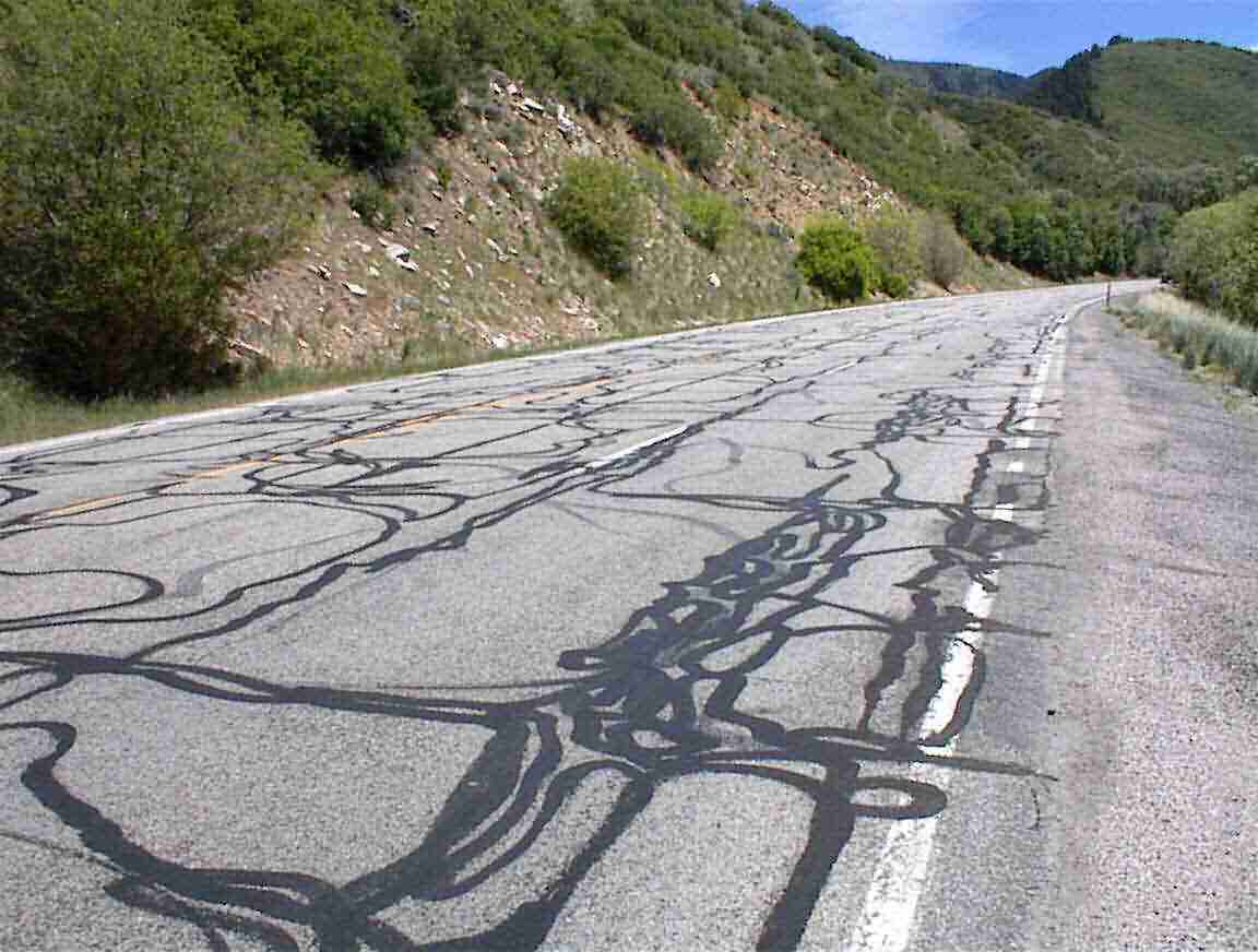
The pavement was rough in places and the shoulder broken at times. In all, I was not overly impressed with this road, or many of the roads I had travelled in Utah. I suspect that there is also a shortage of funds for roads compared to the other states; this was the only place where I saw surface dressings commonly used.
The road continued up the valley. There was a stream on one side and several camping sites. The grade wasn’t too bad, basically a constant 4% which lasted for about 25 km. The following photo gives an idea of what it was like.
I came across a broken down vehicle in the down direction with a fellow under it so I stopped and offered to help. We worked on it for about 30 mins and proved that there was a problem with the fuel getting into the carburettor. The vehicle had two fuel tanks so I left him switching the fuel lines over to get fuel into the primary tank. Reminded me of the problem with the old XJ-6 Jaguars where you had to remember to switch between tanks.
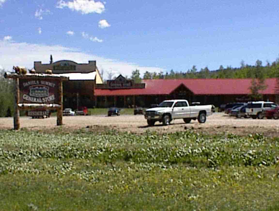
From there it was onwards and upwards until I reached the summit: Daniels Pass which was at 8000’. Compared to yesterday it had been a pretty cruisey climb of 2500’. Amazing what a difference a moderate to a steep grade makes. At the top was a very nice set of shops done in a rustic manner. I liked the carved bears on top of the sign which you can hopefully see in the photo below. This was my last photo of the day since my camera went on the blink.
I still had about 80 km to go until I reached Duschesne and it was a lot of up and down. I passed a reservoir which was a brilliant blue offset against the green of the alpine meadows. The road went along the northern side of the lake and part way along my tailwind became a side and then a head wind. It was pretty rough. There was lots of up and down, but nothing too bad; the longest grade was about 1 km and not too steep. Just a bother with the wind until I turned west again.
There was a great downhill run through the canyon towards Fruitland. The canyons had the brilliant red sandstone rocks that I had last seen in California. The stream to the right was dammed in places by beavers and I could see their lodges. I stopped for a rest at a roadside stop and several chipmunks came up begging for food. I enjoyed the plums and apricots I had bought earlier. Yum. At the stop were several cars and the people were sitting in the cars having a break. It was pathetic. There was this glorious valley to look down on, there was a fresh breeze (OK, a little strong since it almost blew my helmet off the table), it wasn’t too hot and it was wonderful to be out there in nature. Yet they couldn’t leave their vehicles …
I continued on to Fruitland expecting to find some orchard amongst the barren desert land that I had now entered. When I got there I was reminded of the false advertising that was done in naming that other barren wasteland Greenland. Fruit? Ha! There weren’t even any trees … just desert scrub as far as I could see. There was a phone so I caught up with some things to do with a project in NZ before moving on.
After a while I stopped going uphill and commenced a very long downhill run – about 20 km. Wonderful. I did about 40-50 km/h the whole way and it took me to Duchesne. To my left I could see several mountain ranges vanishing off into the distance. The area was desert scrub with not too much water around, but the desert is beautiful in its own way.
As I approached Duchesne there was a brilliant turquoise lake which when set against the browns of the desert was just incredible. What a time for my camera to be on the blink. It was just so inviting that I wanted to go for a swim, but it was late. I stopped at a campground next to the highway but they were for members only so I went on into town. After buying some provisions I got a room at a motel – nowhere to camp – and settled in for the night. I had a nice long chat with Lis and tidied up my web before calling it quits.
On to the Next Day
loans loans loans loans loans loans loans loans loans loans loans loans loans loans loans loans loans loans loans loans loans loans loans loans loans loans loans loans loans loans loans loans loansloans loans loans loans loans loans loans insurance insurance mortgage mortgage