Day 40: Platoro to Brazos Ridge - 50 miles
Since I had a hard cycle ahead of me I wanted an early start. I was downstairs before 07:00 and checked my e-mails before having my standard breakfast of pancakes. When I ordered three the waitress asked if I was sure I wanted that many since they were so large. I said not to worry as I had a long cycle ahead of me and I would do just fine. Seated in front of the heater I was able to watch the sun rise over the hills and the blue sky augured well for the day.
The owner, Debbie, was delightful. She had just purchased the lodge a year ago and so had finished her first full season. From Dallas, she originally trained as an architect and then became a lawyer. When I commented on the unusual combination she agreed; there were apparently only about 8 others in the USA with the same degrees. Two of her sons were engineers and I could relate to her story how one working for BP was given the option of a european salary and european holidays or an American salary with American holidays (ie two weeks). He opted for the later (I'd have gone for the former). The lodge was Debbie's retirement programme and they offered fishing and hunting escapes. That explained the pletoria of hunting and fishing magazines spread about the place.
My waitress was a retired woman who was working as a volunteer. Apparently there are lots of opportunities to travel in the USA and in return for parking their RV and some other minor privileges they work. She was heading to Kansas in a few weeks for 2 months and then to an island off Washington state for the rest of winter. Sounded like an interesting vagabond life!
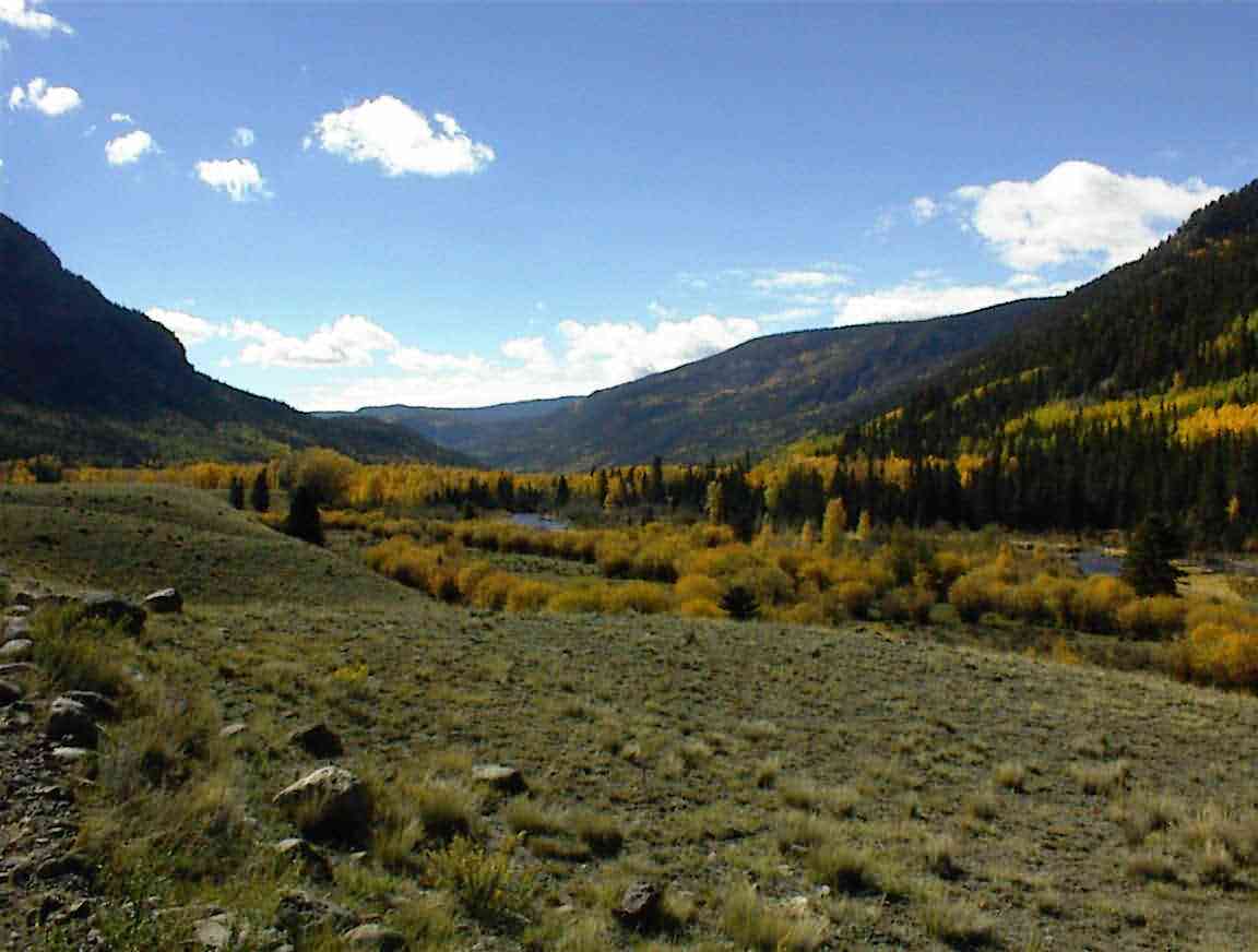
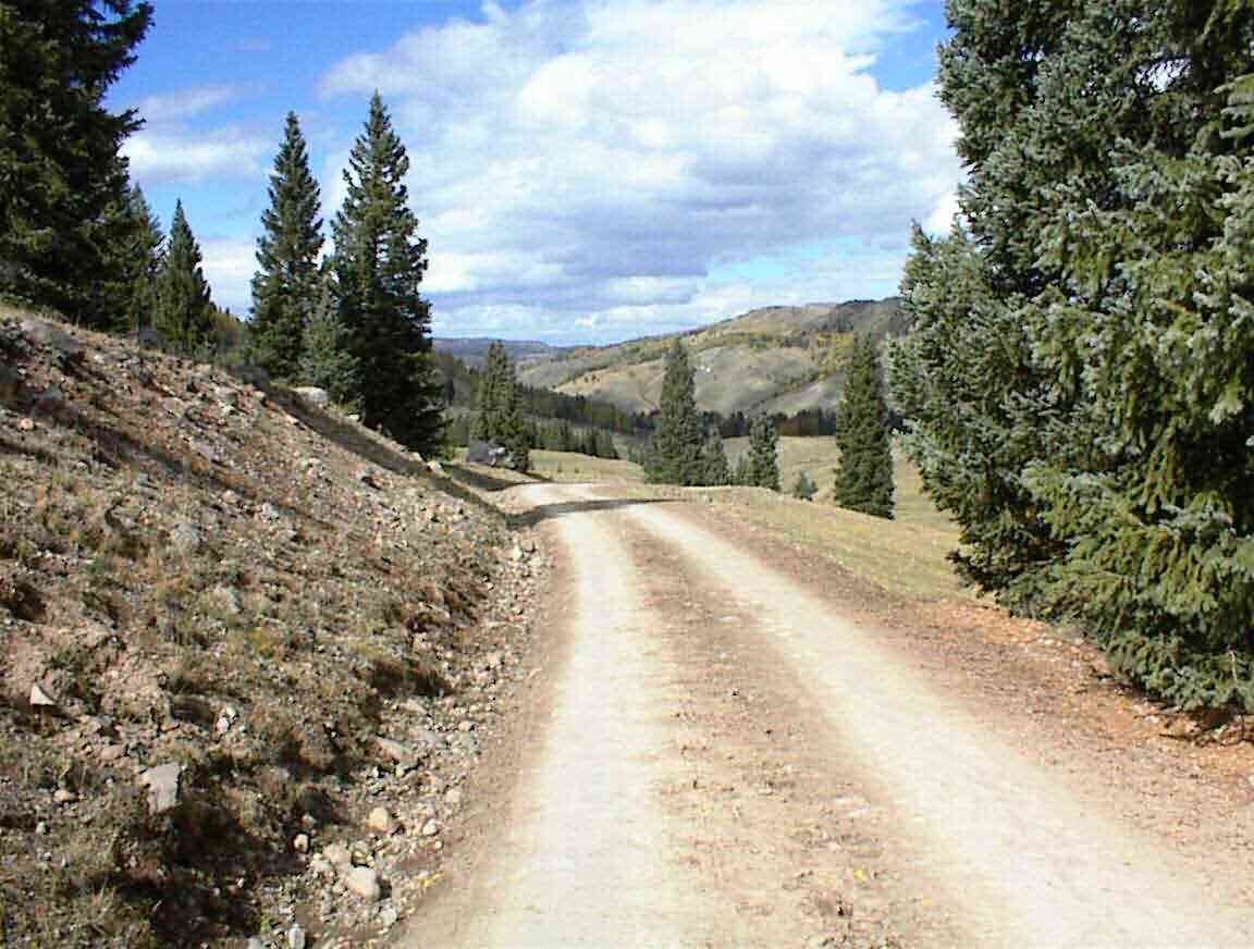
After packing up and saying my goodbyes I was on the road by 09:00. The cycle took me down the valley, at least according to my elevation map, so I looked forward to an easy first few miles. When will I learn not to trust these profiles ... Yes, it was largely downhill, but there were quite a few climbs as well including one that would have been upwards of 750-1000'. At least I usually had a tailwind. As you can see from the photo below, the valley was lovely so I thoroughly enjoyed the cycling.
Along the way I passed a fellow taking photographs of the aspen. I noticed that his licence plate was 'FOTOBOB' so I commented that he must be a serious photographer. He said that he sold his prints and some were up the road at the lodge. I had been admiring the photographs over breakfast and he was most pleased when I complemented him on the calibre of his pictures (I didn't mention the price which was a bit on the high side).
Originally from Scottsdale Arizona, Bob and his wife had bought a cabin in the area when he retired from the police force. His photos mentioned that he had taken portraits of famous people including Margaret Thatcher so I asked him how that came about. He proudly told me how he was a great admirer of hers and when she came to Denver on a visit he requested a sitting which she granted. It was one of the highlights of his life it seemed ... A keen trout fisherman he was planning on visiting New Zealand one day and was interested to hear that it was a challenge to photographers due to the light conditions. Seemed to spur him on a bit. I let him return to his photos while I cycled on, although he passed me several times as I travelled down the road.
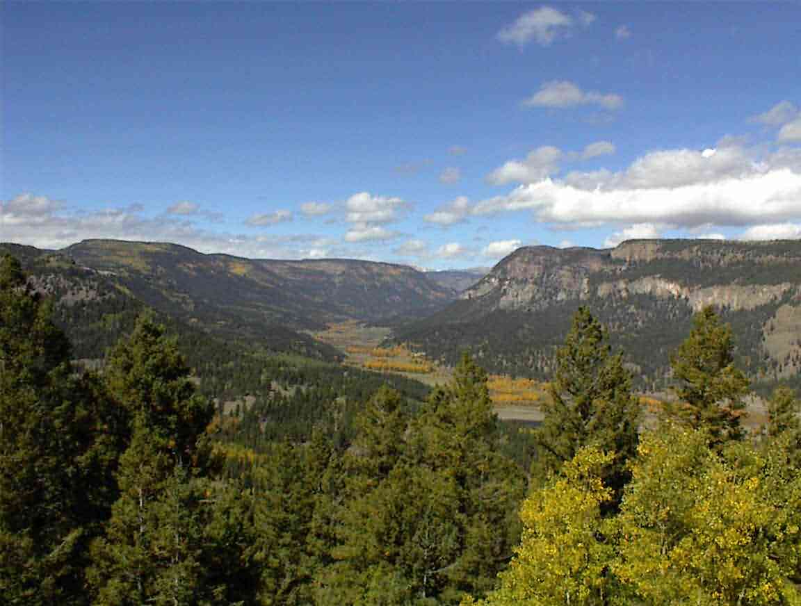
There was little traffic on the road, except two dogs who chased me, and before long I was at the end of the road where it intersected Highway 17. This was a paved road that was still not very busy, but with a good shoulder it didn't worry me either way. I began ascending the 5 miles to La Manga Pass and of course the headwind came up around this time to make things more interesting. The views as I ascended were spectacular. The photo below shows the valley I cycled down. I crossed the mountains in the centre of the photo the previous day.
The first three miles were quite steep so I climbed slowly in my 'granny gear' at about 3-4 mph. There were a number of switchbacks which were most welcome since not only did they provide a relief from the grade, but it also meant that I got a break from the headwind. The last two miles were quite gradual and then I reached the summit at 10,230'.
It should have been a great downhill run except that I had a very strong headwind which greatly impeded my progress. It is a crime to have to peddle like mad on a downgrade to do 12 mph. The road took me down into a valley where there were a number of homes and farms. It was very lovely but quite isolated. I was surprised to see a restaurant/saloon at the bottom of the hill since I wondered who would come this far for a meal. Not many it seems as the place was closed and up for sale.
At the bottom of the hill the 'Cumbres and Toltec Scenic Railroad' was on my left. This is a tourist railroad operating a steam engine and cars from the 1800's. There was even a large wooden watertank for filling the engine. I heard a steam whistle in the distance but couldn't see anything so I hastened uphill over the next 1.5 miles to where I turned off the highway at the railway crossing in the hope of a closeup of the train. I had a break by the tracks but the train didn't eventuate so I continued downhill on a very bumpy unsealed road. At the bottom I spied the train across the valley with steam blowing out the engine. Quite neat. It was too far for a meaningful photo but it looked like a scene from a cowboy and indian movie. I was intrigued at how slow it was -- probably 25 mph -- which I guess 100+ years ago was mighty fast.
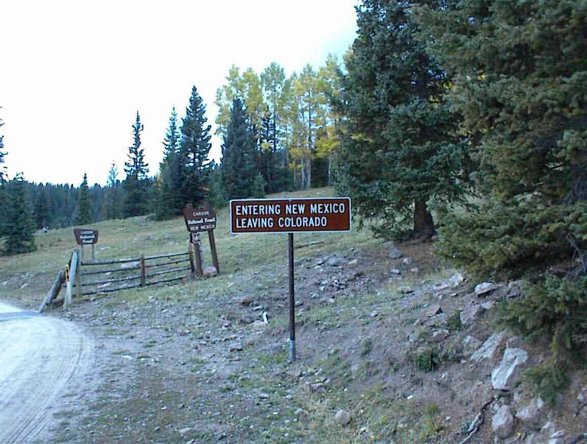
I soon found myself at the New Mexico border - state number 5 and the last one of my trip! Shortly afterwards I turned onto forestry road 87 which would be my route until tomorow.
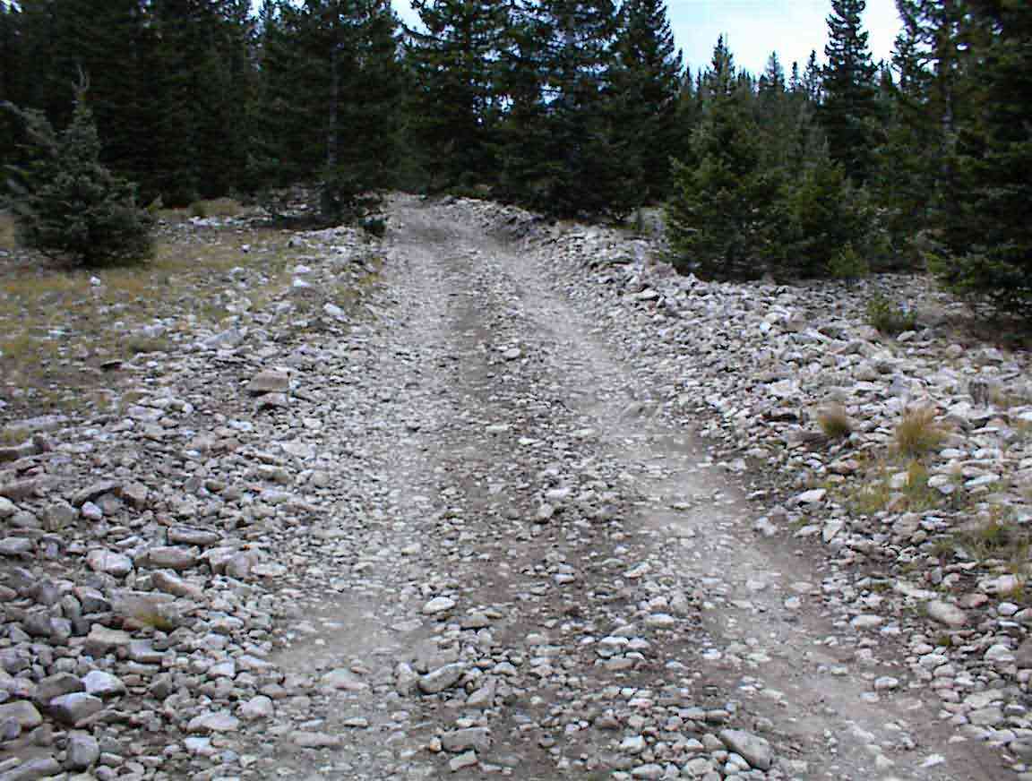
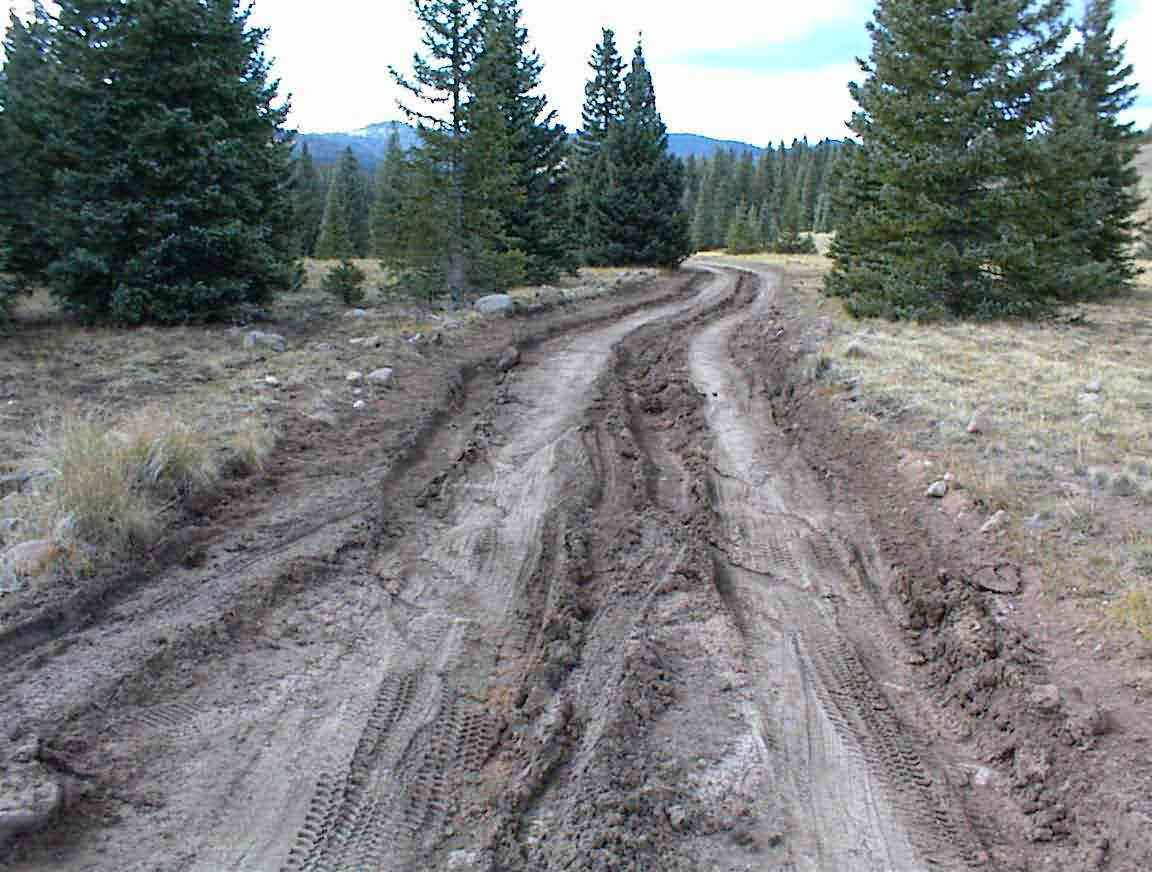
One of the enigmas is the way in which the same road can vary. As shown in the photo below, it started off quite reasonably with a rough but not unmanageable surface. Later, it became unrideable...
The road wound upwards to over 10,000' as it circled the side of the 'Cruces Basin Wilderness'. This is a large basin with no roads and only hiking trails. As I ascended I was rewarded with fantastic views across the valleys and of mountains all around. It was great.
Unfortunately, the riding wasn't. The road deteriorated to an unimproved earth road which had ruts sometimes 300 mm+ deep. It required good concentration and steady steering to make my way through them, and I was thankful that it had not been raining as it would have made life difficult if not impossible. In some places it was so bad one could see new paths made by vehicles navigating around the road.
As I approached Brazos Ridge the earth road was traded for a stone road. But the stones were loose, large, and randomly scattered. Coupled with a steep grade the cycling was difficult, and eventually impossible. My wheel just slid on the stones and I got thrown from my bike. Not fun. I ended up pushing my bike the last quarter mile to the top.
The weather chose that time to turn suddenly. Gone was the blue sky that had accompanied me for most of the day and it was replaced with an ominous black sky. It can be dangerous to be caught out in the mountains and so I peddled as fast as I could to try and make it down off the ridge to the treeline before the weather changed. Unfortunately, this was not to be and I was hit with a howling wind and hail the size of small ball bearings. Very painful on exposed skin.
When the lightening started I got scared and at the first opportunity I left my bike by the road and headed into a cluster of large trees to take shelter. It was great to at least be out of the hail. I waited for about 30 minutes until there was a break in the storm before I continued again, eventually finding a larg stand of trees. I parked my bike again by the road and this time I pitched camp in a small clearing in the trees. I was cold and wet and the snow/hail on the ground didn't help things. I pitched my tent in record time and was soon inside my down sleeping bag wearing dry clothes and warmiing up. I recalled reading that morning at the lodge in a hiking magazine how one could survive 3 h without shelter; 3 days without water; 3 weeks without food. When it comes to me and cold weather I'd say it is about 1 h without shelter!
I was treated to quite a show as the dark skies were lit by lightening. Fortunately, it all seemed to be far away judging by the time lag between the light and the sound, but I said a few prayers just to be safe. It was then a cold dinner of tinned food and listening to my radio before an interrupted night of trying to sleep admist the storms.