Day 36: Salida to Doyleville - 56 miles
During the break I dropped my bike off at Salida's 'Absolute Cycle' shop for a checkover and tune up. They had a brilliant mechanic, Scott, who get everything working very smoothly. My rear tyre sidewall was also at the end of its life, after only 1600 miles, so I replaced it with a new tyre. He also repacked my bottom bracket and made numerous small adjustments. It hasn't riden so well since I first bought it.
The route veers west from Salida following the divide so we decided to make Salida our base and I would do a couple of day trips, returning to town in the evening courtesy of my chauffeur Lis and her rental car. One advantage to this was being able to sink into the hotel's spa pool at the end of the day. I could see myself falling for this lifestyle. It also meant that I didn't need to ride with my bike fully laden which was another advantage. It drives like a Ferrari when not encumbered by 20 kg of gear.
I left the hotel before 08:00 and headed west out of town on Highway 50. There was a very strong wind but at least for the first 5 miles to Poncha Springs it wasn't a headwind. That changed when I turned south on Highway 285 towards Poncha pass. I enjoyed the combination of a moderate climb with a strong headwind. Got the heart pumping.
At the thriving metropolis of Mears Junction (two buildings; one abandoned) I turned right off the highway and onto an unsealed road. This would take me up and over Marshall Pass at 10,842'. I had been concerned about this ride since not only was it a very high pass, but unlike my other high passes I started off at the relatively low elevation of 7,400'. Thus, instead of having a 2,000' climb it was closer to 3,500'.
The road took me along a lovely mountain valley with a stream running next to the road. It had a number of beaver dams but, not surprising, there were no beavers to be seen. I've seen relatively few beaver dams so it was great to see that there were still some in the area. Hard to believe that at one time this part of the country was full of beaver but they were almost all trapped out.
After about 4 miles I came to the turnoff which would take me up the pass. There was a signboard which described some of the history in the area. In the late 1800's there was an 8 mile aerial tramway that was used to transport ore from nearby mines to this place where it was then put on the railway line to ship it further afield. The Marshall Pass route was an important connection between the Gunnison and Arkansas valley and in 1880 a toll road was built; a year later a railway line as part of the Denver and Rio Grande railway. The route today follows the old road/rail line which means that by and large the grades are quite moderate. In other words, easy cycling :-)
As I started up I was passed by this huge car ('Yank Tank' as we often call them in NZ) which had a dog hanging out the window, its paw half way down the side of the vehicle. They sure know how to enjoy travel, unlike cats who generally hide under the seat.
I started climbing and the cycling was great. The road surface was in pretty good condition and it took me up through a forest of pines and aspen. I made good time and the only thing which had me worried was the weather as I was ascending up to dark clouds. Sure enough, after about 2 h the weather closed in and it became very cold. Shortly afterwards I was treated to a hail storm! The hail was small but fell with such an intensity that any exposed skin stung with the impact. Not fun.
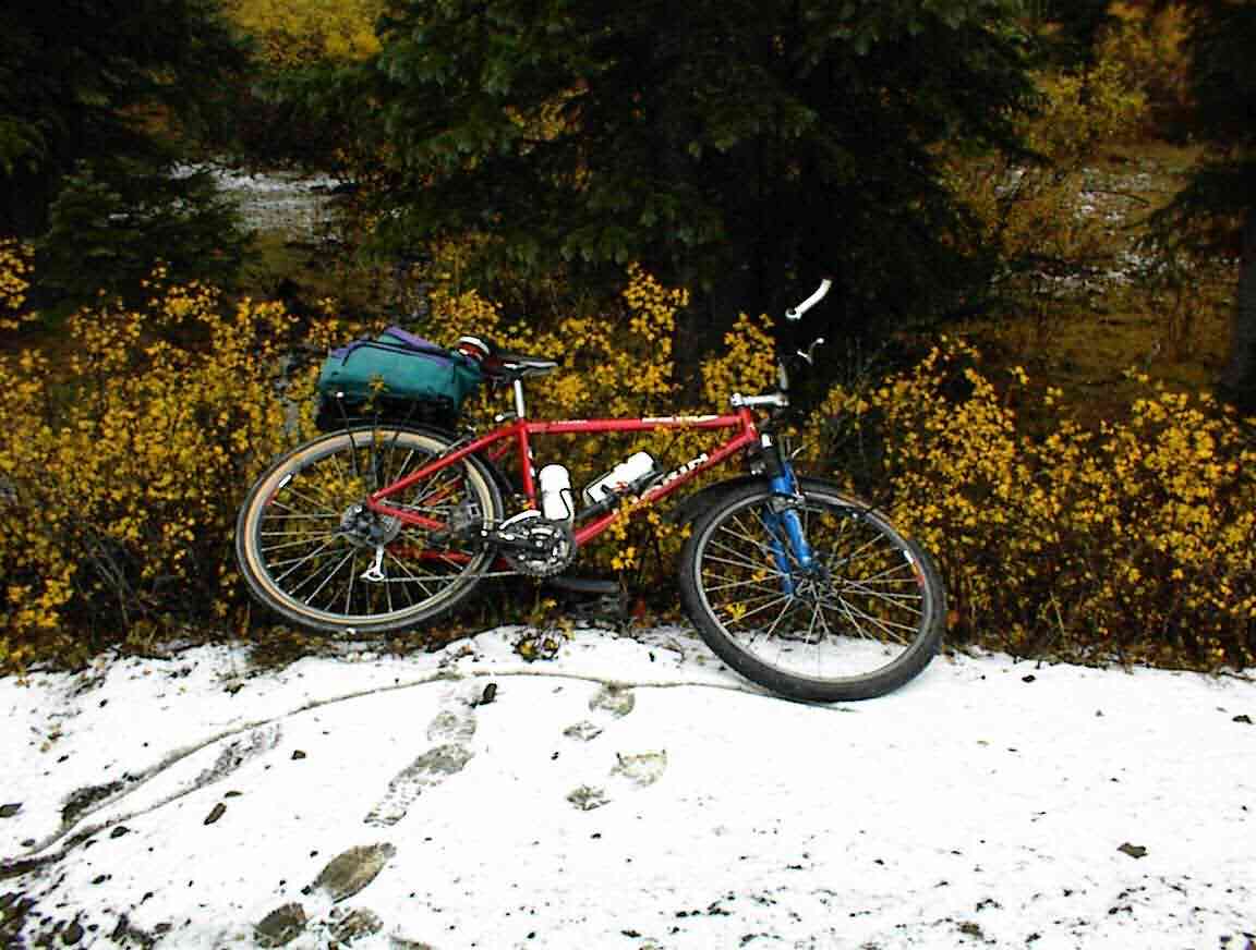
As a sign of how cold it was, there was snow next to the road and as I approached the top of the pass I got the photo below - my first one with snow, but probably not my last!
Shortly after the photo I came to where the Colorado Trail intersected the road. This is a trail which follows the continental divide through Colorado and, given the altitude and the weather, must be walked by very hardy individuals.
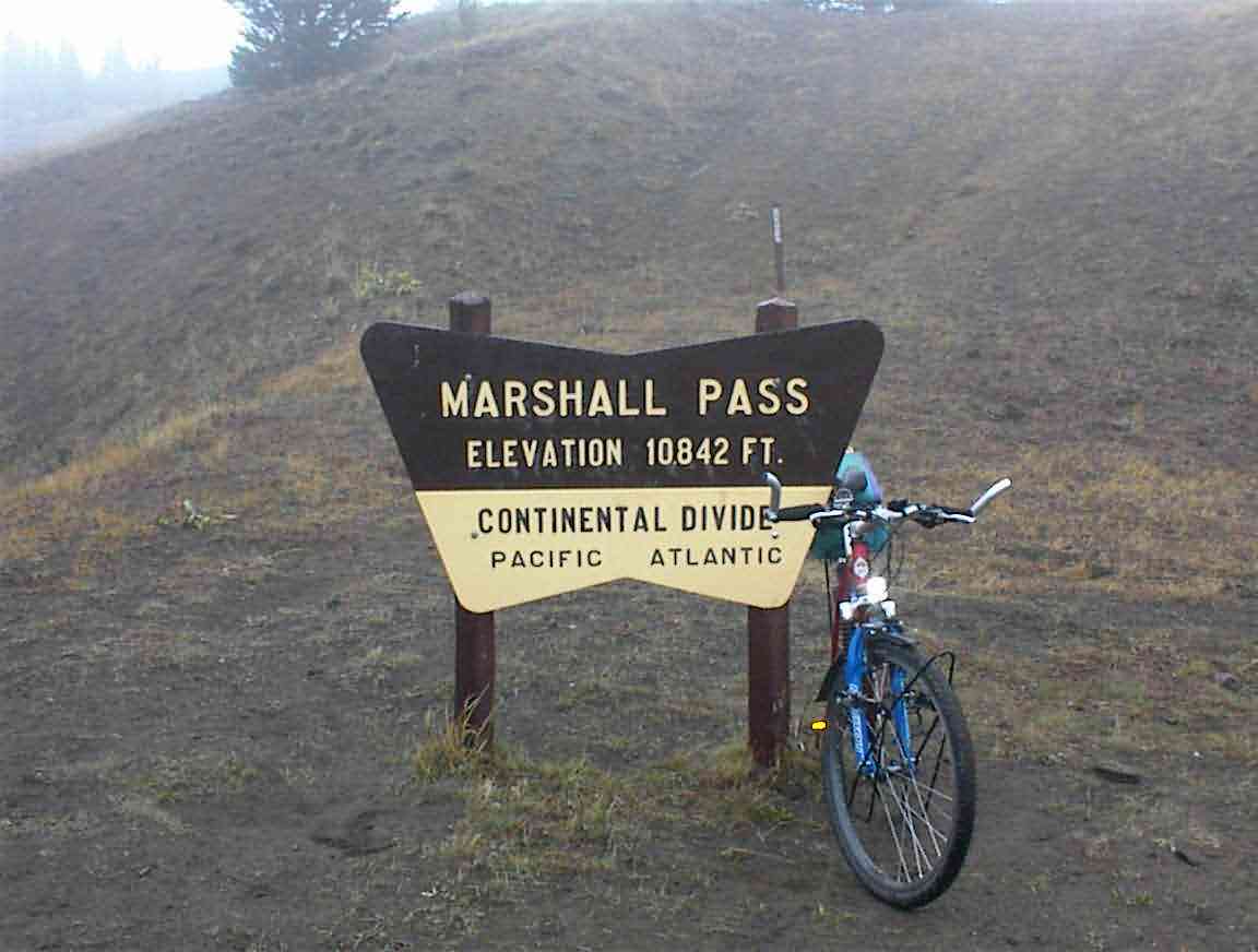
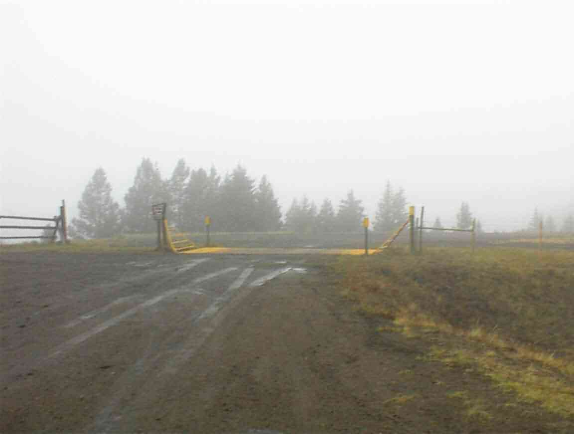
After cycling through a cutting I reached the top of the pass. As you can see from the photos below, the weather was not exactly inviting with cold fog and rain enveloping everything. I didn't spend any time at the top, not that it would have been worth it given that one could only see about 30 metres, before commencing my downhill run.
The bike shop had pumped my tyres up to very full pressure and as I descended this was very noticable. I let some air out which made the riding more pleasant but too much was taken from the rear tyre. Unfortunately, when I went to inflate it further I found that my pump wasn't working correctly. Ho hum. This meant that I had to keep the speed down a bit on the downhill run, which was probably a good thing given the wet road condition.
After about 10 miles I suddenly entered into the sun again and it became so hot that I needed to remove most of my layers. The way in which the weather changes in the mountains is both impressive and scarey. That is why one has to be prepared for anything.
The route took me down along a river valley and it made for very pleasant cycling. Nothing like having miles and miles of downhill runs to cheer up a cyclist. Eventually I reached the main road at Sargents and I stopped at the shop for a drink. While sitting outside I saw Lis driving. In spite of my waving like mad she drove by so I resolved to catch up with her once I finished my drink. Fortunately, I saw her drive into the parking lot about 5 minutes later so I didn't have to play catch up.
I was resolved to cycle to Doylesville which was 12 miles down the road so after a brief lunch (in the nice warm car) I was on the road again. Although it was paved, and largely downhill, I had a very strong headwind which made for hard going. The cycle was through what looked to be very productive farmland; they are obviously in a place which is much better watered than other parts of Colorado.
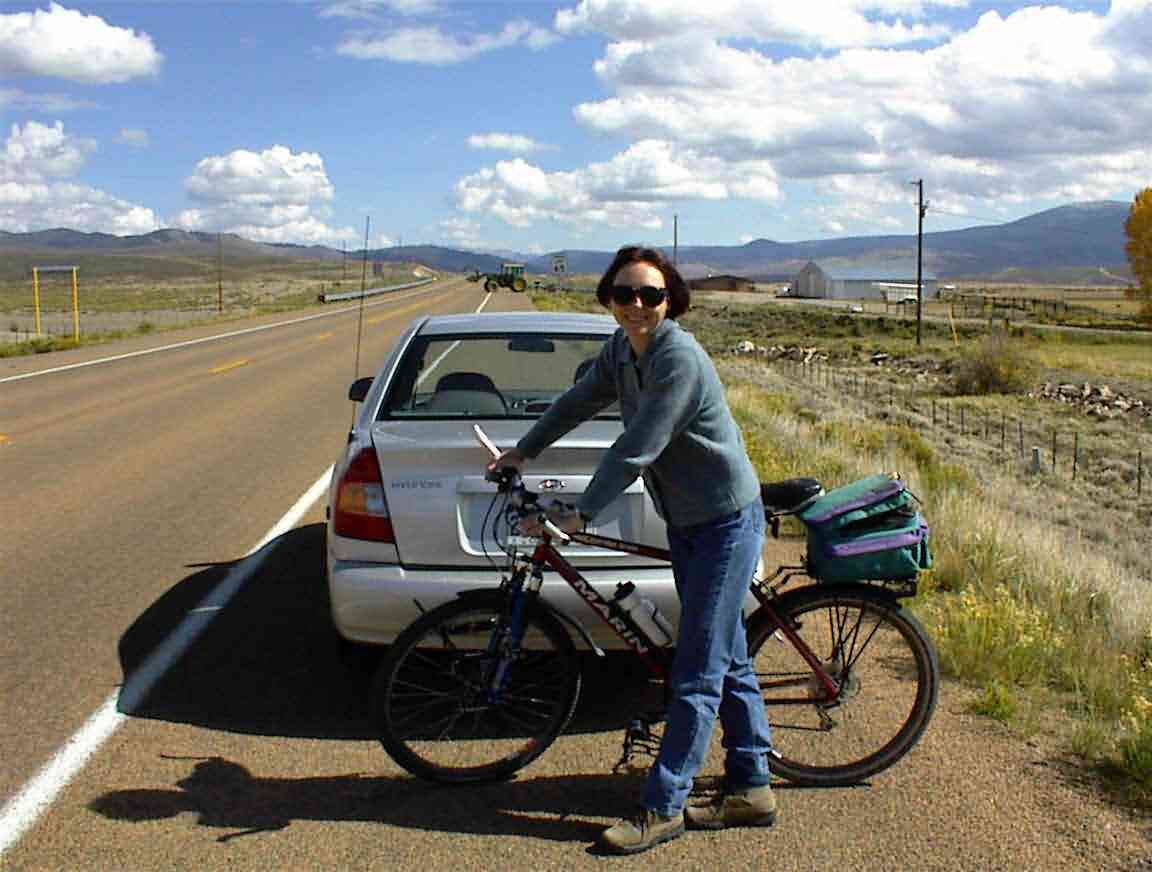
For some reason when one has a specific goal when cycling it takes forever to reach. I kept on thinking that over the next rise I would spot Lis, but it didn't eventuate. The wind was abominable and it was with great joy that I finally spotted the silver car parked by the side of the road up ahead. The photo below is of Lis before we packed my bike in the car for the trip back to Salida.
On the way home we crosssed Monarch Pass (11,898') and stopped at the visitor centre to use the facilities. Glad I didn't have to cycle up there, although as we drove down the other side I commented that it would have been fun to have put the bike together again and enjoy the free momentum. However, it was too late by then, and I was feeling quite snug in the nice warm car.
When we got to town we went to the cycle shop where I bought a pump and Lis rented a bicycle so that she could join me for part of the next day's ride. We then went to 'Bongo Billy's' cafe which was next door for dinner. They had a duet playing Appalachin folk music who were excellent and we stayed until intermission before heading home to the spa pool and some relaxation.