Day 26: Big Sandy River to Atlantic City - 49 miles
As I lay in bed I thought of a good solution for fixing my broken rack and I got up to implement it. I had decided to make a 'splint' which would inhibit the movement of the rack around the area of the break. The problem was that I didn't know if the movement was lateral or longitudinal, so I guessed lateral. As I was to find out later it was longitudinal.
For the splint I needed something rigid. One possibility was to use my knife and fork since I could easily exist with just a spoon, however, these were too wide so I decided to destroy my small portable tripod and use the metal legs. This proved to be a bit more difficult than planned insofar as they were epoxied to the camera mounting bracket, but after 30 minutes with my Swiss Army Knife I had a workable splint. When held in place with my trusty cable ties it looked pretty good.
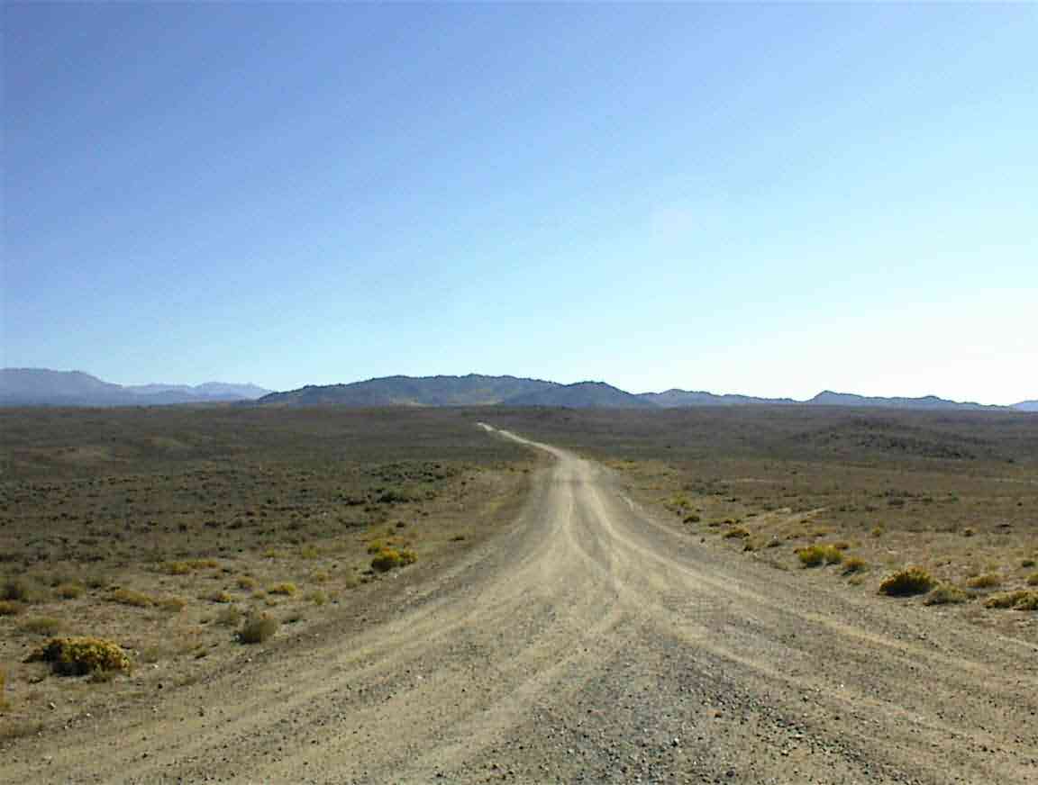
Sean eventually rose and we had breakfast sitting by the river. It was a delightful spot and the sun was quite warm even though it was only 10:00. Since we are in a desert area it is very arid and for the first time we did not have trouble with condensation in our tents. It was interesting to see how even though the river had a good flow in it, particularly when one considers that they are in a drought, there was no greenery more than 10 m from the river bank. I ascribed this to the soil which was a very sandy/silty clay. It just absorbed water like a sponge and the only plants that seemed to be able to survive were desert scrub.
Buckskin crossing where we camped was an important crossing point on the Oregon Trail. This was a crude network of trail which rant from the Missouri River to the west coast. during a period of 20 years over 400,000 emigrants travelled the 2,170 mile trail in search of a new life. In the area where we camped there were graves of those who died at this point, and had we searched for them we could have found the ruts of their wagons and pushcarts which still purportedly exist.
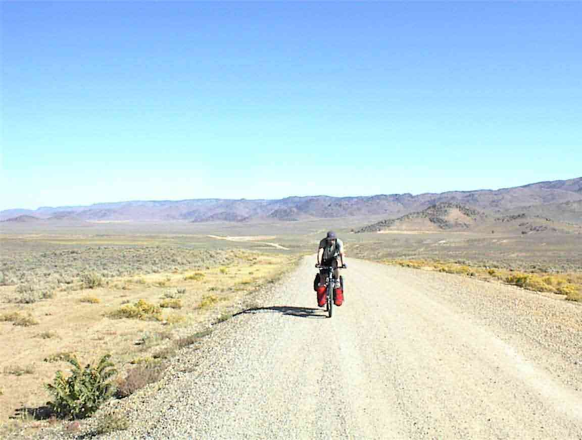
The land was very bleak desert and it must have taken some fortitude to travel through it. As the photo below shows, there is little vegetation and once we were more than 100 m from the river we would never have known there was a water source there, were it not for the occasional trees which obviously point to a water source. I wondered how many died close to water but unable to find it...
This area was called 'Lander Cut-off' and was named after General Lander who purchased the right-of-way from the Shoshone Indians. It shorted the traveler's trip to Oregon by some 200 miles which, when travelling 20-25 miles per day, was quite significant. They worked against the clock since it was not uncommon for winter to set in early and this could mean starvation and death.
Tomorrow we will pass the location of the 'Willie Handcart Company' disaster. Poorly supplied and travelling far too late in the season, they were trapped by a winter storm in mid-October 1856. About 67 of the 404 people froze or starved to death. In another famous incident the Donner-Reed party resorted to canibalism to survive, although this was not on the Oregon trail..
Not only did the travellers need to carry their own food, but cooking fuel, whether wood or buffalo chips, became very scarce. Survival became so important that many people discarded their family heirlooms; food and tools were vital, everything else expendable. One major problem they had in this area was with the drier air causing wooden wheels to shrink and the iron tyres that helld the wheels together loosened or rolled off. There were no friendly mechanics around!
While these somewhat macabre thoughts passed through my mind I thought of my young friend Logan in NZ who has a computer game on the Oregon Trail. At least in the game only virtual people die.
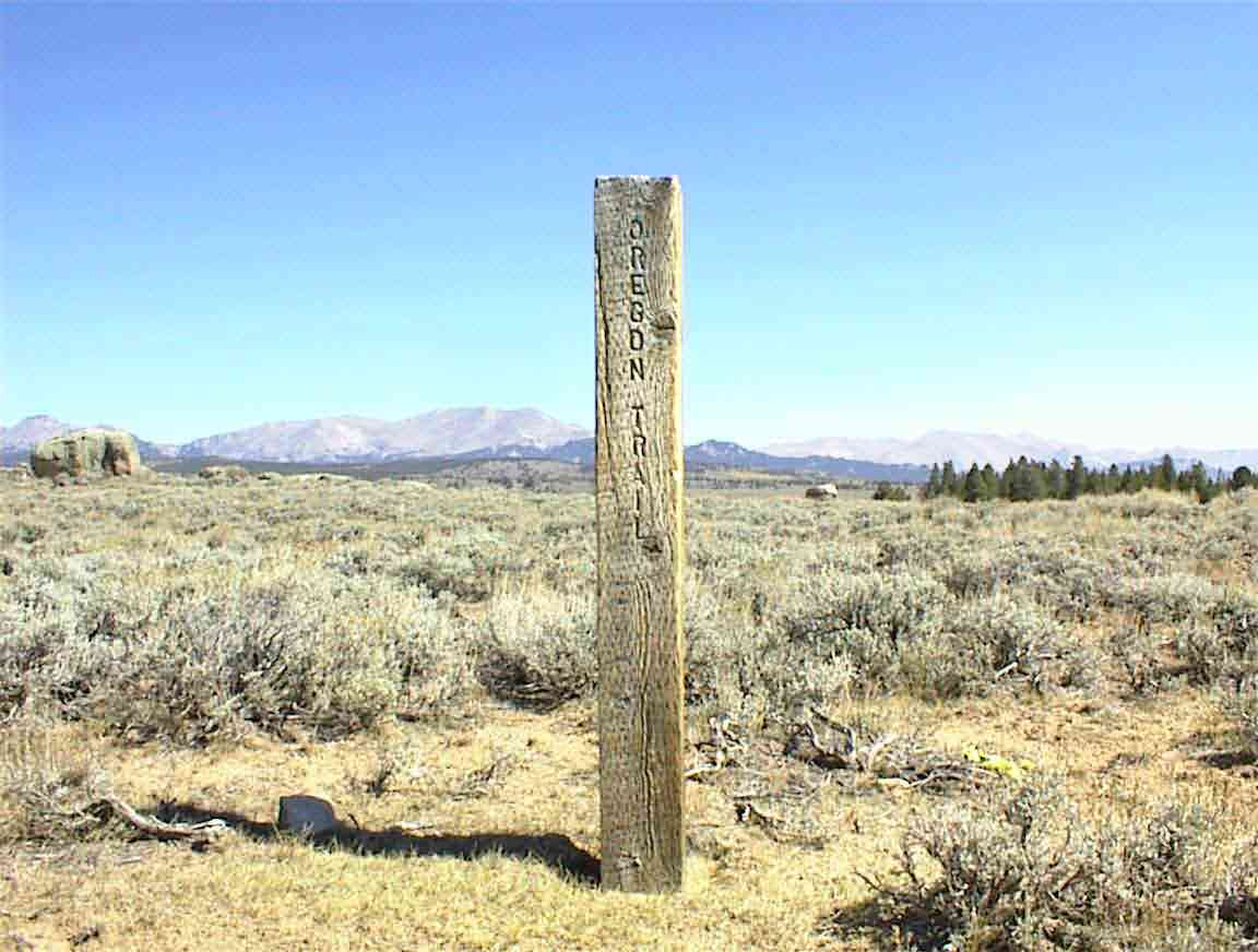
We were constantly reminded of the trail by the regular markers by the side of the road. An example of one is below.
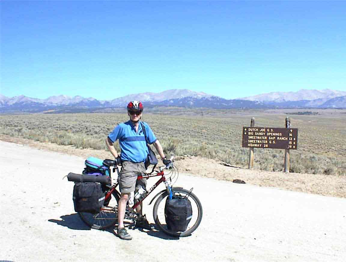
This was a day of three continental divide crossings, and the photo below shows me at the first. None of them were sign posted as such, so we had to take the map as being correct. In actuality the divide may have been crossed more times, particularly since part of the trip was along the actual divide itself.
After 32 miles of unsealed road, which varied from an excellen smooth hard packed surfaced to corrugations with loose sand, we reached Highway 28 at 'South Pass'. There we crossed the divide for the third official time of the day at 7,550'.
South Pass was a very important location to early travellers. This broad pass is at the summit of an amost imperceptible approach to the Continental Divide and was a key point for trans-American travellers. Before the railroad was built, every emigrant passed this way; there was no alternative. No other pass offered a dependable supply of grass and water plus an easy grade to and through the mountains.
Because of this, several of the different trails crossed at this point. There was the Oregon Trail, the Mormon Trail, the Pony Express Trail and the California trail. There was a roadside marker to commerate the point and on the hills nearby we could see the paths of the wagons.
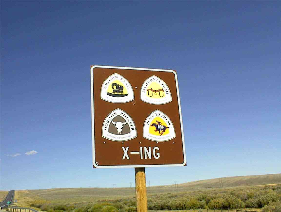
The Mormon Trail has an interesting history. From 1846 to 1869 more than 70,000 Mormons travelled from Nauvoo Illinois along the trail, eventually arriving in Utah. Unlike the other emigrants, their travels were not entirely voluntary; they were trying to maintain a religious and cultural identity. This was a movement of an entire people, an entire religion, and entire culture. While the traditional picture is of wagon trains, the Mormons, at least initially, used handcarts which they pulled 1,300 miles across the plains to the valley of the Great Salt Lake. It beggars the imagination how they did this when I consider the difficult and unforgiving terrain we have been cycling through.
We stopped at a rest area on Highway 28 and recharged our waterbottles before heading on. Our goal was to stop at South Pass City but we missed the turnoff and so continued for quite a few miles on Highway 28, uphill of course. Eventually we reached a turnoff to the site, but Sean was in need of food so he stayed there resting and eating while I went down to the city.
City is perhaps a bit of a misnomer. In 1867 the South Pass gold rush began and South Pass became the largest city in Wyoming, with 3,000+ people. As has happened everywhere else, the boom went to bust and almost as quickly as it started the region fell into decline. Today, South Pass City is a partially restored ghost town comprised of about 30 original buildings showing different facets of life 100+ years ago.
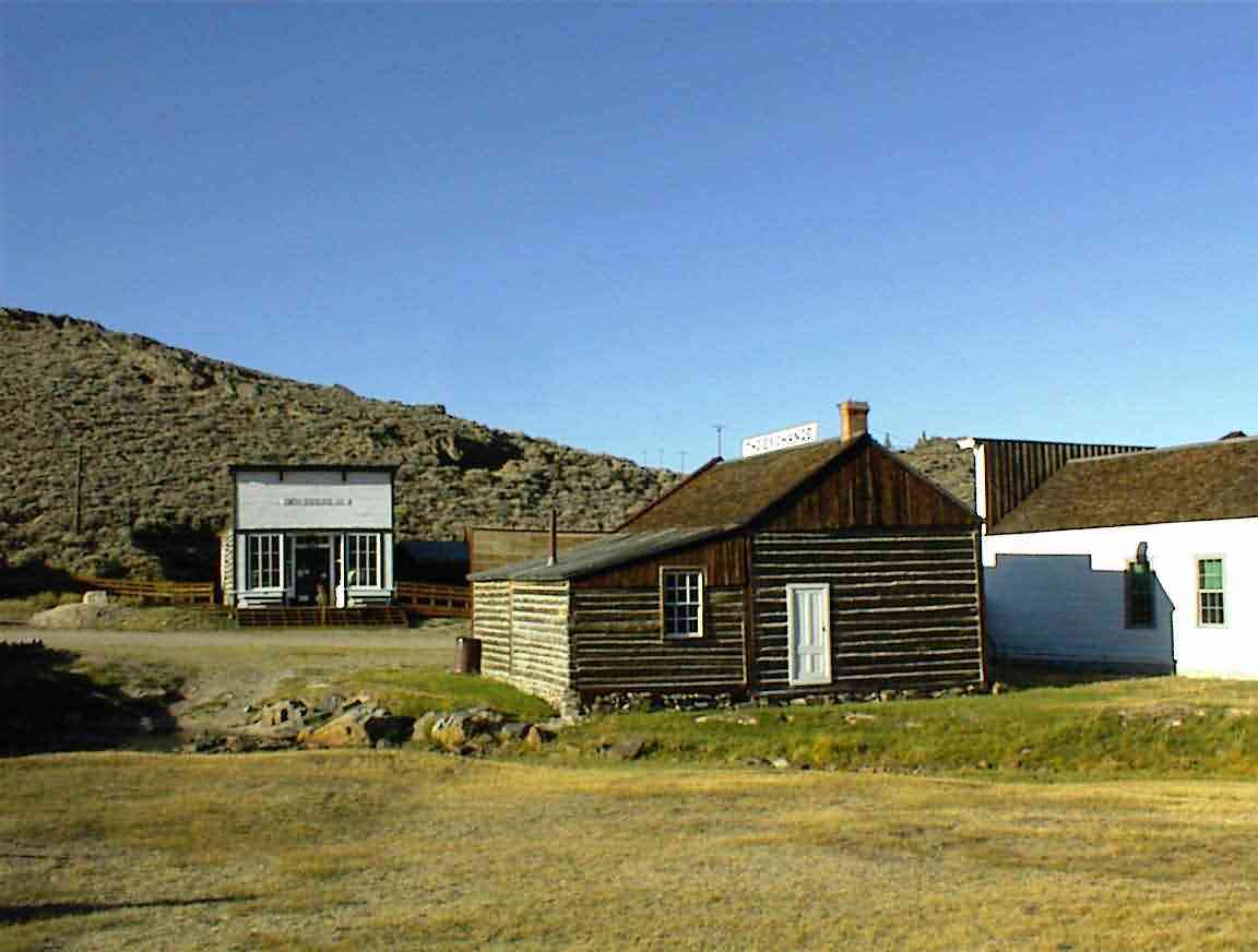
While waiting for Sean I visited the local store and got a drink and some chocolate. I then went to the entry area and chatted with John the curator. He was from Iowa and as a history buff was able to fill me in on some of the history of the area. After 30 mins I decided to go through the town since it was closing in an hour.
The buildings were all in excellent condition and I appreciated the way in which they brought the hardships of frontier life out. For example, one of the places had the walls papered with newsprint; the narrative explained that was all most could afford and it at least served to reduce the dust coming in from the sealing used between boards as well the minimising the insect infestations.
Every building had at least one large stove, a testament to the bitterly cold and long winters. They had an excerpt from someone's journal describing how difficult it was to cope with the weather, and that visiting the saloon for socialising and gambling was the only outlet. Unfortunately, that was restricted to men so I wondered what the women did to keep sane.
One of the buildings was an operating shop and I chatted with the proprietor. It was also the local post office which was surprise since the sign entering the town said 'Population About 17'. I thought this would be too small for a post office. He gave me some advice on the next few days of cycling (stop for water any chance you get) and I purchased some delicious pecan chocolate clusters which I happily munched on.
There was still no sign of Sean as the park closed and I asked motorists if they had seen him and the answer was no. I went back to the top of the road and he wasn't there so I headed for Atlantic City which was the only option. On my way there one of the couples I had asked if they had seen him passed me and said that they saw a bicycle parked outside the store in Atlantic City. When I got to town Sean was hoeing into a steak. He had gone part way to South Pass City and turned off at the gold mine about 1 mile uphill from the town. I was not impressed.
I got a salad and baked potatoe for dinner and then it was some more work on the bike before a hot shower and working on the journal. I was also able to check in with Lis to let her know that I have survived the deserts. However, the big challenge is the next two days to Rawlins where we have about 100+ miles to travel with limited water.