Day 9: Big Nelson Campground to Little Prickly Pear Creek - 50 miles
Today we were going to try and combine two days of cycling into one. This would give us an extra day up our sleeve later on so that we could spend more time in Yellowstone Park. We therefore got off early (for us) leaving the campsite at 09:00.
It was a two mile cycle back to where we left the route and I commented to Sean that had we known about the grades that we would need to ascend just to camp I would have kept on going up the mountain the day before and camped there. It was such a needless waste of energy, even if it was a very pleasant campground. To add insult to injury we saw an excellent campsite about 500 yards into the route. New rule. No more than 500 yards off the route to find campsites.
Just for a change we started the day with a climb. Actually, every day starts with a climb, it is just that some are worse than others. Today's was a 6.5 mile uphill climb over 'Huckleberry' pass. It was only 1500' vertical change so it was not too strenuous given that we now have our cycling fitness, although at times it was difficult. In fact we passed Wayne and Dustin pushing their bicycles. And that was not even at a particularly steep place.
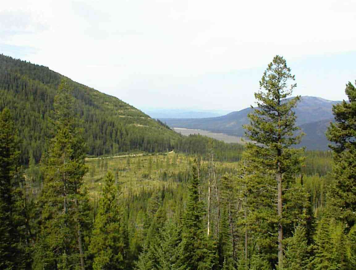
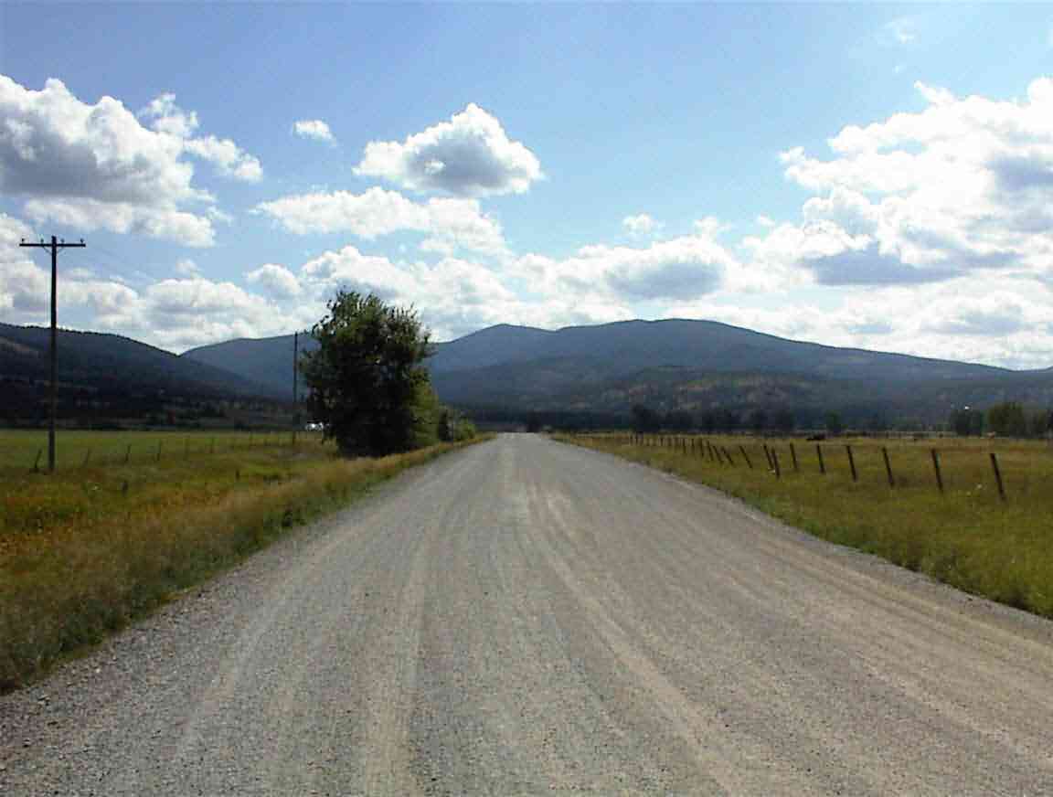
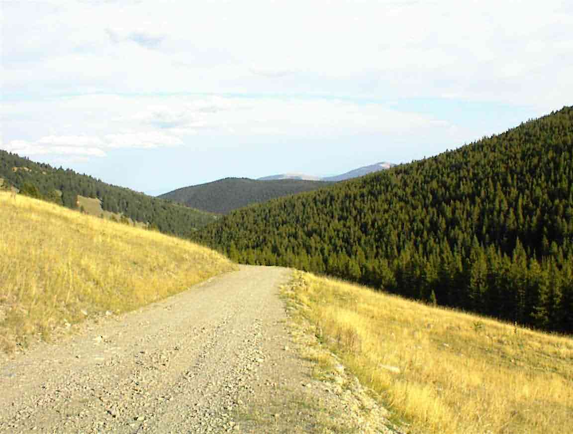
The views down the mountain were great. The photo below shows the golden plain that we crossed yesterday. It also gives an indication of our elevation change.
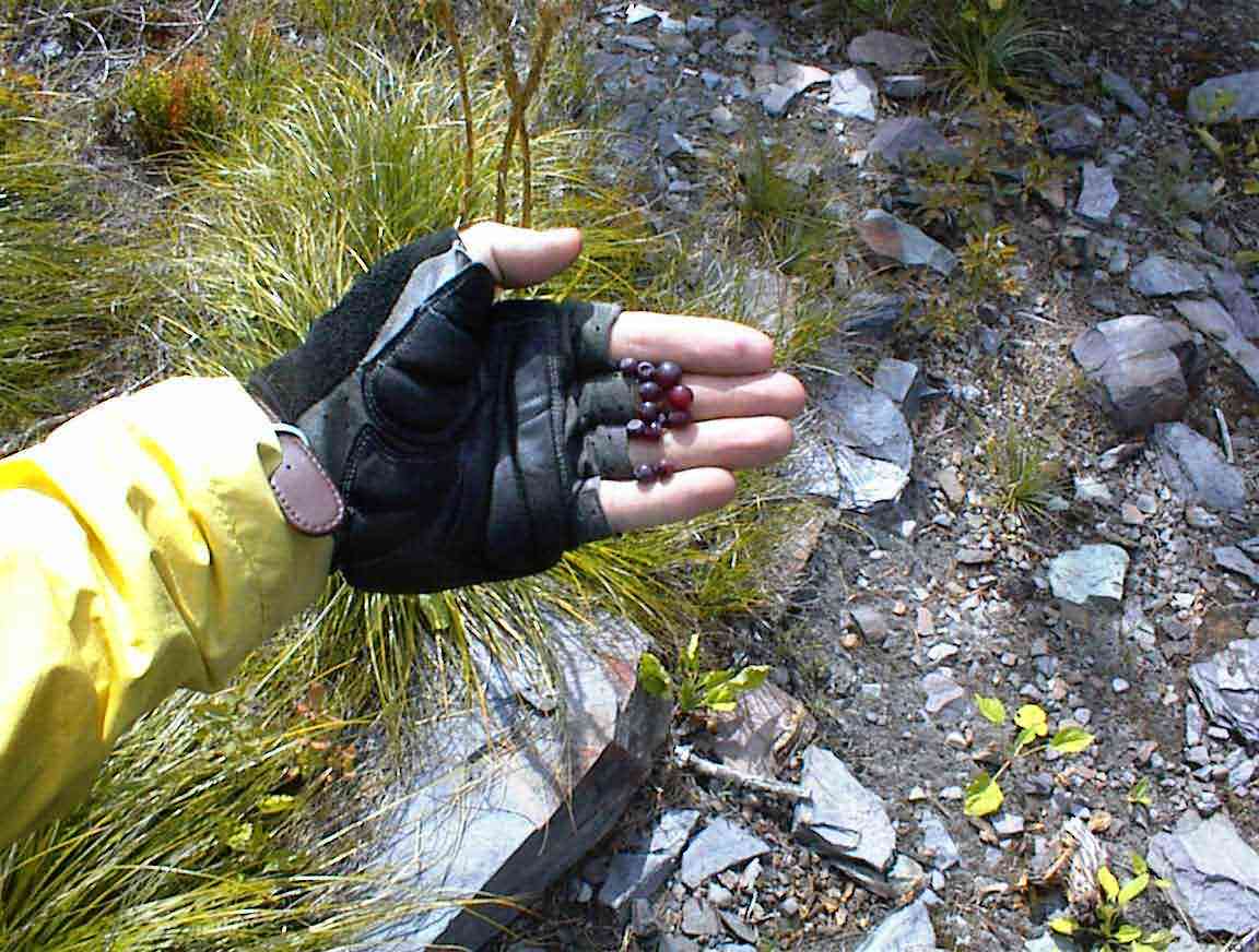
Upon reaching the summit it was time for a break. Sean surmised that with a name like huckleberry pass there were undoubtedly some huckleberries around so he went searching. As you can see from the photo below he was successful so we became quite serious about it.
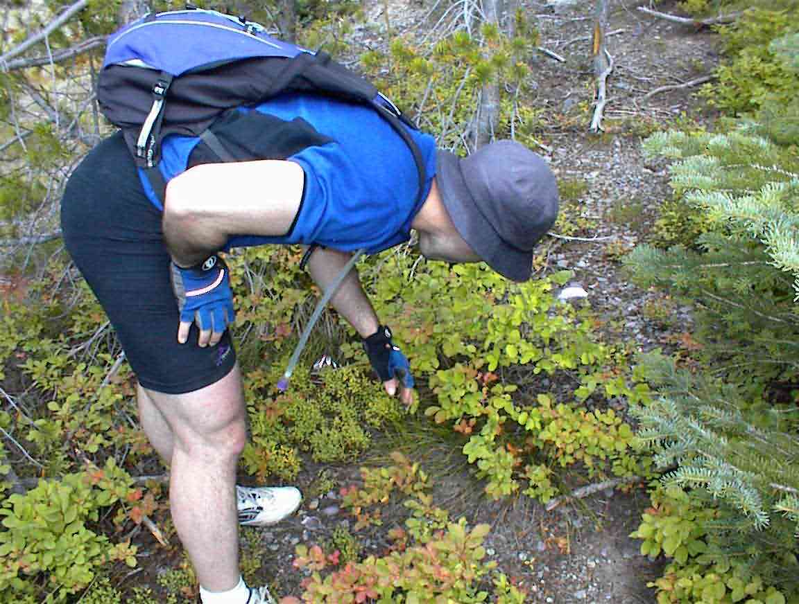
Huckleberries only grow at certain elevations and are therefore a delicacy. A quart of berries fetches about $USD 60 and I thought this was excessive--until I realised just how difficult it would be to collect a quart. As you can see from the photo below, they are very small and, at least where we were, there were only a few to each bush. Perhaps this is because the area had been well scavanged by previous cyclists but I think not; the bushes aren't very large. Since bears also love huckleberries they must spend a lot of time eating given their 300 lb frames.
Wayne and Dustin eventually arrived and they also partook in some huckleberry picking. While they chatted with Sean I oiled my chain. For some reason it has a penchant for starting to squeek when we begin to ascent long grades so the squeek is with me for ages until a suitable place is found for lubricating it, usually the top.
Sean rejoined me and we were off on a downhill run. Sean got off to a good start by hitting Dustin's bike. Dustin took it quite well all things considered...
The downhill road was excellent and, as always, we were able to hit good speeds. For once I dawdled a bit and savoured the mountains around us. We were heading into a valley system with mountains all around. It was spectacular.
The guidebook indicated that it was a downhill run to Lincoln. We were not impressed to find that after a fairly short time we had to go uphill again near Reservoir Lake. In fact we had 5 miles of up and downs until we hit Yukon Creek. By that time it was also warming up so off came the layers (at least for tropical Chris) and on went the sunscreen. Although we had descended by only 1200' from the summit, it was a different world in terms of temperature.
We wound our way down to the town of Lincoln and it was a fun downhill run on a good road. Only 1 vehicle passed us the entire 25 mile trip from the campground to Lincoln which shows how spoiled we are on this trip; we usually have (relatively) good unsealed roads and no traffic. At one point a badger crossed in front of us before diving down into the ditch and hiding in a culvert. As the valley opened up to farms we could see ahead of us our next objective - our first continental divide crossing.
We stopped in Lincoln for lunch. Sean opted for the very first restaurant we found which was a fairly 'tired' cafe. The only vegetarian option was an omlette so I had that with a salad. The waitress was friendly and told us that they had snow only a week ago! Tha is very inauspicious and is a harbinger of a long and cold winter. She said that unless you like snow Montana is not the place to be. Travelling here in summer one has a different perspective on the place, until you pass a field with several snowmobiles parked waiting for winter.
After lunch I went next door to the grocery store and bought some cereal and two apples. When I exited Sean was talking with a hiker named Jeff who was walking the continental divide. He left Mexico 1 May and looked very tanned and lean. He commented that he had lost 20 lbs so far. Not surprising given that he had come 2400 miles over mountains. Knowing how difficult it is to operate with all our gear on bicycles, I'm very impressed by people who do this carrying their gear on the backs.
After lunch we cycled further into town and found several other eateries. Next time we will need to be more adventurous. I called NZ and then we headed towards the mountains.
We headed up Sleepy Hallow (sic) road which was a very wide gravel pavement. As we crossed a bridge we saw Wayne and Dustin down by the river having a rest. They had also decided to do some extra miles that day, but not as many as we were aiming for. Several vehicles passed us covering us with dust. The same one three times! At first we went through farmland but then as we entered the foothills the valley narrowed and was tree lined.
After 11.4 miles of gradual climbing we came to the turnoff llllto our road. The guidebook had two options; a longer and "slightly easier" one over Stemple Pass or a 4.4 mile route with "extremely steep uphill". Of course the masochist in me wanted to do the latter and in spite of some reservations Sean was also game. We had a good rest by the side of the road enjoying the afternoon sun, it was by now 16:00, before setting off.
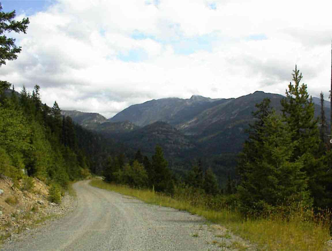
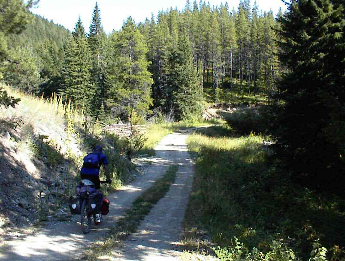
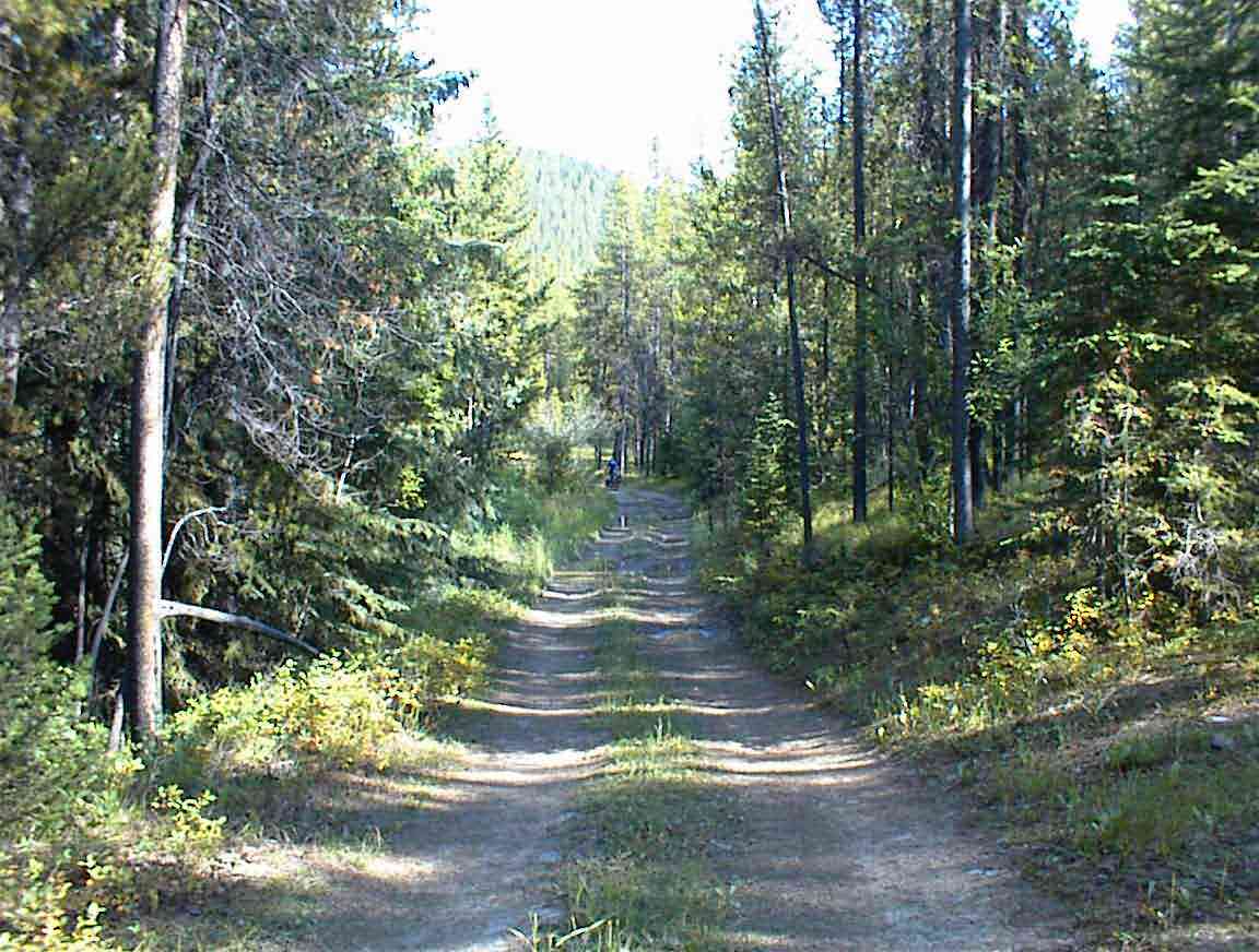
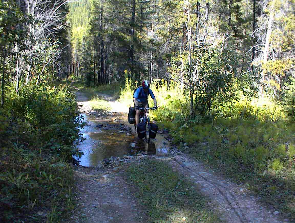
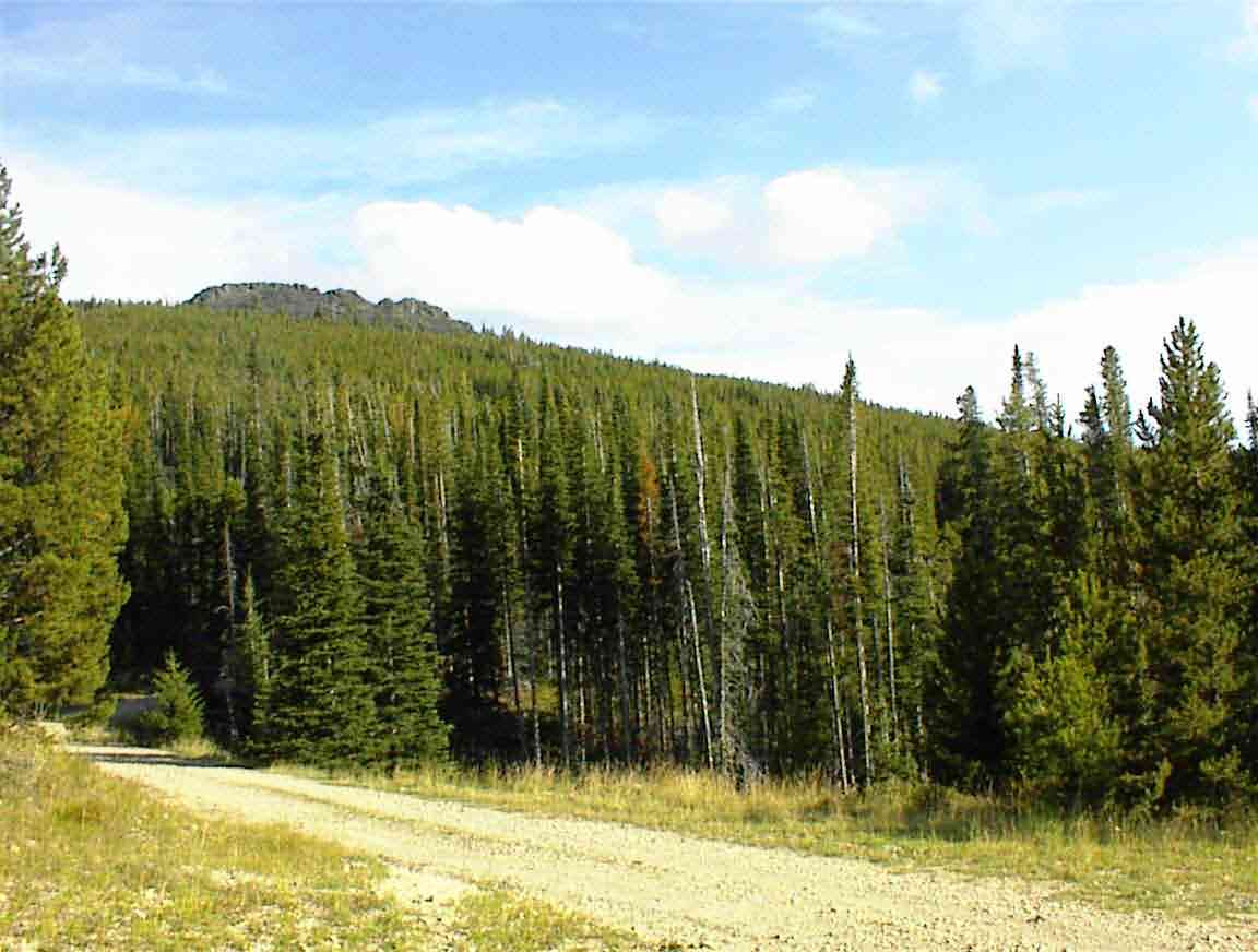
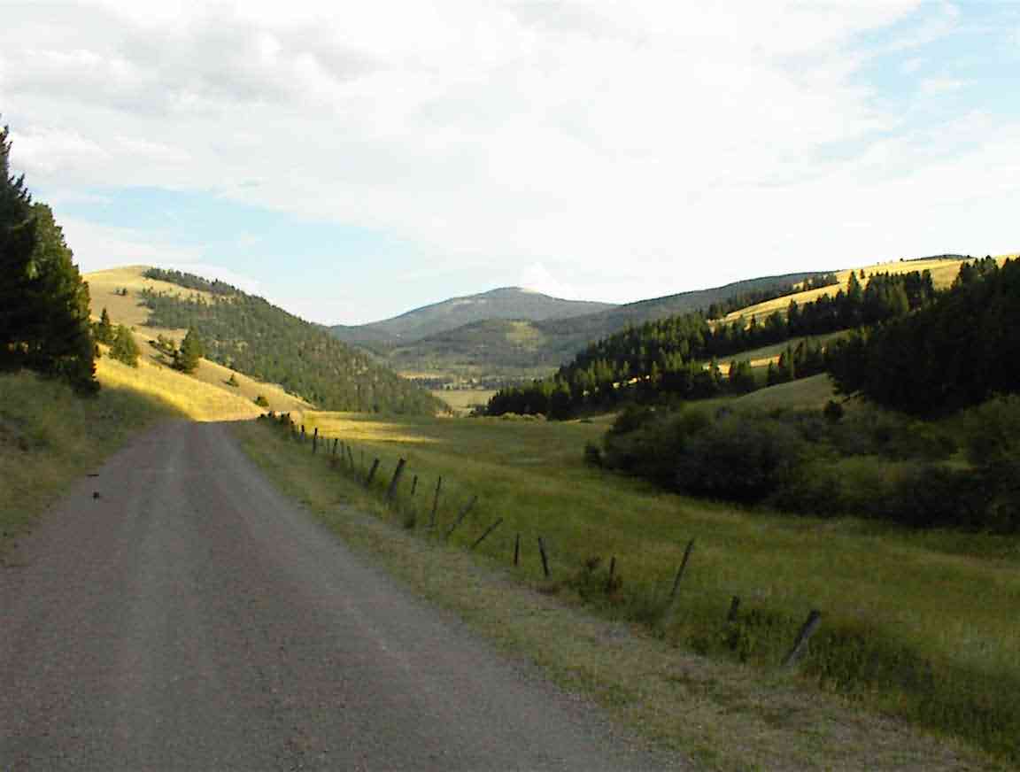
The road was a narrow single lane with pine trees towering above us on either side. There were numerous water crossings and I got my feet wet, but the cycling was great. The grades weren't too bad, at least initially, and the forest created a great atmosphere.The photos below give a bit of a taste of the route.
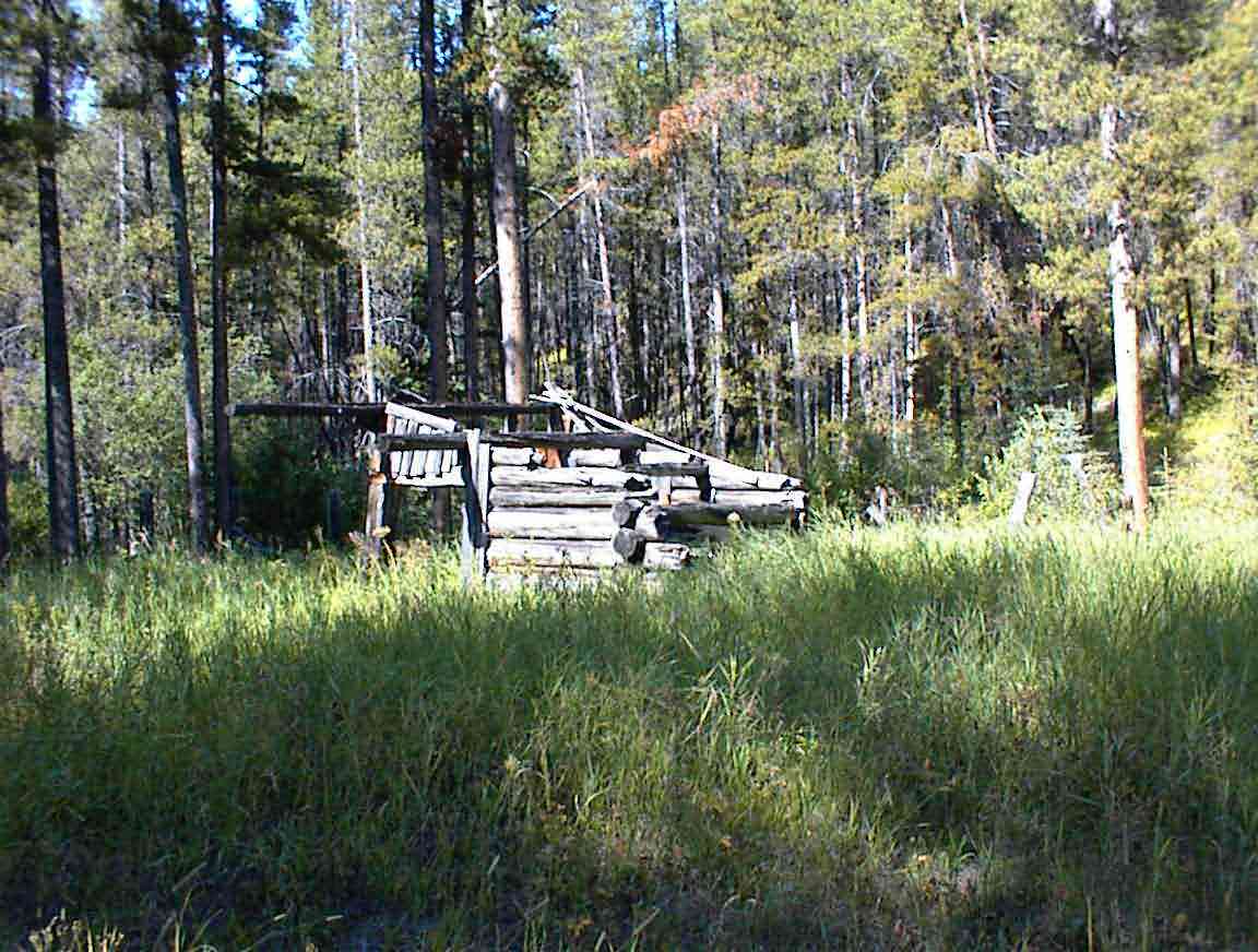
This area has a history of mining and that was reflected by a number of 'ruins' that we passed. There were several old cabins which were in various stages of decay, the forest taking over once again. At one spot there was a large clearing where there was still some mining machinery, gradually rusing away. I went over and inspected it but for the life of me couldn't fathom what it could have been used for.
The final 1.5 miles were very gruelling. The road was very steep and difficult to travel. At two points we needed to push our bikes because the grade was such that our wheels would spin when we tried peddaling. With the hills towering above us it seemed to go on forever, but eventually we reached the junction with the 'main' road where we had a well deserved rest and the apples I had bought. We were near the top, but still had a bit further to go (see below).
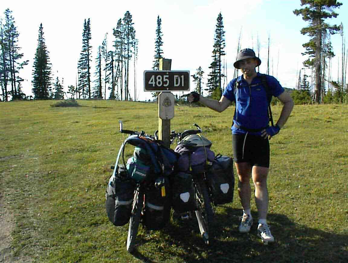
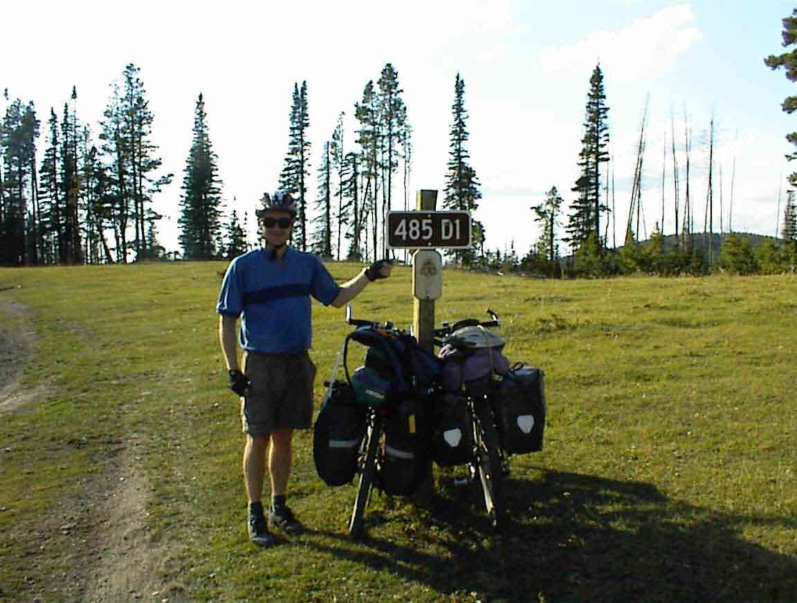
After another mile of up and downs we turned off and found the marker for the continental divide. From this point the waters on one side reach the Pacific Ocean; the other side the Atlantic Ocean via the Mississippi River.
We were around 6800' up and the views were magnificent. We posed for the manditory photos to celebrate our achievement. We had covered about 350 miles, crossed six other mountain ranges including one higher (5700', 5900', 5200', 7400', 5200', 6100'), but we had made it. We were both tired and sore but glad to have reached our first crossing. Only about two dozen more to go!
From the divide it was a long downhill run into the next valley, with hills on all sides. The road was steep and it was difficult to keep the speed down when one wanted to. I hit 32 mph but generally the poor surface meant that I was holding onto the brakes. I made a mental note to buy some spare brake pads at the next bike shop.
Sean wasn't as restrained and came off his bike on a curve after hitting a rut, bouncing over a culvert and hitting a stone in the road. Nothing too bad, just some abrasions which meant that I finally got to use my first aid kit that Lis had prepared for us.
The road went down into a valley with lots of farms. We were now on the 'dry' side of the mountains and that was evident from the way things looked. As we descended we saw tomorrow's challenge, two more continental divide crossings before we hit Helena.
We cycled until 19:00 when we found a suitable campsite in a field by the road next to a stream. I was stonkered and had a tin of beans for dinner while Sean fiddled with the stove and eventually had some rice/pasta. It had been a very long day. After filling our water bottles for tomorrow we retired to our tents. I was still very wound up from the trip and had a hard time sleeping but eventually drifted off. It had been a very hard day but it was very satisfying to have achieved our goal.